
| Memorials | : | 3 |
| Location | : | Headley, Mole Valley District, England |
| Coordinate | : | 51.2799700, -0.2736100 |
frequently asked questions (FAQ):
-
Where is St Marys Churchyard?
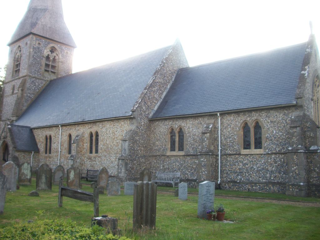
St Marys Churchyard is located at Church Approach Church Lane Headley, Mole Valley District ,Surrey , KT18 6LEEngland.
-
St Marys Churchyard cemetery's updated grave count on graveviews.com?
3 memorials
-
Where are the coordinates of the St Marys Churchyard?
Latitude: 51.2799700
Longitude: -0.2736100

Nearby Cemetories:
1. Saint Peter's Church
Walton-on-the-Hill, Reigate and Banstead Borough, England
Coordinate: 51.2817810, -0.2467230
2. St Giles Churchyard
Ashtead, Mole Valley District, England
Coordinate: 51.3086540, -0.2900093
3. St Michael Churchyard
Mickleham, Mole Valley District, England
Coordinate: 51.2675150, -0.3233720
4. St Mary and St Nicholas Churchyard
Leatherhead, Mole Valley District, England
Coordinate: 51.2925810, -0.3269850
5. St. Mary the Virgin Churchyard
Buckland, Mole Valley District, England
Coordinate: 51.2435590, -0.2511510
6. Epsom Cemetery
Epsom, Epsom and Ewell Borough, England
Coordinate: 51.3198040, -0.2594180
7. Betchworth Parish Council Burial Ground
Betchworth, Mole Valley District, England
Coordinate: 51.2349245, -0.2695398
8. St. Michael's Churchyard
Betchworth, Mole Valley District, England
Coordinate: 51.2336480, -0.2673300
9. St Mary Churchyard
Fetcham, Mole Valley District, England
Coordinate: 51.2881290, -0.3525500
10. St. Martin of Tours Churchyard
Epsom, Epsom and Ewell Borough, England
Coordinate: 51.3306847, -0.2593640
11. Randalls Park Cemetery and Crematorium
Leatherhead, Mole Valley District, England
Coordinate: 51.3035290, -0.3469730
12. Dorking Cemetery
Dorking, Mole Valley District, England
Coordinate: 51.2365646, -0.3189580
13. St Ann's Memorial Garden
Banstead, Reigate and Banstead Borough, England
Coordinate: 51.3215180, -0.2120434
14. Deepdene Mausoleum
Dorking, Mole Valley District, England
Coordinate: 51.2307590, -0.3206630
15. St Martin Churchyard
Dorking, Mole Valley District, England
Coordinate: 51.2326360, -0.3320140
16. All Saints Churchyard
Banstead, Reigate and Banstead Borough, England
Coordinate: 51.3220583, -0.2008833
17. St Nicolas Parish Churchyard
Great Bookham, Mole Valley District, England
Coordinate: 51.2798220, -0.3739870
18. St Mary Magdalene Churchyard
Reigate, Reigate and Banstead Borough, England
Coordinate: 51.2368540, -0.1972560
19. Polesden Lacey Estate Pet Cemetery
Great Bookham, Mole Valley District, England
Coordinate: 51.2592260, -0.3718640
20. Polesden Lacey Estate
Great Bookham, Mole Valley District, England
Coordinate: 51.2591310, -0.3718630
21. Reigate Cemetery
Reigate, Reigate and Banstead Borough, England
Coordinate: 51.2353550, -0.1977820
22. Quakers Burial Ground
Reigate, Reigate and Banstead Borough, England
Coordinate: 51.2372600, -0.1936700
23. St. Barnabas Churchyard
Ranmore Common, Mole Valley District, England
Coordinate: 51.2419730, -0.3602730
24. Yehudi Menuhin International School
Stoke D'Abernon, Elmbridge Borough, England
Coordinate: 51.3059170, -0.3775720