
| Memorials | : | 0 |
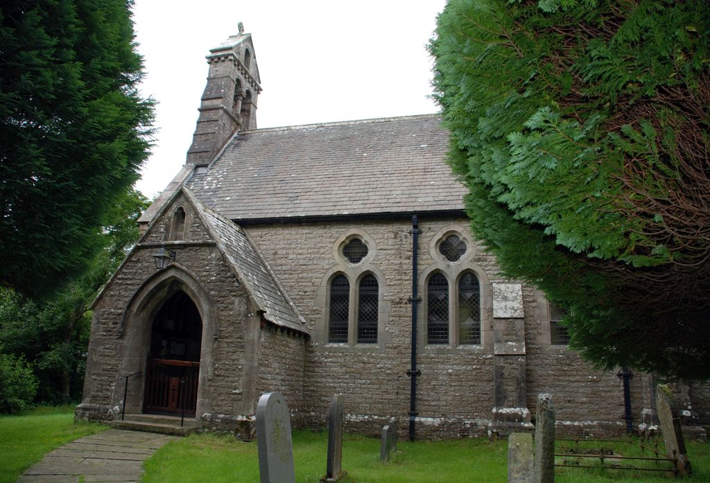
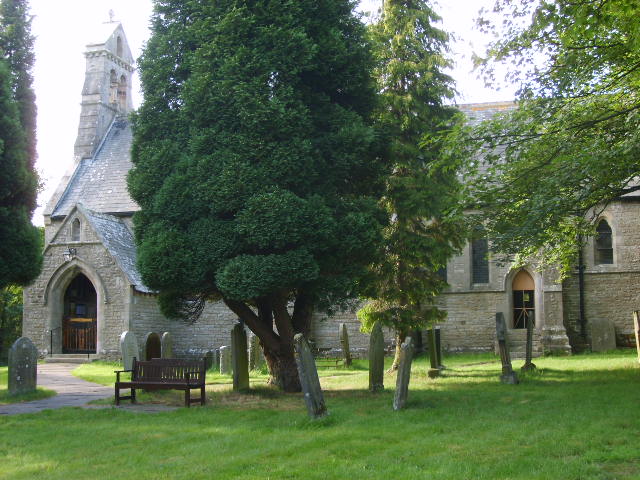
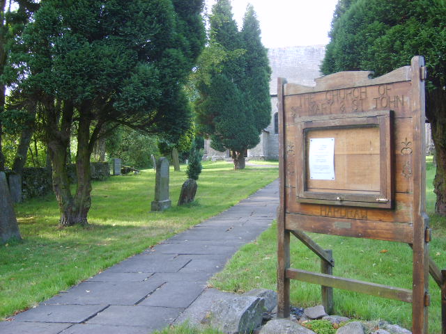
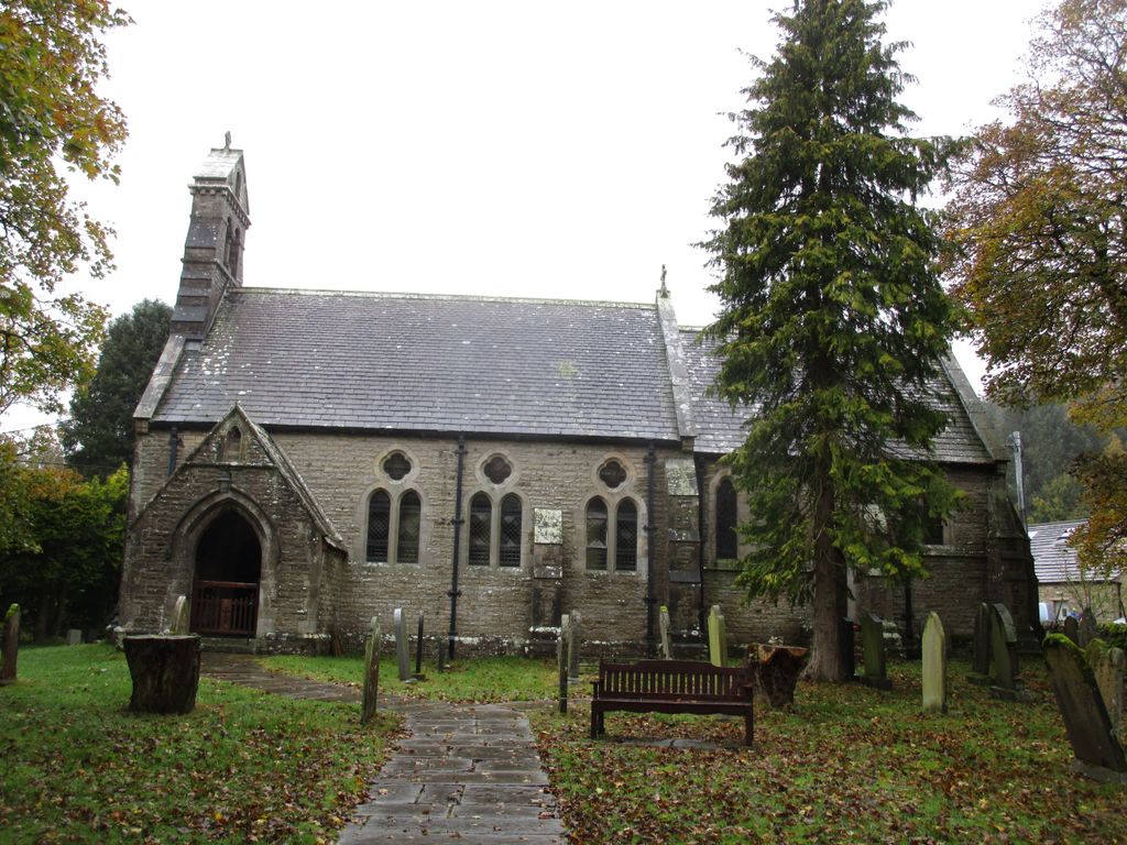
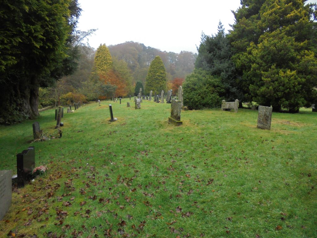
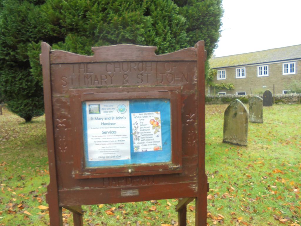
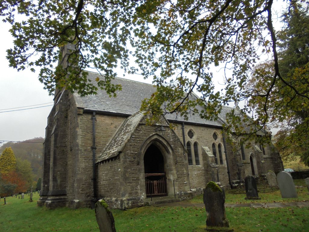
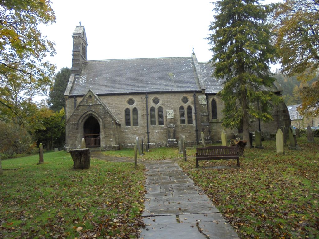
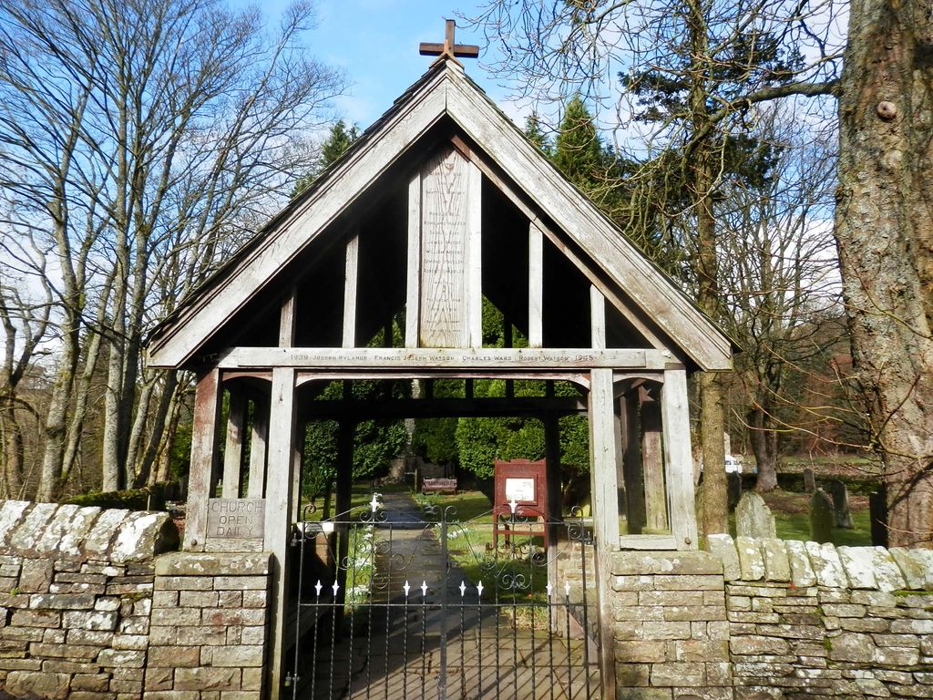
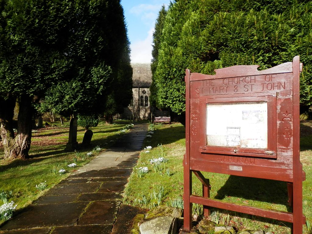
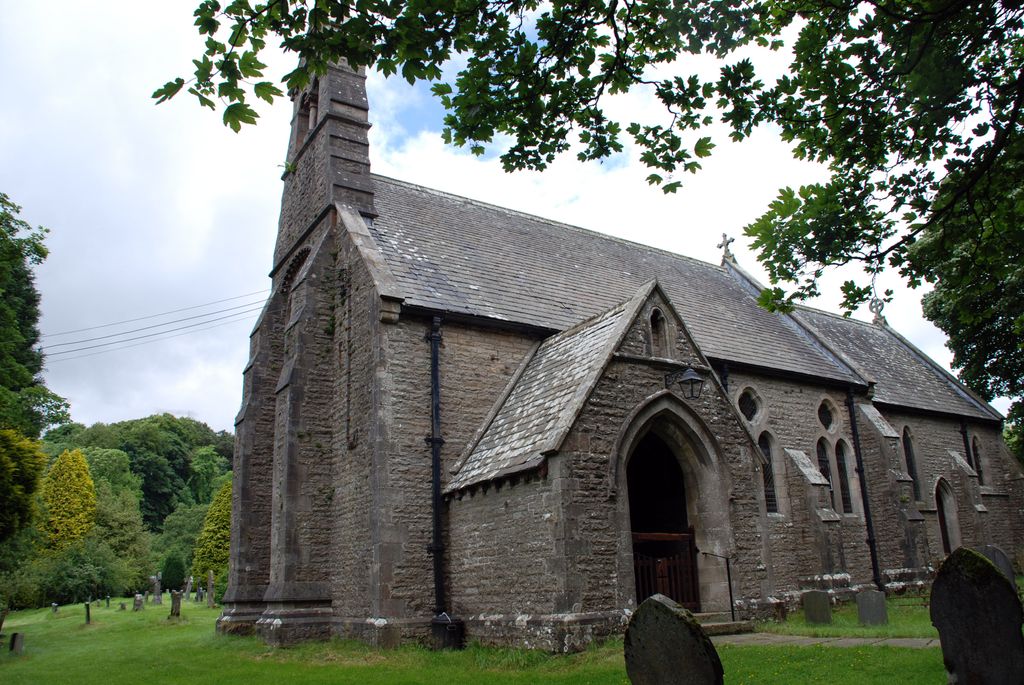
| Location | : | Hardraw, Richmondshire District, England |
| Coordinate | : | 54.3169800, -2.2052700 |
frequently asked questions (FAQ):
-
Where is St. Mary and St. John Churchyard?
St. Mary and St. John Churchyard is located at Bellow Hill Hardraw, Richmondshire District ,North Yorkshire , DL8 3LZEngland.
-
St. Mary and St. John Churchyard cemetery's updated grave count on graveviews.com?
0 memorials
-
Where are the coordinates of the St. Mary and St. John Churchyard?
Latitude: 54.3169800
Longitude: -2.2052700
Nearby Cemetories:
1. St. Margaret's Churchyard
Hawes, Richmondshire District, England
Coordinate: 54.3032300, -2.1969700
2. Friends Burial Ground
Hawes, Richmondshire District, England
Coordinate: 54.3039790, -2.1937940
3. Sandemanian Chapel Burial Ground
Hawes, Richmondshire District, England
Coordinate: 54.2992110, -2.1982010
4. Friends Burial Ground
Bainbridge, Richmondshire District, England
Coordinate: 54.3093330, -2.1023380
5. Bainbridge Cemetery
Bainbridge, Richmondshire District, England
Coordinate: 54.3054000, -2.0994100
6. St Matthew Old Churchyard
Stalling Busk, Richmondshire District, England
Coordinate: 54.2695500, -2.1289300
7. St Matthew Churchyard
Stalling Busk, Richmondshire District, England
Coordinate: 54.2686220, -2.1302030
8. Askrigg Cemetery
Askrigg, Richmondshire District, England
Coordinate: 54.3141230, -2.0915060
9. St. Mary's Churchyard
Muker, Richmondshire District, England
Coordinate: 54.3763690, -2.1392860
10. St. Oswald Churchyard
Askrigg, Richmondshire District, England
Coordinate: 54.3147100, -2.0817500
11. Keld United Reform Chapelyard
Keld, Richmondshire District, England
Coordinate: 54.4055920, -2.1660210
12. Gunnerside Wesleyan Methodist Chapelyard
Gunnerside, Richmondshire District, England
Coordinate: 54.3783950, -2.0778320
13. St. John the Baptist Churchyard
Garsdale, South Lakeland District, England
Coordinate: 54.3008610, -2.3914140
14. Low Smithy Methodist Church Graveyard
Garsdale, South Lakeland District, England
Coordinate: 54.3003930, -2.3992090
15. Low Row United Reformed Chapelyard
Low Row, Richmondshire District, England
Coordinate: 54.3755880, -2.0317420
16. St Mary's Churchyard
Mallerstang, Eden District, England
Coordinate: 54.4079040, -2.3374060
17. Low Row Methodist Cemetery
Low Row, Richmondshire District, England
Coordinate: 54.3798050, -2.0259320
18. Holy Trinity Churchyard
Low Row, Richmondshire District, England
Coordinate: 54.3812800, -2.0223090
19. Friends Meeting House Burial Ground
Carperby, Richmondshire District, England
Coordinate: 54.3031720, -1.9925670
20. St. Michael and All Angels Churchyard
Hubberholme, Craven District, England
Coordinate: 54.2001100, -2.1147330
21. St. Andrew Churchyard
Aysgarth, Richmondshire District, England
Coordinate: 54.2922340, -1.9833760
22. St Andrew Churchyard
Dent, South Lakeland District, England
Coordinate: 54.2781540, -2.4542310
23. Dent Zion Chapel
Dent, South Lakeland District, England
Coordinate: 54.2766335, -2.4558426
24. Dent Methodist Churchyard
Dent, South Lakeland District, England
Coordinate: 54.2786300, -2.4569800