
| Memorials | : | 3 |
| Location | : | Middleton Tyas, Richmondshire District, England |
| Coordinate | : | 54.4451400, -1.6390500 |
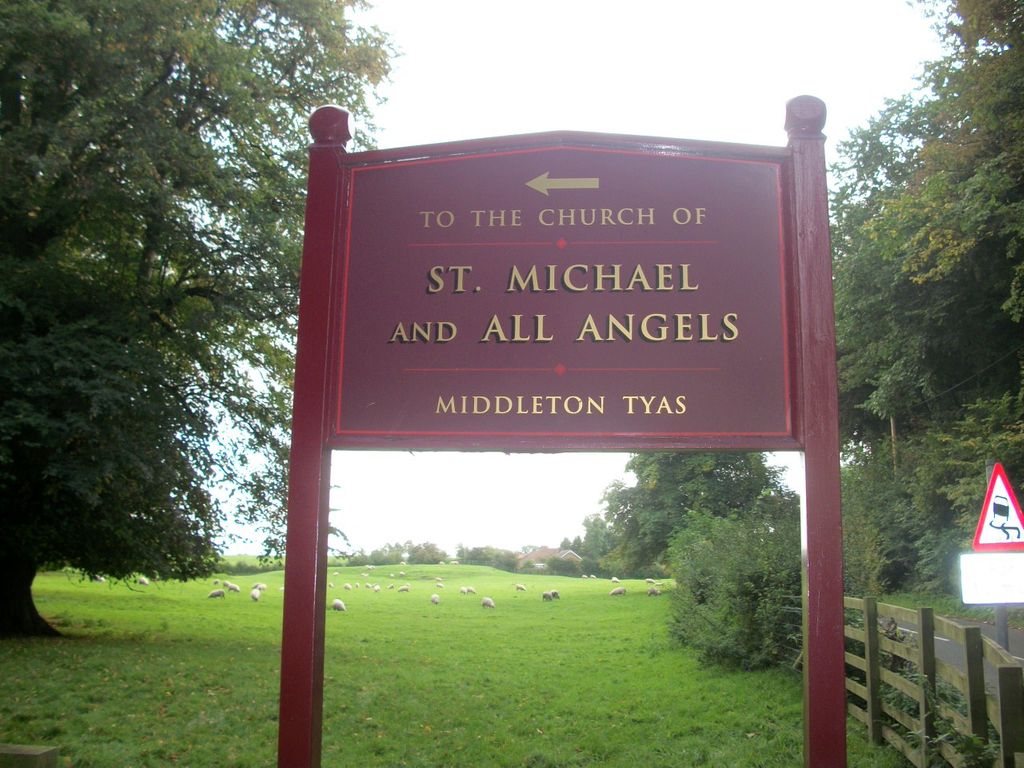
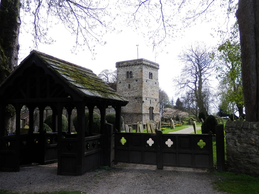
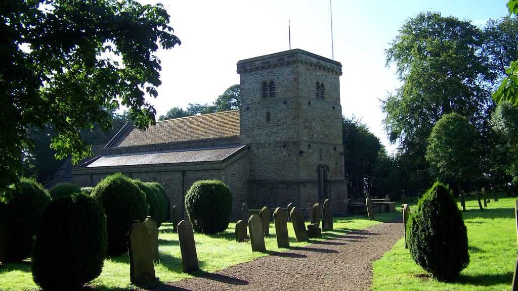
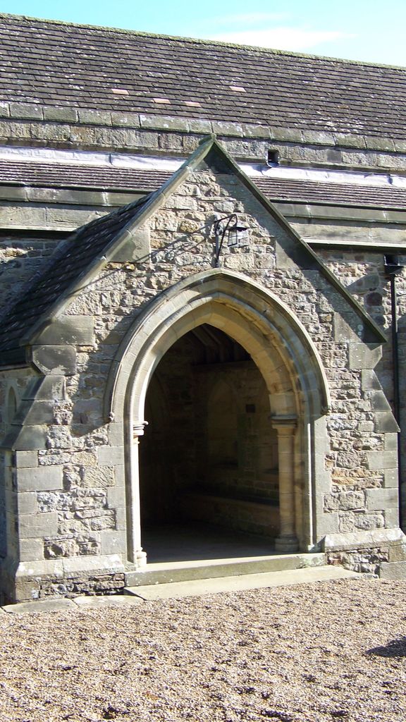
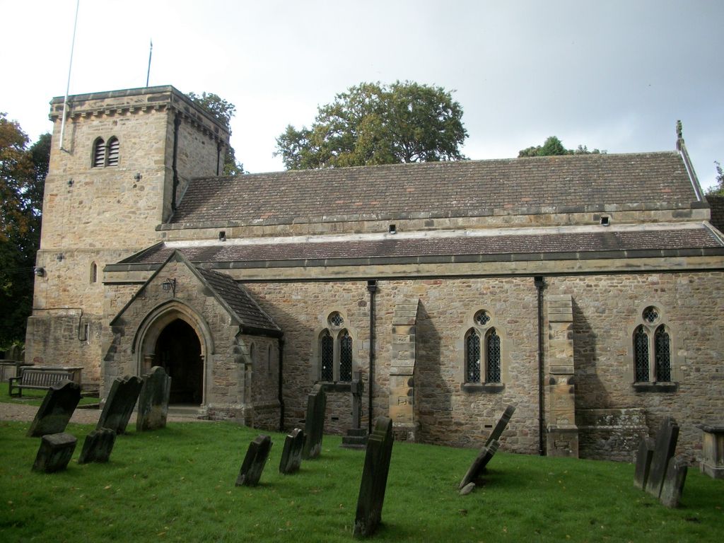
| Description | : | St Michael and All Angael Church Middleton Tyas is on the east side of the A1, less than a mile from Scotch Corner. The Church of St Michael and All Angels (a Grade 1 listed building) lies just outside the village on the road towards Moulton. It is believed that a building existed here in the twelfth century closely association with St Mary's Abbey in York. It is an ancient structure, with Norman arches and pillars on the north side, and Early English on the south with the list of incumbents dating from 1280. The church has a... Read More |
frequently asked questions (FAQ):
-
Where is St Michael and All Angels Churchyard?
St Michael and All Angels Churchyard is located at Moulton Road Middleton Tyas, Richmondshire District ,North Yorkshire , DL10 6SBEngland.
-
St Michael and All Angels Churchyard cemetery's updated grave count on graveviews.com?
2 memorials
-
Where are the coordinates of the St Michael and All Angels Churchyard?
Latitude: 54.4451400
Longitude: -1.6390500
Nearby Cemetories:
1. Middleton Lodge Chapel
Middleton Tyas, Richmondshire District, England
Coordinate: 54.4562000, -1.6567000
2. St Cuthbert and St Mary Churchyard
Barton, Richmondshire District, England
Coordinate: 54.4754490, -1.6458250
3. St James the Great Churchyard
Melsonby, Richmondshire District, England
Coordinate: 54.4711100, -1.6916100
4. St. Agatha and St. Oswin Churchyard
Gilling West, Richmondshire District, England
Coordinate: 54.4414840, -1.7209980
5. Brompton-On-Swale Cemetery
Brompton on Swale, Richmondshire District, England
Coordinate: 54.3917400, -1.6608900
6. Scorton & District Joint Cemetery
Scorton, Richmondshire District, England
Coordinate: 54.3914400, -1.6156200
7. St. Mary's Churchyard
South Cowton, Hambleton District, England
Coordinate: 54.4187600, -1.5501800
8. St Mary Churchyard
Bolton-on-Swale, Richmondshire District, England
Coordinate: 54.3875300, -1.6127600
9. St Mary Churchyard
East Cowton, Hambleton District, England
Coordinate: 54.4291100, -1.5370200
10. St Peter Churchyard
Croft-on-Tees, Richmondshire District, England
Coordinate: 54.4830000, -1.5556200
11. St Agatha Churchyard
Easby, Richmondshire District, England
Coordinate: 54.3976010, -1.7158320
12. Catterick Cemetery
Catterick, Richmondshire District, England
Coordinate: 54.3774700, -1.6349100
13. St Mary the Virgin Churchyard
Richmond, Richmondshire District, England
Coordinate: 54.4046600, -1.7333700
14. St Anne Churchyard
Catterick, Richmondshire District, England
Coordinate: 54.3768500, -1.6319800
15. St Peter Churchyard
Cleasby, Richmondshire District, England
Coordinate: 54.5123200, -1.6166600
16. St Paulinus Roman Catholic Churchyard
Brough with St Giles, Richmondshire District, England
Coordinate: 54.3779100, -1.6698900
17. All Saints Churchyard
Manfield, Richmondshire District, England
Coordinate: 54.5154080, -1.6573120
18. St John the Baptist Churchyard
Stanwick St John, Richmondshire District, England
Coordinate: 54.5028550, -1.7155730
19. All Saints Churchyard
Hurworth, Darlington Unitary Authority, England
Coordinate: 54.4869900, -1.5285200
20. Catterick Garrison Military Cemetery
Hipswell, Richmondshire District, England
Coordinate: 54.3803100, -1.7138300
21. St John The Evangelist Churchyard
Hipswell, Richmondshire District, England
Coordinate: 54.3798700, -1.7130100
22. Richmond Cemetery
Richmond, Richmondshire District, England
Coordinate: 54.4053750, -1.7572010
23. St Cuthbert Churchyard
Forcett, Richmondshire District, England
Coordinate: 54.5051660, -1.7304510
24. St Mary the Virgin Churchyard
Eryholme, Richmondshire District, England
Coordinate: 54.4754000, -1.5067000