
| Memorials | : | 2 |
| Location | : | Brough with St Giles, Richmondshire District, England |
| Coordinate | : | 54.3779100, -1.6698900 |
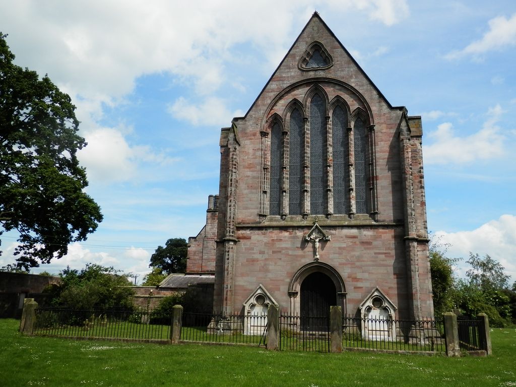
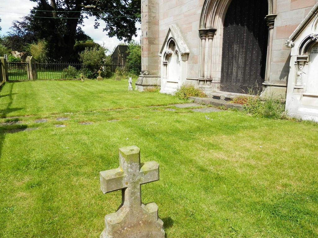
| Description | : | The former Roman Catholic church of St Paulinus in the grounds of Brough Hall was designed in 1837 by Ignatius Bonomi for the recusant William Lawson and is a Grade II* listed building. The small churchyard contains a few burials of the Lawson family of Brough Hall. Brough with St Giles is a village and a civil parish in the Richmondshire district of North Yorkshire, England. The civil parish also includes the settlements of Catterick Bridge and Walkerville, and Catterick Racecourse and the site of the Roman town of Cataractonium. According to the 2001 Census the parish had a population of 338,... Read More |
frequently asked questions (FAQ):
-
Where is St Paulinus Roman Catholic Churchyard?
St Paulinus Roman Catholic Churchyard is located at Brough with St Giles, Richmondshire District ,North Yorkshire ,England.
-
St Paulinus Roman Catholic Churchyard cemetery's updated grave count on graveviews.com?
2 memorials
-
Where are the coordinates of the St Paulinus Roman Catholic Churchyard?
Latitude: 54.3779100
Longitude: -1.6698900
Nearby Cemetories:
1. Brompton-On-Swale Cemetery
Brompton on Swale, Richmondshire District, England
Coordinate: 54.3917400, -1.6608900
2. Catterick Cemetery
Catterick, Richmondshire District, England
Coordinate: 54.3774700, -1.6349100
3. Holy Trinity Churchyard
Tunstall, Richmondshire District, England
Coordinate: 54.3572840, -1.6683920
4. St Anne Churchyard
Catterick, Richmondshire District, England
Coordinate: 54.3768500, -1.6319800
5. St John The Evangelist Churchyard
Hipswell, Richmondshire District, England
Coordinate: 54.3798700, -1.7130100
6. Catterick Garrison Military Cemetery
Hipswell, Richmondshire District, England
Coordinate: 54.3803100, -1.7138300
7. St Agatha Churchyard
Easby, Richmondshire District, England
Coordinate: 54.3976010, -1.7158320
8. Scorton & District Joint Cemetery
Scorton, Richmondshire District, England
Coordinate: 54.3914400, -1.6156200
9. St Mary Churchyard
Bolton-on-Swale, Richmondshire District, England
Coordinate: 54.3875300, -1.6127600
10. St Mary Churchyard
Hornby, Richmondshire District, England
Coordinate: 54.3388470, -1.6594880
11. St Mary the Virgin Churchyard
Richmond, Richmondshire District, England
Coordinate: 54.4046600, -1.7333700
12. Richmond Cemetery
Richmond, Richmondshire District, England
Coordinate: 54.4053750, -1.7572010
13. St Oswald Churchyard
Hauxwell, Richmondshire District, England
Coordinate: 54.3333300, -1.7333300
14. St Mary Churchyard
Kirkby Fleetham, Hambleton District, England
Coordinate: 54.3561750, -1.5691590
15. St Patrick Churchyard
Patrick Brompton, Richmondshire District, England
Coordinate: 54.3112400, -1.6647300
16. St Michael and All Angels Churchyard
Middleton Tyas, Richmondshire District, England
Coordinate: 54.4451400, -1.6390500
17. St Michael and All Angels Churchyard
Hudswell, Richmondshire District, England
Coordinate: 54.3990300, -1.7846500
18. St. Agatha and St. Oswin Churchyard
Gilling West, Richmondshire District, England
Coordinate: 54.4414840, -1.7209980
19. St Andrew Churchyard
Great Fencote, Hambleton District, England
Coordinate: 54.3366300, -1.5662200
20. Crakehall and Langthorne Cemetery
Crakehall, Hambleton District, England
Coordinate: 54.3086800, -1.6272800
21. St. Andrew's Churchyard
Finghall, Richmondshire District, England
Coordinate: 54.3068300, -1.7085500
22. St Gregory Churchyard
Crakehall, Hambleton District, England
Coordinate: 54.3046690, -1.6255660
23. Middleton Lodge Chapel
Middleton Tyas, Richmondshire District, England
Coordinate: 54.4562000, -1.6567000
24. St. Wilfrid Churchyard
Great Langton, Hambleton District, England
Coordinate: 54.3598870, -1.5367380