
| Memorials | : | 2 |
| Location | : | Nuneham Courtenay, South Oxfordshire District, England |
| Coordinate | : | 51.6882380, -1.2057616 |
frequently asked questions (FAQ):
-
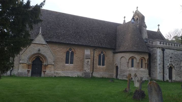
Where is All Saints Parish Churchyard?
All Saints Parish Churchyard is located at Nuneham Courtenay, South Oxfordshire District ,Oxfordshire ,England.
-
All Saints Parish Churchyard cemetery's updated grave count on graveviews.com?
2 memorials
-
Where are the coordinates of the All Saints Parish Churchyard?
Latitude: 51.6882380
Longitude: -1.2057616
Nearby Cemetories:
1. Old All Saints Church
Nuneham Courtenay, South Oxfordshire District, England
Coordinate: 51.6805300, -1.2181300
2. St Peter Churchyard
Marsh Baldon, South Oxfordshire District, England
Coordinate: 51.6941870, -1.1884550
3. Radley Cemetery
Radley, Vale of White Horse District, England
Coordinate: 51.6893900, -1.2446800
4. St. James the Great Churchyard
Radley, Vale of White Horse District, England
Coordinate: 51.6907270, -1.2462510
5. St Lawrence Churchyard
Toot Baldon, South Oxfordshire District, England
Coordinate: 51.7051720, -1.1750220
6. Kennington Cemetery
Kennington, Vale of White Horse District, England
Coordinate: 51.7055400, -1.2397800
7. St. Andrew's Churchyard
Sandford-on-Thames, South Oxfordshire District, England
Coordinate: 51.7121430, -1.2289060
8. St Michael Churchyard
Clifton Hampden, South Oxfordshire District, England
Coordinate: 51.6558680, -1.2103840
9. St Mary and St Nicholas Churchyard
Littlemore, City of Oxford, England
Coordinate: 51.7210753, -1.2232272
10. Littlemore Chapel
Littlemore, City of Oxford, England
Coordinate: 51.7208320, -1.2270330
11. Saint Mary's Churchyard
Garsington, South Oxfordshire District, England
Coordinate: 51.7140100, -1.1600700
12. St. James Churchyard
Cowley, City of Oxford, England
Coordinate: 51.7305878, -1.2202638
13. St Mary the Virgin Churchyard
Iffley, City of Oxford, England
Coordinate: 51.7273590, -1.2381680
14. Rose Hill Cemetery
Oxford, City of Oxford, England
Coordinate: 51.7320960, -1.2254070
15. St Mary the Virgin Churchyard
Long Wittenham, South Oxfordshire District, England
Coordinate: 51.6423650, -1.2092860
16. Our Lady and St Edmund of Abingdon Roman Catholic
Abingdon, Vale of White Horse District, England
Coordinate: 51.6747940, -1.2776270
17. Dorchester Cemetery
Dorchester, South Oxfordshire District, England
Coordinate: 51.6478130, -1.1649480
18. St Leonard and St Catherine
Drayton St Leonard, South Oxfordshire District, England
Coordinate: 51.6640020, -1.1387005
19. St John the Baptist Churchyard
Stadhampton, South Oxfordshire District, England
Coordinate: 51.6848390, -1.1279600
20. Abingdon Abbey (Defunct)
Abingdon, Vale of White Horse District, England
Coordinate: 51.6704790, -1.2783620
21. St Nicholas Church
Abingdon, Vale of White Horse District, England
Coordinate: 51.6702720, -1.2808640
22. St Leonard's Churchyard
Sunningwell, Vale of White Horse District, England
Coordinate: 51.7013600, -1.2840500
23. Dorchester Abbey
Dorchester, South Oxfordshire District, England
Coordinate: 51.6436250, -1.1644290
24. Abingdon War Memorial
Abingdon, Vale of White Horse District, England
Coordinate: 51.6702940, -1.2839070