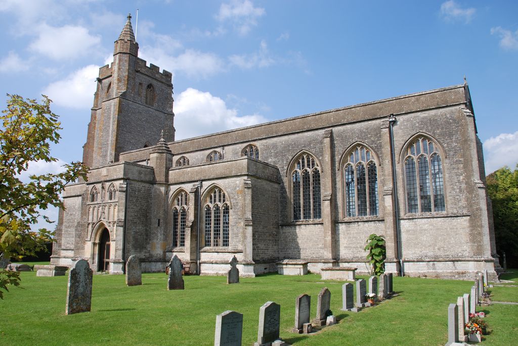
| Memorials | : | 4 |
| Location | : | North Cadbury, South Somerset District, England |
| Coordinate | : | 51.0416670, -2.5213610 |
| Description | : | Although there was a church on the site from the 12th or 13th century (a dean of Cadbury was recorded in the early 13th century and a rector in 1239) the current building dates from 1417, Papal approval being given in 1418, when the church named St. Michael the Archangel. Elizabeth Daubeney, Baroness Botreaux (d.1433), wife of William de Botreaux, 1st Baron Botreaux (d.1391) rebuilt the the nave and chancel in 1427; the earlier three-stage tower was left intact. Henry Hastings, 3rd Earl of Huntingdon, granted the patronage of the church to Emmanuel College, Cambridge, leading to a dispute between... Read More |
frequently asked questions (FAQ):
-
Where is St Michael Churchyard?
St Michael Churchyard is located at Woolston Road North Cadbury, South Somerset District ,Somerset , BA22 7DREngland.
-
St Michael Churchyard cemetery's updated grave count on graveviews.com?
4 memorials
-
Where are the coordinates of the St Michael Churchyard?
Latitude: 51.0416670
Longitude: -2.5213610
Nearby Cemetories:
1. Blessed Virgin Mary Churchyard
Compton Pauncefoot, South Somerset District, England
Coordinate: 51.0336770, -2.5089430
2. St. Michael's Churchyard
Blackford, South Somerset District, England
Coordinate: 51.0336960, -2.4892290
3. St Nicolas' Churchyard
North Barrow, South Somerset District, England
Coordinate: 51.0623705, -2.5605033
4. St. Peter & St. Paul Churchyard
Maperton, South Somerset District, England
Coordinate: 51.0335993, -2.4686628
5. Castle Cary Cemetery
Castle Cary, South Somerset District, England
Coordinate: 51.0803800, -2.5223600
6. Saint Barnabas Churchyard
Queen Camel, South Somerset District, England
Coordinate: 51.0225850, -2.5759270
7. Corton Denham Cemetery
Corton Denham, South Somerset District, England
Coordinate: 51.0015810, -2.5202380
8. Saint Andrew Churchyard
Corton Denham, South Somerset District, England
Coordinate: 51.0015790, -2.5203100
9. Saint Peter & Saint Paul Churchyard
Charlton Horethorne, South Somerset District, England
Coordinate: 51.0060200, -2.4790100
10. Saint Nicholas Churchyard
Holton, South Somerset District, England
Coordinate: 51.0401280, -2.4502641
11. All Saints
Castle Cary, South Somerset District, England
Coordinate: 51.0865760, -2.5165400
12. St. Nicholas' Churchyard
Bratton Seymour, South Somerset District, England
Coordinate: 51.0679406, -2.4625400
13. Saint John the Baptist Churchyard
North Cheriton, South Somerset District, England
Coordinate: 51.0309000, -2.4474000
14. Church of St Thomas of Canterbury
Lovington, South Somerset District, England
Coordinate: 51.0754000, -2.5771000
15. St. Mary the Virgin Churchyard
Rimpton, South Somerset District, England
Coordinate: 50.9947330, -2.5564860
16. St Andrew Churchyard
Ansford, South Somerset District, England
Coordinate: 51.0943350, -2.5180470
17. North Cheriton Cemetery
North Cheriton, South Somerset District, England
Coordinate: 51.0284840, -2.4389150
18. St. Nicholas Churchyard
Sandford Orcas, West Dorset District, England
Coordinate: 50.9874190, -2.5394460
19. St. Mary's Churchyard
Marston Magna, South Somerset District, England
Coordinate: 50.9989970, -2.5805915
20. All Saint's Church
Alford, South Somerset District, England
Coordinate: 51.0916210, -2.5659300
21. St Leonard Churchyard and Extension
Pitcombe, South Somerset District, England
Coordinate: 51.0925600, -2.4684600
22. All Saints Churchyard
Poyntington, West Dorset District, England
Coordinate: 50.9782070, -2.4997530
23. Saint John's Churchyard
Horsington, South Somerset District, England
Coordinate: 51.0126300, -2.4238400
24. St Peters Churchyard
East Lydford, Mendip District, England
Coordinate: 51.0789840, -2.6116080

