
| Memorials | : | 0 |
| Location | : | East Lydford, Mendip District, England |
| Coordinate | : | 51.0789840, -2.6116080 |
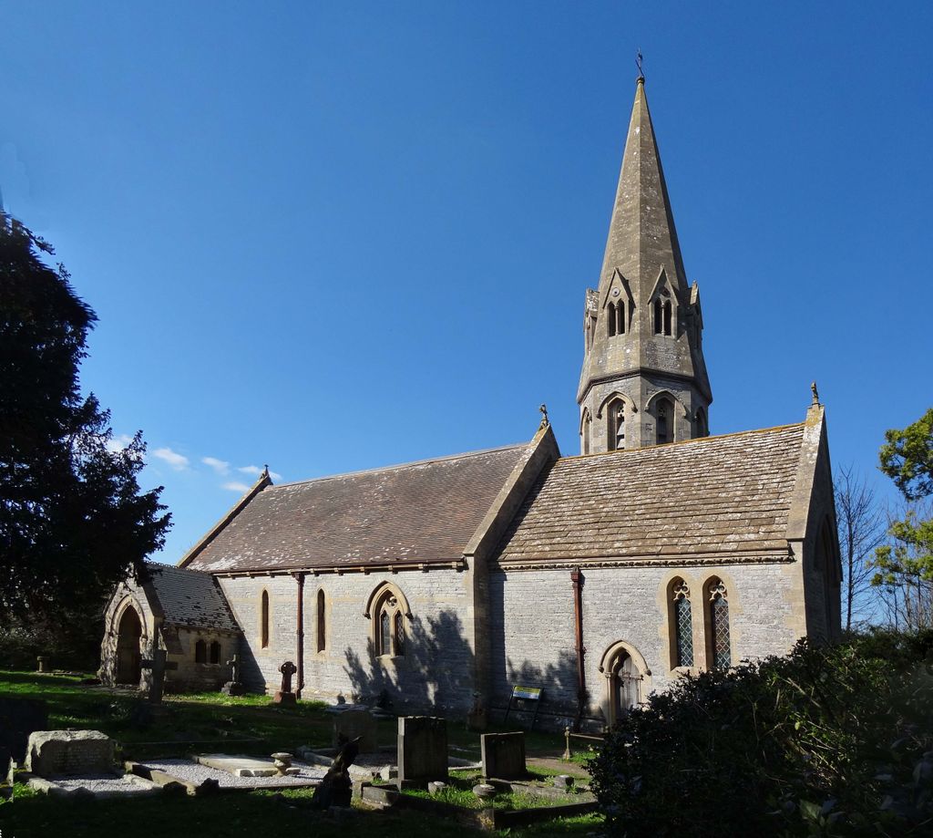
| Description | : | "EAST LYDFORD, a parish in the hundred of Somerton, county Somerset, 5 miles E. of Somerton, its post town, and 5 W. of Castle Cary station on the Wilts and Somerset railway. The parish, which is of small extent, lies near the river Brue. The road from Bath to Exeter skirts the village. The tithes have been commuted for a rent-charge of £106 16s. The living is a rectory* in the diocese of Bath and Wells, value £180. The church is dedicated to St. Peter. The register commences in 1730. There are parochial and Sunday schools. The old Roman Fosse... Read More |
frequently asked questions (FAQ):
-
Where is St Peters Churchyard?
St Peters Churchyard is located at East Lydford, Mendip District ,Somerset ,England.
-
St Peters Churchyard cemetery's updated grave count on graveviews.com?
0 memorials
-
Where are the coordinates of the St Peters Churchyard?
Latitude: 51.0789840
Longitude: -2.6116080
Nearby Cemetories:
1. St Marys Churchyard
East Lydford, Mendip District, England
Coordinate: 51.0789890, -2.6116890
2. Saint Mary's Churchyard
East Lydford, Mendip District, England
Coordinate: 51.0789630, -2.6117072
3. St. Peter Churchyard
Lydford-on-Fosse, Mendip District, England
Coordinate: 51.0846000, -2.6231400
4. Church of St Thomas of Canterbury
Lovington, South Somerset District, England
Coordinate: 51.0754000, -2.5771000
5. Holy Cross Churchyard
Babcary, South Somerset District, England
Coordinate: 51.0563609, -2.6268770
6. Saint Mary Magdalene Churchyard
Keinton Mandeville, South Somerset District, England
Coordinate: 51.0683291, -2.6471408
7. St. David's Churchyard
Barton St David, South Somerset District, England
Coordinate: 51.0828220, -2.6585470
8. St Peter's Church
Hornblotton, Mendip District, England
Coordinate: 51.1037752, -2.5846439
9. All Saint's Church
Alford, South Somerset District, England
Coordinate: 51.0916210, -2.5659300
10. St Nicolas' Churchyard
North Barrow, South Somerset District, England
Coordinate: 51.0623705, -2.5605033
11. St. Peter & St. Paul's Churchyard
Charlton Adam, South Somerset District, England
Coordinate: 51.0552350, -2.6647930
12. St. Dunstan Churchyard
Baltonsborough, Mendip District, England
Coordinate: 51.1107200, -2.6557600
13. All Saints Churchyard
Kingweston, South Somerset District, England
Coordinate: 51.0793076, -2.6791489
14. Church of the Virgin Mary
Charlton Mackrell, South Somerset District, England
Coordinate: 51.0524210, -2.6743894
15. Saint James Churchyard
West Bradley, Mendip District, England
Coordinate: 51.1293030, -2.6332386
16. St Leonard Churchyard
Butleigh, Mendip District, England
Coordinate: 51.1025800, -2.6868850
17. Castle Cary Cemetery
Castle Cary, South Somerset District, England
Coordinate: 51.0803800, -2.5223600
18. All Saints Churchyard
East Pennard, Mendip District, England
Coordinate: 51.1351890, -2.5773210
19. All Saints
Castle Cary, South Somerset District, England
Coordinate: 51.0865760, -2.5165400
20. Saint Barnabas Churchyard
Queen Camel, South Somerset District, England
Coordinate: 51.0225850, -2.5759270
21. St Andrew Churchyard
Ansford, South Somerset District, England
Coordinate: 51.0943350, -2.5180470
22. St. Peter’s Churchyard
Podimore, South Somerset District, England
Coordinate: 51.0219250, -2.6492310
23. St Nicholas Churchyard
West Pennard, Mendip District, England
Coordinate: 51.1415596, -2.6413050
24. St Mary Magdalene Churchyard
Ditcheat, Mendip District, England
Coordinate: 51.1250270, -2.5362010