| Memorials | : | 0 |
| Location | : | Melbourne, South Derbyshire District, England |
| Coordinate | : | 52.8210800, -1.4242900 |
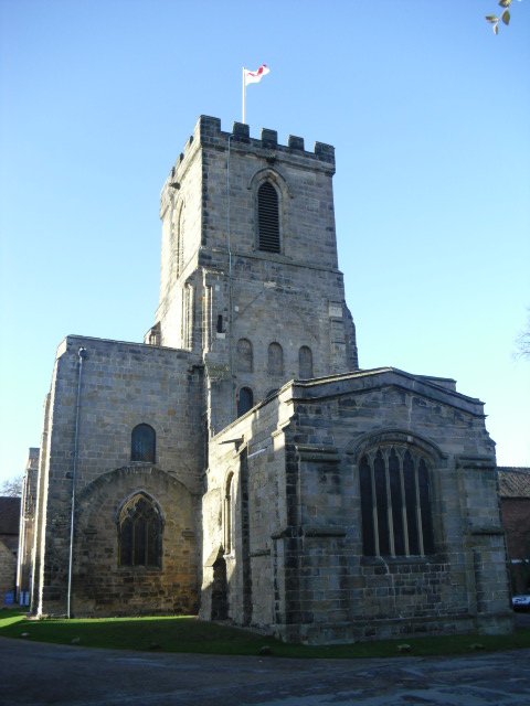
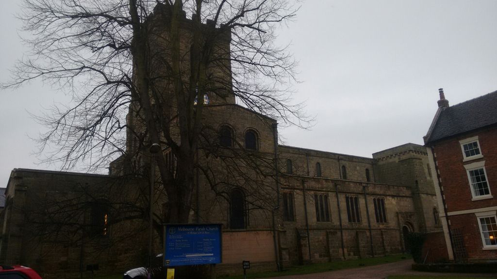
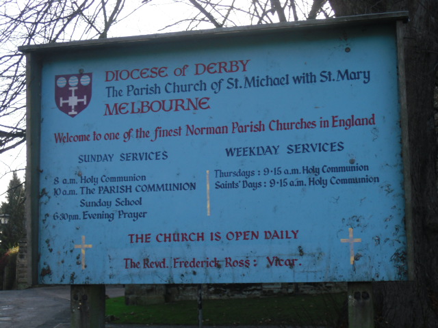
| Description | : | The church of St Michael with St Mary is on the site of a much earlier Anglo Saxon building, and is regarded as one of the finest Norman Parish Churches in the country. It is mostly 12th century, with some later additions. It was built as a retreat for the Bishops of Carlisle, who were under constant threat of raids and violence in their northern parish. The church possesses a 2 tower facade, unique amongst Norman parish churches, a crossing tower, a nave of 5 bays, aisles and transepts. All of this is Norman with the exception of the Perp aisle... Read More |
frequently asked questions (FAQ):
-
Where is St Michael with St Mary Church?
St Michael with St Mary Church is located at Church Square, Melbourne, South Derbyshire District ,Derbyshire , DE73 EJHEngland.
-
St Michael with St Mary Church cemetery's updated grave count on graveviews.com?
0 memorials
-
Where are the coordinates of the St Michael with St Mary Church?
Latitude: 52.8210800
Longitude: -1.4242900
Nearby Cemetories:
1. St Michael & St Mary Old Churchyard
Melbourne, South Derbyshire District, England
Coordinate: 52.8221000, -1.4240900
2. Melbourne Cemetery
Melbourne, South Derbyshire District, England
Coordinate: 52.8291310, -1.4271470
3. Breedon Priory
Breedon on the Hill, North West Leicestershire District, England
Coordinate: 52.8060120, -1.3999600
4. St Mary the Virgin Churchyard
Weston on Trent, South Derbyshire District, England
Coordinate: 52.8444900, -1.4105600
5. All Saints Churchyard
Isley Walton, North West Leicestershire District, England
Coordinate: 52.8211576, -1.3710891
6. St. George's Churchyard
Ticknall, South Derbyshire District, England
Coordinate: 52.8133780, -1.4801570
7. St. James' Churchyard
Swarkestone, South Derbyshire District, England
Coordinate: 52.8535560, -1.4490940
8. Holy Trinity Churchyard
Staunton Harold, North West Leicestershire District, England
Coordinate: 52.7841040, -1.4381631
9. Staunton Harold Churchyard
Ashby-de-la-Zouch, North West Leicestershire District, England
Coordinate: 52.7840510, -1.4381150
10. St Wilfrid Churchyard
Barrow upon Trent, South Derbyshire District, England
Coordinate: 52.8517910, -1.4773020
11. All Saints Churchyard
Aston on Trent, South Derbyshire District, England
Coordinate: 52.8606040, -1.3866670
12. Barrow Upon Trent Cemetery
Barrow upon Trent, South Derbyshire District, England
Coordinate: 52.8532164, -1.4788765
13. St. Peter's Churchyard
Chellaston, Derby Unitary Authority, England
Coordinate: 52.8694725, -1.4350250
14. Moor Lane
Aston on Trent, South Derbyshire District, England
Coordinate: 52.8651600, -1.3826900
15. St. Edward King & Martyr Churchyard
Castle Donington, North West Leicestershire District, England
Coordinate: 52.8417000, -1.3383000
16. St Michael & All Angels Churchyard
Long Whatton, North West Leicestershire District, England
Coordinate: 52.8164170, -1.3282730
17. Quaker Burial Ground
Castle Donington, North West Leicestershire District, England
Coordinate: 52.8435100, -1.3328900
18. Castle Donington Cemetery
Castle Donington, North West Leicestershire District, England
Coordinate: 52.8431520, -1.3307570
19. Methodist Church Churchyard
Griffydam, North West Leicestershire District, England
Coordinate: 52.7629060, -1.3894370
20. St Mary the Blessed Virgin Church
Osgathorpe, North West Leicestershire District, England
Coordinate: 52.7715890, -1.3623270
21. St John Churchyard
Belton, North West Leicestershire District, England
Coordinate: 52.7830810, -1.3374590
22. St James Churchyard
Shardlow, South Derbyshire District, England
Coordinate: 52.8686280, -1.3508150
23. St Peter's Church
Hartshorne, South Derbyshire District, England
Coordinate: 52.7840400, -1.5162100
24. St. Mary's Churchyard
Coleorton, North West Leicestershire District, England
Coordinate: 52.7513600, -1.4224500


