
| Memorials | : | 0 |
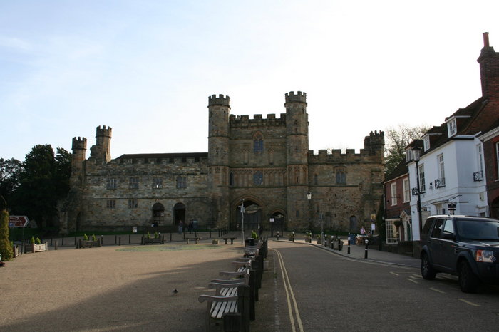
| Location | : | Battle, Rother District, England |
| Coordinate | : | 50.9144940, 0.4875140 |
| Description | : | Bodies were moved when the Abbey was built which was after the Battle of Hastings in 1066. The bodies were removed to St Mary the Virgin Churchyard (ID# 638812) |
frequently asked questions (FAQ):
-
Where is Battle Abbey?
Battle Abbey is located at Battle, Rother District ,East Sussex ,England.
-
Battle Abbey cemetery's updated grave count on graveviews.com?
0 memorials
-
Where are the coordinates of the Battle Abbey?
Latitude: 50.9144940
Longitude: 0.4875140
Nearby Cemetories:
1. St Mary the Virgin Churchyard
Battle, Rother District, England
Coordinate: 50.9150690, 0.4883620
2. Battle Cemetery
Battle, Rother District, England
Coordinate: 50.9155800, 0.4935500
3. St Mary Magdalene Churchyard
Whatlington, Rother District, England
Coordinate: 50.9365900, 0.5042980
4. St. Laurence Churchyard
Catsfield, Rother District, England
Coordinate: 50.8938230, 0.4563190
5. Crowhurst Churchyard
Crowhurst, Rother District, England
Coordinate: 50.8838070, 0.4968630
6. St John The Baptist Churchyard
Mountfield, Rother District, England
Coordinate: 50.9404170, 0.4512760
7. St. John Baptist Anglcian Churchyard
Sedlescombe, Rother District, England
Coordinate: 50.9412440, 0.5281560
8. All Saints Churchyard
Mountfield, Rother District, England
Coordinate: 50.9558449, 0.4685820
9. St Michael the Archangel Churchyard
Penhurst, Rother District, England
Coordinate: 50.9235920, 0.4092830
10. St. Mary the Virgin Churchyard
Ninfield, Wealden District, England
Coordinate: 50.8848760, 0.4224590
11. St. Leonard Churchyard
Hollington, Hastings Borough, England
Coordinate: 50.8743230, 0.5379840
12. St John the Baptist Churchyard
Westfield, Rother District, England
Coordinate: 50.9080090, 0.5729280
13. St. Peter's Churchyard
Ashburnham, Rother District, England
Coordinate: 50.9056730, 0.4014650
14. Bexhill Cemetery
Bexhill-on-Sea, Rother District, England
Coordinate: 50.8587980, 0.4517460
15. Darvell Bruderhof Cemetery
Robertsbridge, Rother District, England
Coordinate: 50.9790497, 0.4561470
16. St. Peter's Churchyard
Bexhill-on-Sea, Rother District, England
Coordinate: 50.8460530, 0.4787950
17. St George Churchyard
Brede, Rother District, England
Coordinate: 50.9349140, 0.5963830
18. Hastings Cemetery and Crematorium
Hastings, Hastings Borough, England
Coordinate: 50.8805070, 0.5904080
19. St. Leonard's Churchyard
St Leonards, Hastings Borough, England
Coordinate: 50.8513100, 0.5514400
20. St. Mark's Churchyard
Bexhill-on-Sea, Rother District, England
Coordinate: 50.8456760, 0.4372000
21. St. Thomas A. Becket Churchyard
Brightling, Rother District, England
Coordinate: 50.9638440, 0.3961020
22. St Mary the Virgin Churchyard
Salehurst, Rother District, England
Coordinate: 50.9910170, 0.4911260
23. BroadOak Methodist Chapel
Brede, Rother District, England
Coordinate: 50.9487320, 0.6015820
24. St. Oswald Anglican Churchyard
Hooe, Wealden District, England
Coordinate: 50.8576960, 0.3899300