
| Memorials | : | 6 |
| Location | : | Weaverthorpe, Ryedale District, England |
| Coordinate | : | 54.1267400, -0.5226800 |
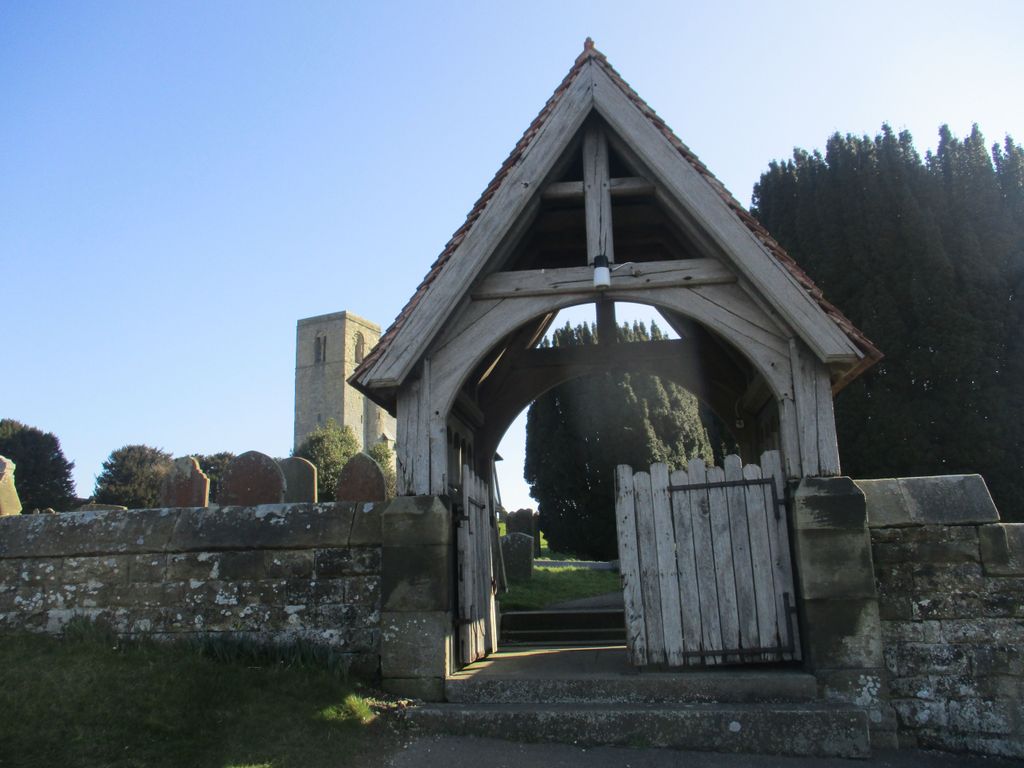
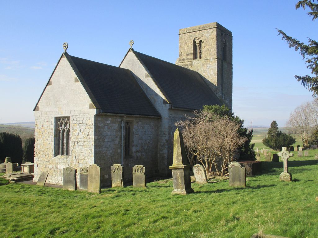
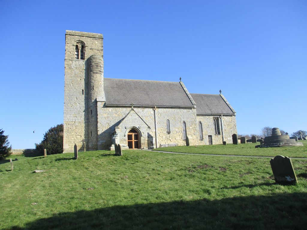
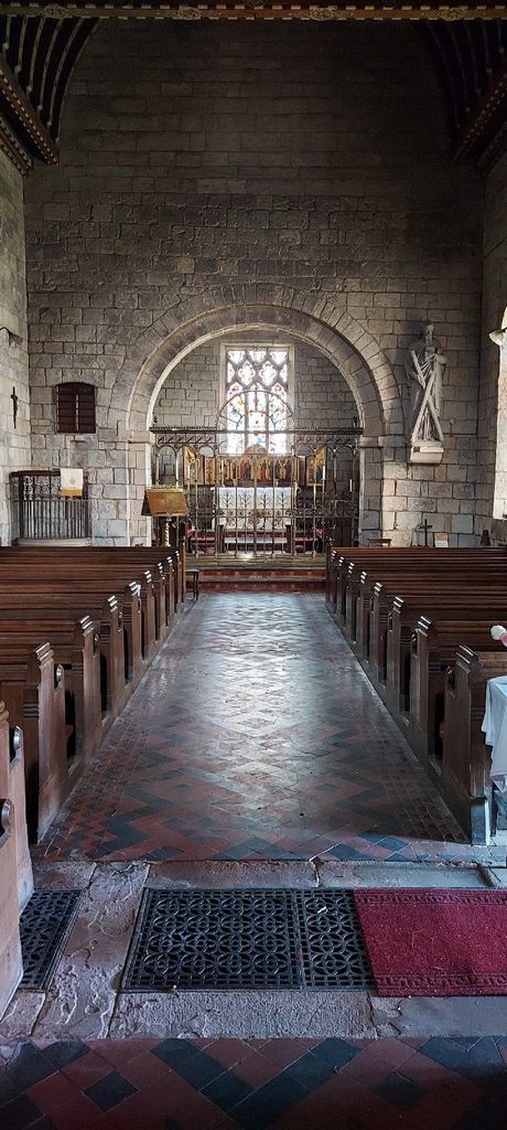
| Description | : | This info is provided courtesy of "Friends of St Andrew's Weaverthorpe": St Andrew's Weaverthorpe is a wonderful Grade 1 listed Norman church that was subject to only limited alteration during the Medieval period and then restored by one of the greatest Victorian architects, George Edmund Street. The churchyard is located on the steeply sloping side of the chalk Wold in a dominant position above the village at the northwest corner of the site of Fitzherbert's medieval manor. A listing of the inscriptions on the memorials is provided in "Weaverthorpe Monumental Inscriptions" published by the East Yorkshire Family History Society in 1999. |
frequently asked questions (FAQ):
-
Where is St Andrew Churchyard?
St Andrew Churchyard is located at Weaverthorpe, Ryedale District ,North Yorkshire ,England.
-
St Andrew Churchyard cemetery's updated grave count on graveviews.com?
4 memorials
-
Where are the coordinates of the St Andrew Churchyard?
Latitude: 54.1267400
Longitude: -0.5226800


Nearby Cemetories:
1. St Nicholas Churchyard
Foxholes, Ryedale District, England
Coordinate: 54.1297000, -0.4843000
2. St. Mary's Church Luttons Ambo
West Lutton, Ryedale District, England
Coordinate: 54.1105340, -0.5779463
3. Octon Crematorium
Langtoft, East Riding of Yorkshire Unitary Authority, England
Coordinate: 54.1089720, -0.4506760
4. St. Mary Churchyard
Cowlam, East Riding of Yorkshire Unitary Authority, England
Coordinate: 54.0787700, -0.5292200
5. St. Hilda Churchyard
Sherburn, Ryedale District, England
Coordinate: 54.1837400, -0.5311200
6. Cottam Church
Cottam, East Riding of Yorkshire Unitary Authority, England
Coordinate: 54.0707320, -0.4833770
7. St. Andrew's Churchyard
East Heslerton, Ryedale District, England
Coordinate: 54.1772500, -0.5825000
8. St Nicholas Churchyard
Ganton, Ryedale District, England
Coordinate: 54.1846000, -0.4846000
9. St. Andrew's Churchyard
Kirby Grindalythe, Ryedale District, England
Coordinate: 54.0955440, -0.6200050
10. All Saints Churchyard
West Heslerton, Ryedale District, England
Coordinate: 54.1704100, -0.6057100
11. St Peter Churchyard
Wintringham, Ryedale District, England
Coordinate: 54.1467660, -0.6431680
12. St. Peter's Churchyard
Willerby, Ryedale District, England
Coordinate: 54.1984200, -0.4558500
13. Fordon Churchyard
East Riding of Yorkshire Unitary Authority, England
Coordinate: 54.1610140, -0.3939100
14. All Saints Church Cemetery
Brompton-by-Sawdon, Scarborough Borough, England
Coordinate: 54.2223100, -0.5500900
15. All Saints' Churchyard
Thorpe Bassett, Ryedale District, England
Coordinate: 54.1496503, -0.6875921
16. St. John the Baptist Churchyard
Yedingham, Ryedale District, England
Coordinate: 54.2041744, -0.6320491
17. All Saints Churchyard
Brompton-by-Sawdon, Scarborough Borough, England
Coordinate: 54.2262550, -0.5549320
18. St. Mary's Churchyard
Wharram le Street, Ryedale District, England
Coordinate: 54.0820040, -0.6810779
19. St. Andrew’s Churchyard Extension
Rillington, Ryedale District, England
Coordinate: 54.1558500, -0.6926500
20. St Cuthbert Churchyard
Burton Fleming, East Riding of Yorkshire Unitary Authority, England
Coordinate: 54.1357420, -0.3431860
21. Flixton Cemetery New
Folkton, Scarborough Borough, England
Coordinate: 54.2006600, -0.3934700
22. St. Andrew's Churchyard
Rillington, Ryedale District, England
Coordinate: 54.1579700, -0.6959800
23. All Saints Churchyard
Kilham, East Riding of Yorkshire Unitary Authority, England
Coordinate: 54.0645570, -0.3750570
24. St. Michael and All Angels Churchyard
Garton-on-the-Wolds, East Riding of Yorkshire Unitary Authority, England
Coordinate: 54.0204960, -0.5030440