
| Memorials | : | 3 |
| Location | : | Clopton, East Northamptonshire Borough, England |
| Coordinate | : | 52.4077000, -0.4342000 |
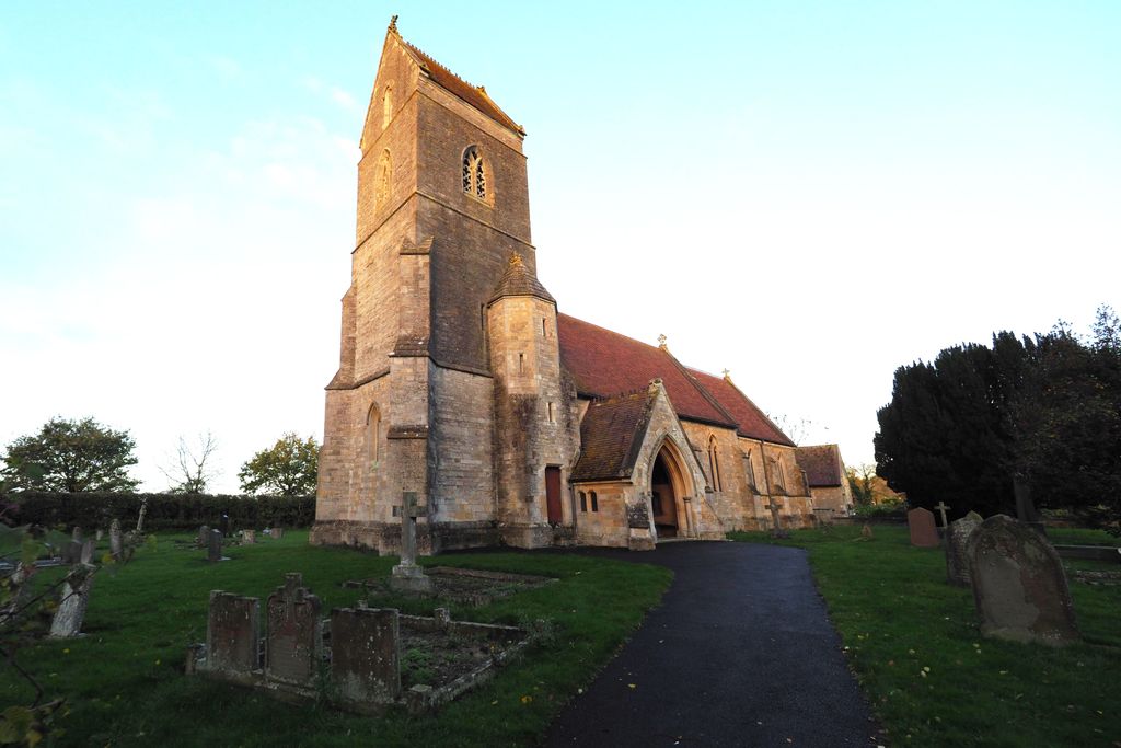
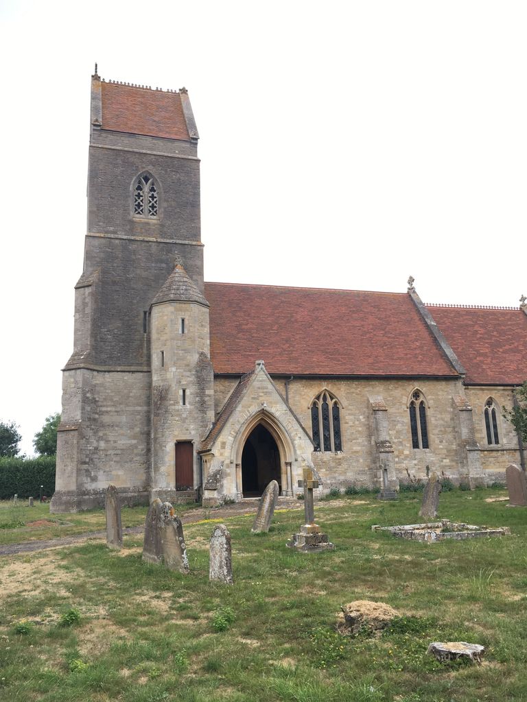
| Description | : | St Peter is the Church of England parish Church, a Victorian building that replaced an earlier medieval structure |
frequently asked questions (FAQ):
-
Where is St. Peter's Churchyard?
St. Peter's Churchyard is located at Clopton, East Northamptonshire Borough ,Northamptonshire ,England.
-
St. Peter's Churchyard cemetery's updated grave count on graveviews.com?
3 memorials
-
Where are the coordinates of the St. Peter's Churchyard?
Latitude: 52.4077000
Longitude: -0.4342000
Nearby Cemetories:
1. St James the Great
Thurning, East Northamptonshire Borough, England
Coordinate: 52.4327883, -0.4042219
2. Old Weston Church Cemetery
Old Weston, Huntingdonshire District, England
Coordinate: 52.3819525, -0.3940217
3. Church of Saint Peter Molesworth Churchyard
Molesworth, Huntingdonshire District, England
Coordinate: 52.3700110, -0.4296580
4. St. Mary's Churchyard
Titchmarsh, East Northamptonshire Borough, England
Coordinate: 52.4076080, -0.4998860
5. Brington Parish Churchyard
Brington, Huntingdonshire District, England
Coordinate: 52.3686926, -0.4089893
6. All Saints Chancel
Barnwell, East Northamptonshire Borough, England
Coordinate: 52.4482400, -0.4594600
7. All Saints Churchyard
Aldwincle, East Northamptonshire Borough, England
Coordinate: 52.4222080, -0.5142150
8. Great Gidding Baptist Church Cemetery
Great Gidding, Huntingdonshire District, England
Coordinate: 52.4336468, -0.3575526
9. Aldwincle St Peters Churchyard
Aldwincle, East Northamptonshire Borough, England
Coordinate: 52.4255060, -0.5217460
10. Thrapston Cemetery
Thrapston, East Northamptonshire Borough, England
Coordinate: 52.4000170, -0.5292640
11. St. Michael and All Angels Churchyard
Wadenhoe, East Northamptonshire Borough, England
Coordinate: 52.4382400, -0.5176200
12. St. Andrew's Churchyard
Steeple Gidding, Huntingdonshire District, England
Coordinate: 52.4184500, -0.3368200
13. St Mary's Churchyard
Leighton Bromswold, Huntingdonshire District, England
Coordinate: 52.3641002, -0.3631478
14. St. Leonard’s Churchyard
Catworth, Huntingdonshire District, England
Coordinate: 52.3475718, -0.4029185
15. All Saints Churchyard
Hamerton, Huntingdonshire District, England
Coordinate: 52.4028700, -0.3308800
16. St. Rumbold Churchyard
Stoke Doyle, East Northamptonshire Borough, England
Coordinate: 52.4678253, -0.4880529
17. St. Nicholas Churchyard
Islip, East Northamptonshire Borough, England
Coordinate: 52.3991300, -0.5513600
18. Holy Trinity Church
Denford, East Northamptonshire Borough, England
Coordinate: 52.3787353, -0.5450568
19. St. Peter's Churchyard
Lowick, East Northamptonshire Borough, England
Coordinate: 52.4116300, -0.5570600
20. St. Peter's Churchyard
Oundle, East Northamptonshire Borough, England
Coordinate: 52.4817430, -0.4671130
21. Oundle Cemetery
Oundle, East Northamptonshire Borough, England
Coordinate: 52.4799120, -0.4803840
22. All Saints Church
Buckworth, Huntingdonshire District, England
Coordinate: 52.3770200, -0.3147570
23. Nativity of the Blessed Virgin Mary Churchyard
Ringstead, East Northamptonshire Borough, England
Coordinate: 52.3652660, -0.5533620
24. Station Street Cemetery
Ringstead, East Northamptonshire Borough, England
Coordinate: 52.3654427, -0.5538628