
| Memorials | : | 0 |
| Location | : | Steeple Gidding, Huntingdonshire District, England |
| Coordinate | : | 52.4184500, -0.3368200 |
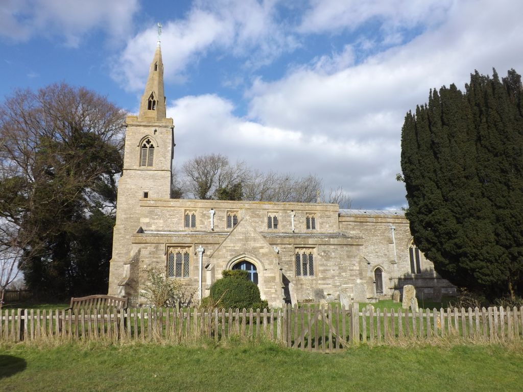
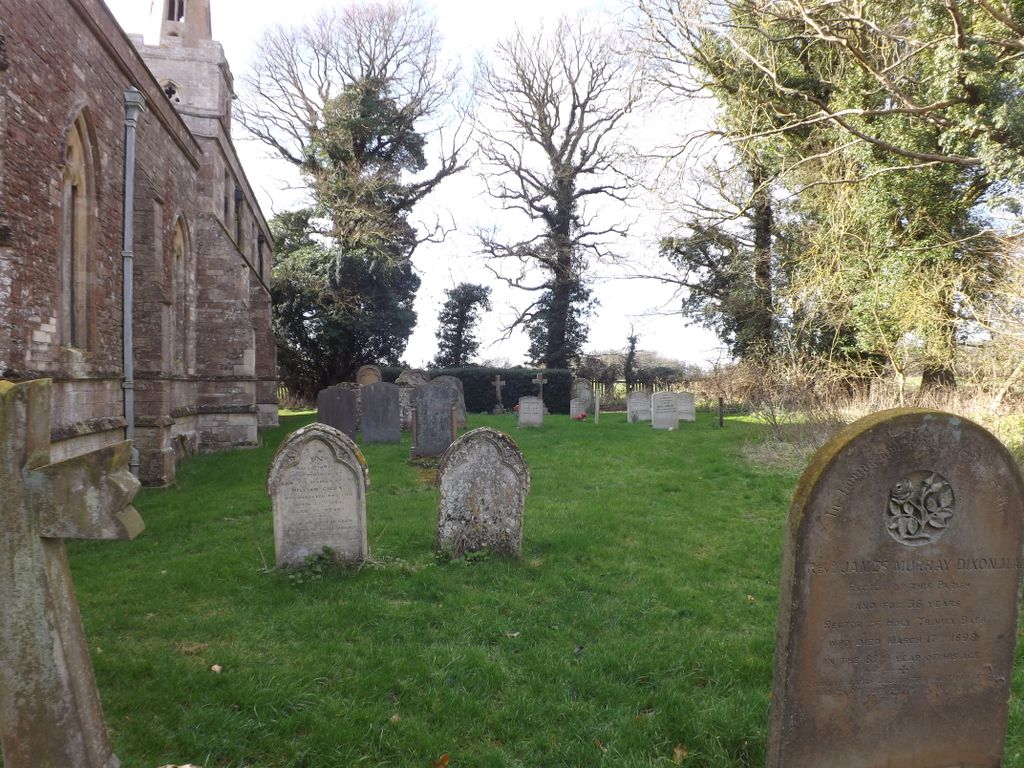
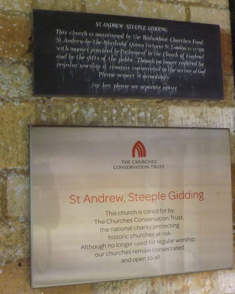
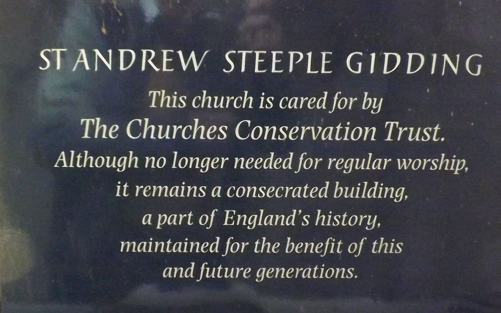
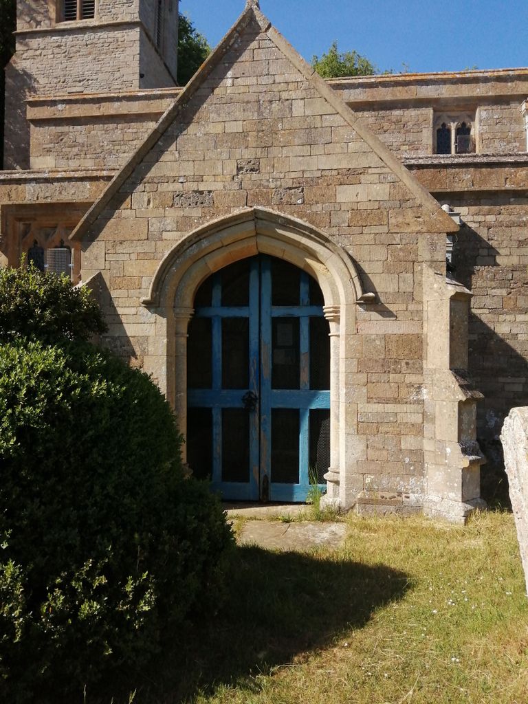
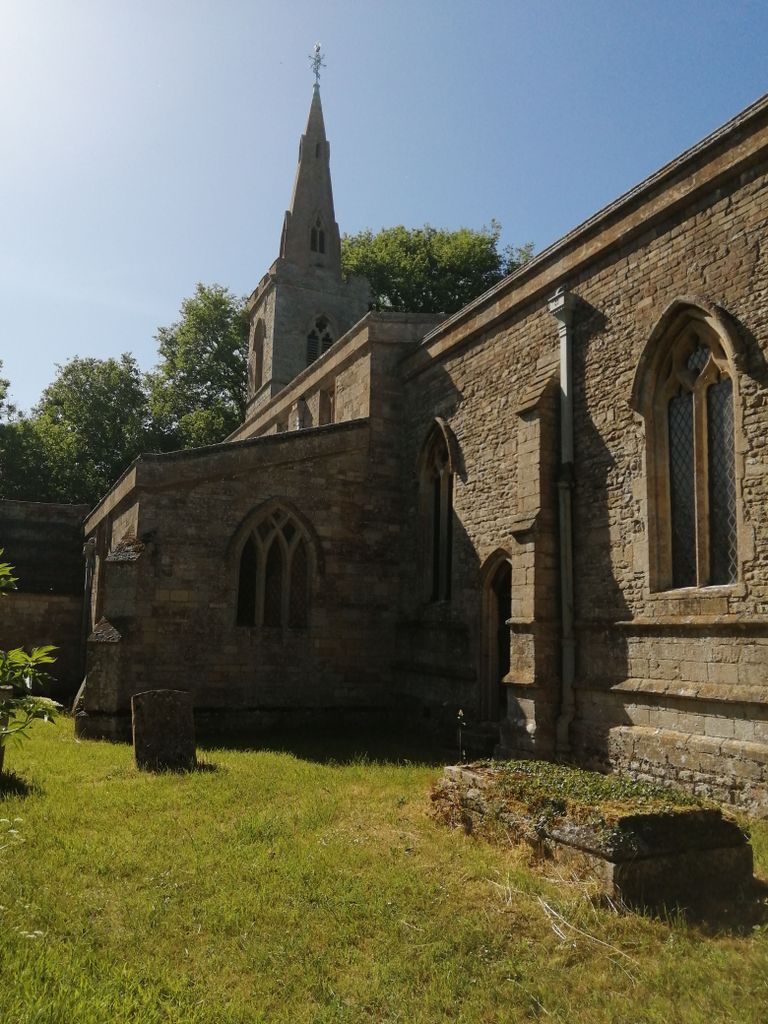
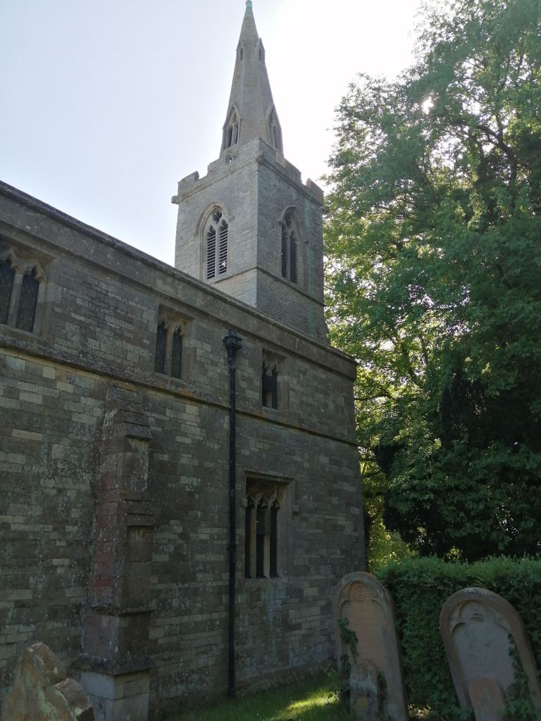
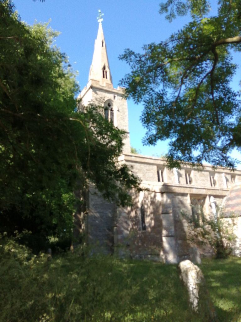
| Description | : | St Andrew's Church is a redundant Anglican church in the hamlet of Steeple Gidding, about 10 miles northwest of Huntingdon, England. It is recorded in the National Heritage List for England as a designated Grade II listed building, and is under the care of the Churches Conservation Trust. |
frequently asked questions (FAQ):
-
Where is St. Andrew's Churchyard?
St. Andrew's Churchyard is located at Steeple Gidding, Huntingdonshire District ,Cambridgeshire ,England.
-
St. Andrew's Churchyard cemetery's updated grave count on graveviews.com?
0 memorials
-
Where are the coordinates of the St. Andrew's Churchyard?
Latitude: 52.4184500
Longitude: -0.3368200
Nearby Cemetories:
1. All Saints Churchyard
Hamerton, Huntingdonshire District, England
Coordinate: 52.4028700, -0.3308800
2. Great Gidding Baptist Church Cemetery
Great Gidding, Huntingdonshire District, England
Coordinate: 52.4336468, -0.3575526
3. Sawtry All Saints
Sawtry, Huntingdonshire District, England
Coordinate: 52.4410949, -0.2771430
4. St James the Great
Thurning, East Northamptonshire Borough, England
Coordinate: 52.4327883, -0.4042219
5. All Saints Church
Buckworth, Huntingdonshire District, England
Coordinate: 52.3770200, -0.3147570
6. Sawtry St Andrew
Sawtry, Huntingdonshire District, England
Coordinate: 52.4406931, -0.2716515
7. St.Margaret Churchyard
Upton, Huntingdonshire District, England
Coordinate: 52.3918700, -0.2753400
8. St Nicholas Churchyard
Glatton, Huntingdonshire District, England
Coordinate: 52.4607440, -0.3035450
9. Old Weston Church Cemetery
Old Weston, Huntingdonshire District, England
Coordinate: 52.3819525, -0.3940217
10. St Mary's Churchyard
Leighton Bromswold, Huntingdonshire District, England
Coordinate: 52.3641002, -0.3631478
11. Sawtry Abbey
Sawtry, Huntingdonshire District, England
Coordinate: 52.4270330, -0.2411420
12. All Saints Churchyard
Conington, Huntingdonshire District, England
Coordinate: 52.4581985, -0.2642000
13. St. Peter's Churchyard
Clopton, East Northamptonshire Borough, England
Coordinate: 52.4077000, -0.4342000
14. St. Mary Churchyard
Woolley, Metropolitan Borough of Wakefield, England
Coordinate: 52.3565791, -0.3125185
15. Brington Parish Churchyard
Brington, Huntingdonshire District, England
Coordinate: 52.3686926, -0.4089893
16. St. Peter & St. Paul Churchyard
Alconbury, Huntingdonshire District, England
Coordinate: 52.3697800, -0.2610200
17. St Andrew's Churchyard, Wood Walton
Woodwalton, Huntingdonshire District, England
Coordinate: 52.4239863, -0.2235789
18. Church of Saint Peter Molesworth Churchyard
Molesworth, Huntingdonshire District, England
Coordinate: 52.3700110, -0.4296580
19. Stilton Cemetery
Stilton, Huntingdonshire District, England
Coordinate: 52.4895230, -0.2923260
20. St. Giles' Churchyard
Holme, Huntingdonshire District, England
Coordinate: 52.4767090, -0.2502880
21. Holme Cemetery
Holme, Huntingdonshire District, England
Coordinate: 52.4726120, -0.2408410
22. All Saints Chancel
Barnwell, East Northamptonshire Borough, England
Coordinate: 52.4482400, -0.4594600
23. St. Leonard’s Churchyard
Catworth, Huntingdonshire District, England
Coordinate: 52.3475718, -0.4029185
24. St. Martin’s Churchyard
Little Stukeley, Huntingdonshire District, England
Coordinate: 52.3659040, -0.2252790