
| Memorials | : | 0 |
| Location | : | Barnwell, East Northamptonshire Borough, England |
| Coordinate | : | 52.4482400, -0.4594600 |
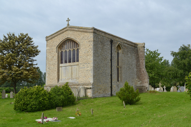
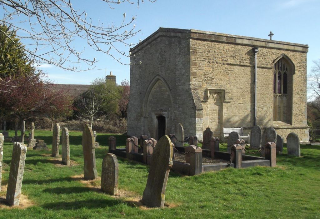
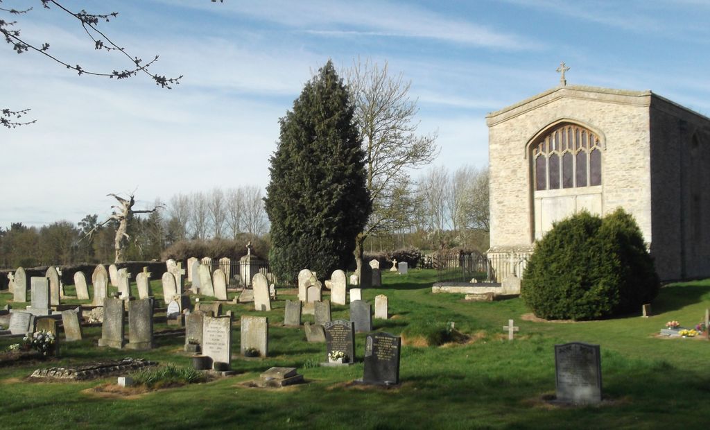
| Description | : | Located at the lower end of the main street in Barnwell, East Northamptonshire Borough, is the church of All Saints, or what remains of it. The church was demolished in 1825 but the chancel still remains and is still sometimes used for special occasions. For more than 200 years the church was used as the mausoleum of the Montagu family, owners of Barnwell Manor which once stood in the adjoining field. Now the village is served by the church of St Andrew. |
frequently asked questions (FAQ):
-
Where is All Saints Chancel?
All Saints Chancel is located at Barnwell, East Northamptonshire Borough ,Northamptonshire ,England.
-
All Saints Chancel cemetery's updated grave count on graveviews.com?
0 memorials
-
Where are the coordinates of the All Saints Chancel?
Latitude: 52.4482400
Longitude: -0.4594600
Nearby Cemetories:
1. St. Rumbold Churchyard
Stoke Doyle, East Northamptonshire Borough, England
Coordinate: 52.4678253, -0.4880529
2. St. Peter's Churchyard
Oundle, East Northamptonshire Borough, England
Coordinate: 52.4817430, -0.4671130
3. Oundle Cemetery
Oundle, East Northamptonshire Borough, England
Coordinate: 52.4799120, -0.4803840
4. St. Michael and All Angels Churchyard
Wadenhoe, East Northamptonshire Borough, England
Coordinate: 52.4382400, -0.5176200
5. St James the Great
Thurning, East Northamptonshire Borough, England
Coordinate: 52.4327883, -0.4042219
6. All Saints Churchyard
Aldwincle, East Northamptonshire Borough, England
Coordinate: 52.4222080, -0.5142150
7. St. Peter's Churchyard
Clopton, East Northamptonshire Borough, England
Coordinate: 52.4077000, -0.4342000
8. Aldwincle St Peters Churchyard
Aldwincle, East Northamptonshire Borough, England
Coordinate: 52.4255060, -0.5217460
9. St. Mary's Churchyard
Titchmarsh, East Northamptonshire Borough, England
Coordinate: 52.4076080, -0.4998860
10. St Leonard's Churchyard
Glapthorn, East Northamptonshire Borough, England
Coordinate: 52.5001397, -0.4924849
11. St. Mary's Churchyard
Tansor, East Northamptonshire Borough, England
Coordinate: 52.5057500, -0.4493700
12. Great Gidding Baptist Church Cemetery
Great Gidding, Huntingdonshire District, England
Coordinate: 52.4336468, -0.3575526
13. Saint Mary the Virgin Churchyard
Warmington, East Northamptonshire Borough, England
Coordinate: 52.5064111, -0.4144919
14. Thrapston Cemetery
Thrapston, East Northamptonshire Borough, England
Coordinate: 52.4000170, -0.5292640
15. St. Mary Churchyard
Benefield, East Northamptonshire Borough, England
Coordinate: 52.4854100, -0.5460660
16. St. Peter's Churchyard
Lowick, East Northamptonshire Borough, England
Coordinate: 52.4116300, -0.5570600
17. St. Nicholas Churchyard
Islip, East Northamptonshire Borough, England
Coordinate: 52.3991300, -0.5513600
18. All Saints Church
Sudborough, East Northamptonshire Borough, England
Coordinate: 52.4283980, -0.5782500
19. Fotheringhay Castle
Fotheringhay, East Northamptonshire Borough, England
Coordinate: 52.5243170, -0.4363420
20. Old Weston Church Cemetery
Old Weston, Huntingdonshire District, England
Coordinate: 52.3819525, -0.3940217
21. St Mary the Virgin and All Saints Churchyard
Fotheringhay, East Northamptonshire Borough, England
Coordinate: 52.5258330, -0.4390740
22. Church of Saint Peter Molesworth Churchyard
Molesworth, Huntingdonshire District, England
Coordinate: 52.3700110, -0.4296580
23. St. Andrew's Churchyard
Steeple Gidding, Huntingdonshire District, England
Coordinate: 52.4184500, -0.3368200
24. Brington Parish Churchyard
Brington, Huntingdonshire District, England
Coordinate: 52.3686926, -0.4089893