
| Memorials | : | 0 |
| Location | : | Parham, Horsham District, England |
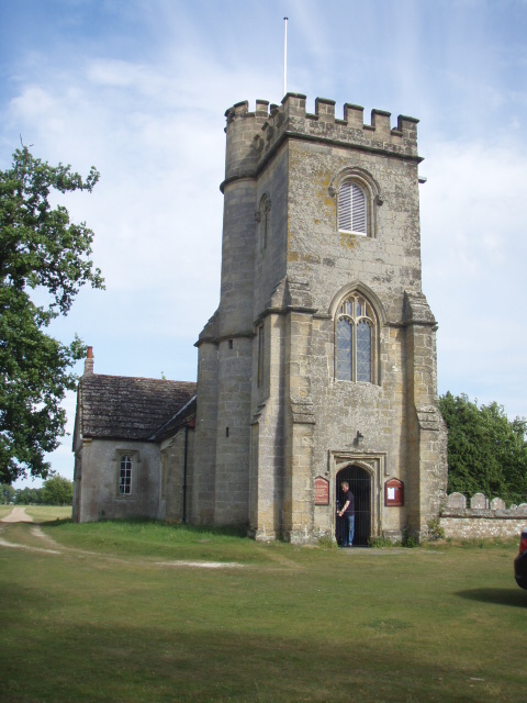
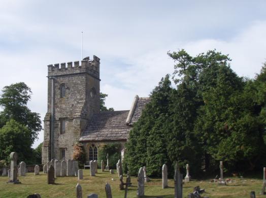
| Description | : | The Church of St Peter at Parham sits in a strange position on the lawns in front of the fabulous Tudor mansion of Parham House. The church used to serve the village of Parham, but the village has now completely disappeared from view. Towards the end of the 18th century there was a small but apparently thriving Parham village alongside St Peter's Church. The village was cleared some time in the 19th century, ostensibly for reasons of "hygiene" but more realistically to allow the Estate at Parham to be enclosed, forming the lovely deer park which can be seen today. Added Wertypop |
frequently asked questions (FAQ):
-
Where is St. Peter's Churchyard?
St. Peter's Churchyard is located at Parham, Horsham District, England.
-
St. Peter's Churchyard cemetery's updated grave count on graveviews.com?
0 memorials
Nearby Cemetories:
1. St James Churchyard
Ashurst, Horsham District, England
Coordinate: 51.0331850, -0.2610280
2. St Andrew Churchyard
Edburton, Horsham District, England
Coordinate: 51.0552500, -0.2889280
3. St Michael & All Angels Churchyard
Partridge Green, Horsham District, England
Coordinate: 51.1227750, -0.2789080
4. Newbuildings Place House and Estate Grounds
Shipley, Horsham District, England
Coordinate: 50.9986257, -0.4249232
5. St Mary the Virgin Churchyard
Shipley, Horsham District, England
Coordinate: 50.9446420, -0.4213350
6. Holy Sepulchre Churchyard
Warminghurst, Horsham District, England
Coordinate: 50.9542360, -0.4492980
7. All Saints Churchyard
Wiston, Horsham District, England
Coordinate: 51.0817080, -0.2444000
8. St Mary Churchyard
Wiston, Horsham District, England
9. Billingshurst Trinity United Reformed Churchyard
Billingshurst, Horsham District, England
10. Billingshurst Unitarian Chapel Cemetery
Billingshurst, Horsham District, England
Coordinate: 51.0596630, -0.3286750
11. St Mary Churchyard
Billingshurst, Horsham District, England
Coordinate: 51.0645800, -0.3463350
12. St Botolph Churchyard
Hardham, Horsham District, England
13. Holy Trinity Churchyard
Lower Beeding, Horsham District, England
Coordinate: 51.0331850, -0.2610280
14. St John The Evangelist Churchyard
Lower Beeding, Horsham District, England
Coordinate: 51.0552500, -0.2889280
15. Saint Mary Magdalene Churchyard
Rusper, Horsham District, England
Coordinate: 51.1227750, -0.2789080
16. Blue Idol Quaker Burying Ground
Thakeham, Horsham District, England
Coordinate: 50.9986257, -0.4249232
17. St. Mary's Churchyard
Thakeham, Horsham District, England
Coordinate: 50.9446420, -0.4213350
18. St. Mary's Churchyard
West Chiltington, Horsham District, England
Coordinate: 50.9542360, -0.4492980
19. St Saviour Churchyard
Colgate, Horsham District, England
Coordinate: 51.0817080, -0.2444000
20. Congregational Church Graveyard
Horsham, Horsham District, England
21. Denne Rd St Marys new Churchyard
Horsham, Horsham District, England
22. Denne Road Cemetery
Horsham, Horsham District, England
Coordinate: 51.0596630, -0.3286750
23. Hills Cemetery
Horsham, Horsham District, England
Coordinate: 51.0645800, -0.3463350
24. Horsham Quaker Burying Ground
Horsham, Horsham District, England