
| Memorials | : | 0 |
| Location | : | Partridge Green, Horsham District, England |
| Coordinate | : | 50.9618600, -0.3081540 |
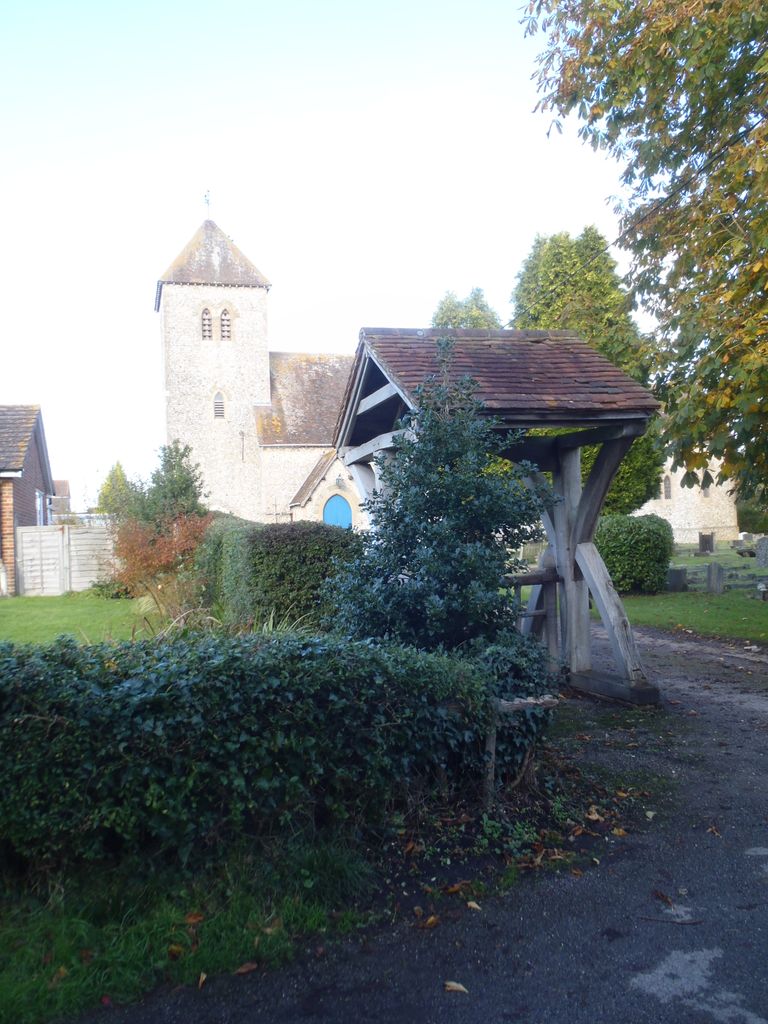
| Description | : | Partridge Green is a village in the Horsham District of West Sussex, England. It lies on the B2135 road 2.4 miles (3.9km) northwest of Henfield. St Michael and All Angels Church was built in the 1890 to keep up with the increase in population. Text By Wertypop. |
frequently asked questions (FAQ):
-
Where is St Michael & All Angels Churchyard?
St Michael & All Angels Churchyard is located at Church Lane Partridge Green, Horsham District ,West Sussex ,England.
-
St Michael & All Angels Churchyard cemetery's updated grave count on graveviews.com?
0 memorials
-
Where are the coordinates of the St Michael & All Angels Churchyard?
Latitude: 50.9618600
Longitude: -0.3081540

Nearby Cemetories:
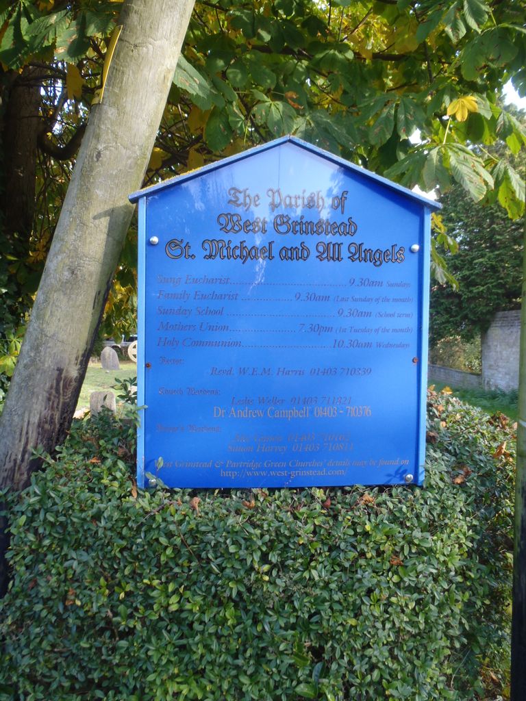
1. St Michael and All Angels Churchyard
West Grinstead, Horsham District, England
Coordinate: 50.9619680, -0.3081750
2. Our Lady Of Consolation and St Francis Churchyard
West Grinstead, Horsham District, England
Coordinate: 50.9779220, -0.3245590
3. St Hugh's Charterhouse
Horsham, Horsham District, England
Coordinate: 50.9730110, -0.2827360
4. St George Churchyard
West Grinstead, Horsham District, England
Coordinate: 50.9736360, -0.3336990
5. St Giles Churchyard
Shermanbury, Horsham District, England
Coordinate: 50.9561320, -0.2726010
6. St James Churchyard
Ashurst, Horsham District, England
Coordinate: 50.9347992, -0.3273070
7. Henfield Cemetery
Henfield, Horsham District, England
Coordinate: 50.9342000, -0.2764400
8. St Peter Churchyard
Cowfold, Horsham District, England
Coordinate: 50.9898500, -0.2740200
9. St Peter's Churchyard
Henfield, Horsham District, England
Coordinate: 50.9323340, -0.2762030
10. St Mary the Virgin Churchyard
Shipley, Horsham District, England
Coordinate: 50.9842530, -0.3701900
11. St Peter's Churchyard
Woodmancote, Horsham District, England
Coordinate: 50.9213180, -0.2497350
12. St Peters Churchyard
Twineham, Mid Sussex District, England
Coordinate: 50.9657310, -0.2174410
13. St Andrew Churchyard
Nuthurst, Horsham District, England
Coordinate: 51.0222790, -0.3010080
14. All Saints Churchyard
Wiston, Horsham District, England
Coordinate: 50.9132350, -0.3725910
15. Holy Sepulchre Churchyard
Warminghurst, Horsham District, England
Coordinate: 50.9402980, -0.4113760
16. St Mary Churchyard
Wiston, Horsham District, England
Coordinate: 50.8995280, -0.3582890
17. The Church of the Holy Innocents Cemetery
Southwater, Horsham District, England
Coordinate: 51.0244290, -0.3576390
18. Southwater Parish Cemetery
Southwater, Horsham District, England
Coordinate: 51.0245167, -0.3574486
19. Holy Innocents Churchyard
Southwater, Horsham District, England
Coordinate: 51.0252410, -0.3584748
20. St. Mary Magdalene Churchyard
Bolney, Mid Sussex District, England
Coordinate: 50.9898000, -0.2035200
21. St Andrew and St Cuthman Churchyard
Steyning, Horsham District, England
Coordinate: 50.8900700, -0.3250280
22. St. Mary's Churchyard
Thakeham, Horsham District, England
Coordinate: 50.9446420, -0.4213350
23. St Peter Churchyard
Upper Beeding, Horsham District, England
Coordinate: 50.8873530, -0.3056540
24. Holy Trinity Churchyard
Lower Beeding, Horsham District, England
Coordinate: 51.0331850, -0.2610280