
| Memorials | : | 1 |
| Location | : | Wiston, Horsham District, England |
| Coordinate | : | 50.8995280, -0.3582890 |
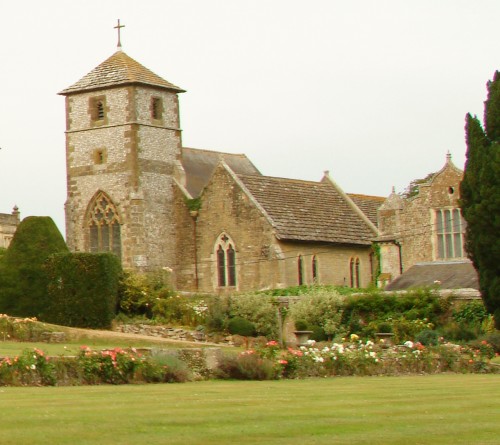
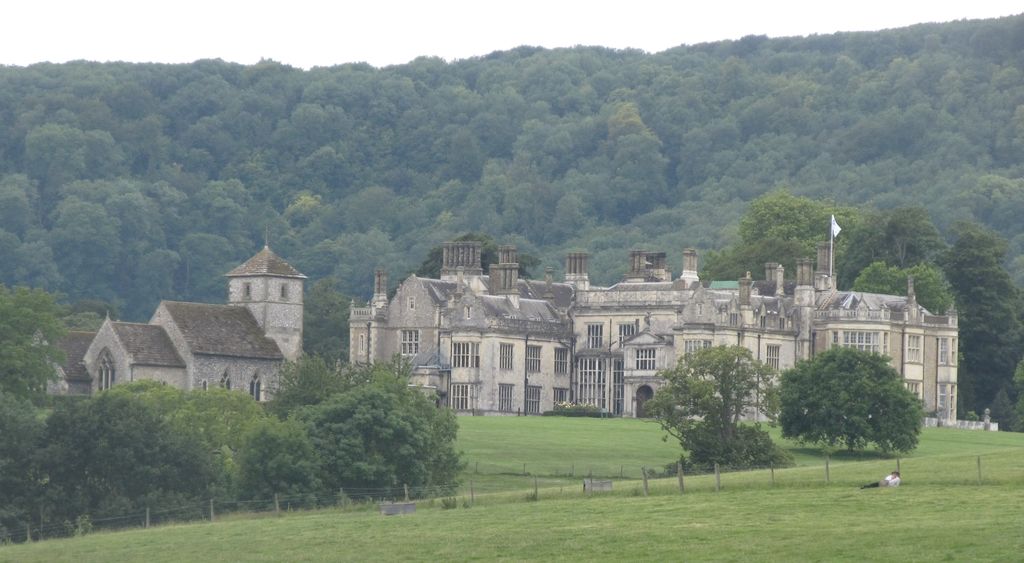
| Description | : | Wiston is a scattered village and civil parish in the Horsham District of West Sussex, England. It lies on the A283 road 2.8 miles (4.5 km) northwest of Steyning. The parish covers an area of 1,360 hectares (3,400 acres). In the 2001 census 221 people lived in 86 households, of whom 120 were economically active. ----------------------------------------- St. Mary's Church, Wiston. The church stands next to Wiston Park House - Telephone: 01903 8150 This is a small Norman church of great beauty and simplicity by the river Stour, with a fine Norman south doorway, a beautiful Norman chancel arch and 13th century wall paintings... Read More |
frequently asked questions (FAQ):
-
Where is St Mary Churchyard?
St Mary Churchyard is located at Mouse Lane Wiston, Horsham District ,West Sussex , BN44 3DZEngland.
-
St Mary Churchyard cemetery's updated grave count on graveviews.com?
1 memorials
-
Where are the coordinates of the St Mary Churchyard?
Latitude: 50.8995280
Longitude: -0.3582890
Nearby Cemetories:
1. All Saints Churchyard
Wiston, Horsham District, England
Coordinate: 50.9132350, -0.3725910
2. St Andrew and St Cuthman Churchyard
Steyning, Horsham District, England
Coordinate: 50.8900700, -0.3250280
3. St Nicholas Churchyard
Bramber, Horsham District, England
Coordinate: 50.8828660, -0.3153580
4. St Mary's Churchyard Extension
Washington, Horsham District, England
Coordinate: 50.9036269, -0.4089782
5. St. Mary's Parish Churchyard
Washington, Horsham District, England
Coordinate: 50.9043450, -0.4103140
6. St Peter Churchyard
Upper Beeding, Horsham District, England
Coordinate: 50.8873530, -0.3056540
7. St James Churchyard
Ashurst, Horsham District, England
Coordinate: 50.9347992, -0.3273070
8. Worthing Crematorium
Findon, Arun District, England
Coordinate: 50.8728370, -0.4085170
9. St Botolph's
Boto By, Guldborgsund Kommune, Denmark
Coordinate: 50.8704488, -0.3049848
10. Botolph Cemetery
Steyning, Horsham District, England
Coordinate: 50.8698470, -0.3051070
11. Findon Cemetery
Findon, Arun District, England
Coordinate: 50.8678500, -0.4100500
12. St John the Baptist Churchyard
Findon, Arun District, England
Coordinate: 50.8650400, -0.4148790
13. Coombes Churchyard
Coombes, Adur District, England
Coordinate: 50.8611730, -0.3082180
14. Saint Marys Churchyard
Sullington, Horsham District, England
Coordinate: 50.9070090, -0.4391640
15. Holy Sepulchre Churchyard
Warminghurst, Horsham District, England
Coordinate: 50.9402980, -0.4113760
16. St. Mary's Churchyard
Thakeham, Horsham District, England
Coordinate: 50.9446420, -0.4213350
17. St. Mary's Churchyard
Sompting, Adur District, England
Coordinate: 50.8386030, -0.3518740
18. St Peter's Churchyard
Henfield, Horsham District, England
Coordinate: 50.9323340, -0.2762030
19. Lancing and Sompting Cemetery
Lancing, Adur District, England
Coordinate: 50.8405270, -0.3280020
20. Henfield Cemetery
Henfield, Horsham District, England
Coordinate: 50.9342000, -0.2764400
21. Landing College Chapel
Lancing, Adur District, England
Coordinate: 50.8459798, -0.3042240
22. St. Mary's Churchyard
Storrington, Horsham District, England
Coordinate: 50.9160360, -0.4566160
23. Durrington Cemetery
Durrington, Worthing Borough, England
Coordinate: 50.8390820, -0.3934460
24. St. James the Less Churchyard
Lancing, Adur District, England
Coordinate: 50.8378170, -0.3226110