| Memorials | : | 0 |
| Location | : | Malvern Wells, Malvern Hills District, England |
| Coordinate | : | 52.0783528, -2.3322165 |
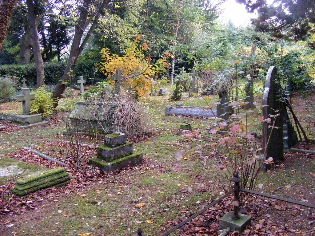
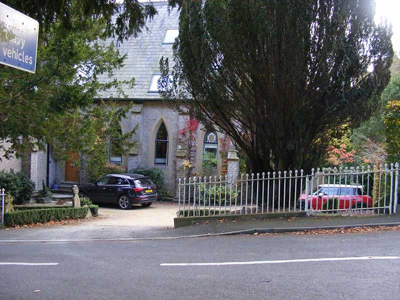
| Description | : | St Peter's church is located on the corner of Green Lane and the Wells Road. It was designed circa 1836 by Robert Jearrad of Cheltenham. In 1994 the church was declared redundant and sold for residential development. The small churchyard lies in a hollow on the south side of the church. Access is still possible via a wooden gate on the west side of the building, down two steps, then across a courtyard and through a low metal gate. The grass is kept cut but the headstones are sunk in leaves and ivy concealing many of the inscriptions. |
frequently asked questions (FAQ):
-
Where is St Peter's Churchyard?
St Peter's Churchyard is located at Green Lane, Malvern Wells Malvern Wells, Malvern Hills District ,Worcestershire , WR14 4HUEngland.
-
St Peter's Churchyard cemetery's updated grave count on graveviews.com?
0 memorials
-
Where are the coordinates of the St Peter's Churchyard?
Latitude: 52.0783528
Longitude: -2.3322165
Nearby Cemetories:
1. Malvern Wells Cemetery
Malvern Wells, Malvern Hills District, England
Coordinate: 52.0779911, -2.3286663
2. St. Wulstan Roman Catholic Churchyard
Little Malvern, Malvern Hills District, England
Coordinate: 52.0666050, -2.3356450
3. Little Malvern Priory
Little Malvern, Malvern Hills District, England
Coordinate: 52.0612500, -2.3365800
4. Welland Cemetery
Welland, Malvern Hills District, England
Coordinate: 52.0591625, -2.3021845
5. St. James Churchyard
Welland, Malvern Hills District, England
Coordinate: 52.0577700, -2.2974900
6. St. James the Great Churchyard
Colwall, Herefordshire Unitary Authority, England
Coordinate: 52.0785300, -2.3821400
7. Great Malvern Priory Churchyard
Great Malvern, Malvern Hills District, England
Coordinate: 52.1106750, -2.3284660
8. St. Gabriel's Churchyard
Hanley Swan, Malvern Hills District, England
Coordinate: 52.0829420, -2.2784110
9. St. James's Churchyard
West Malvern, Malvern Hills District, England
Coordinate: 52.1127220, -2.3469830
10. Great Malvern Cemetery
Great Malvern, Malvern Hills District, England
Coordinate: 52.1133010, -2.3135120
11. Our Lady & St Alphonsus Catholic Churchyard
Hanley Swan, Malvern Hills District, England
Coordinate: 52.0907960, -2.2753160
12. St James Churchyard
Great Malvern, Malvern Hills District, England
Coordinate: 52.1197650, -2.3316900
13. St. Mary's Churchyard
Guarlford, Malvern Hills District, England
Coordinate: 52.1061887, -2.2738220
14. Church of the Good Shepherd Churchyard
Malvern Hills District, England
Coordinate: 52.0632720, -2.2624630
15. St. Peter's Churchyard
Malvern Link, Malvern Hills District, England
Coordinate: 52.1259530, -2.3380280
16. St. Gregory Churchyard
Castlemorton, Malvern Hills District, England
Coordinate: 52.0332900, -2.3003800
17. All Saints Churchyard
Coddington, Herefordshire Unitary Authority, England
Coordinate: 52.0820020, -2.4123970
18. All Saints Churchyard
Hollybush, Malvern Hills District, England
Coordinate: 52.0282510, -2.3384140
19. St. Matthias Churchyard
Malvern Link, Malvern Hills District, England
Coordinate: 52.1290490, -2.3178900
20. Convent of the Holy Name, Chapel and Cloister
Malvern Link, Malvern Hills District, England
Coordinate: 52.1304500, -2.3068900
21. St Mary the Virgin Churchyard
Madresfield, Malvern Hills District, England
Coordinate: 52.1252800, -2.2864800
22. St. James' the Great Churchyard
Cradley, Herefordshire Unitary Authority, England
Coordinate: 52.1218440, -2.3870920
23. St. John the Baptist
Eastnor, Herefordshire Unitary Authority, England
Coordinate: 52.0330980, -2.3932590
24. St. Mary's Churchyard
Hanley Castle, Malvern Hills District, England
Coordinate: 52.0755870, -2.2365390


