
| Memorials | : | 0 |
| Location | : | Malvern Link, Malvern Hills District, England |
| Website | : | historicengland.org.uk/listing/the-list/list-entry/1082736 |
| Coordinate | : | 52.1304500, -2.3068900 |
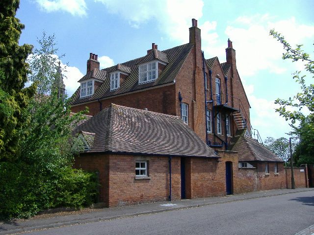
| Description | : | RANELAGH ROAD 1. 5245 (east side) SO 74 NE 12/177 4.6.73 Chapel and Cloister at The Convent of the Holy Name II* (star) GV 2. Community of the Mission Sisters of the Holy Name of Jesus, usually shortened to Community of the Holy Name. https://www.derelictplaces.co.uk/main/religious-sites/21028-gospel-centre-malvern-link-formerly-convent-holy-name-nov-2011-a.html Gospel Centre in Malvern Link, formerly the Convent of the Holy Name |
frequently asked questions (FAQ):
-
Where is Convent of the Holy Name, Chapel and Cloister?
Convent of the Holy Name, Chapel and Cloister is located at Ranelagh Road Malvern Link, Malvern Hills District ,Worcestershire , WR14 1BQEngland.
-
Convent of the Holy Name, Chapel and Cloister cemetery's updated grave count on graveviews.com?
0 memorials
-
Where are the coordinates of the Convent of the Holy Name, Chapel and Cloister?
Latitude: 52.1304500
Longitude: -2.3068900
Nearby Cemetories:
1. Newland Cemetery
Newland, Malvern Hills District, England
Coordinate: 52.1342764, -2.2988052
2. St. Matthias Churchyard
Malvern Link, Malvern Hills District, England
Coordinate: 52.1290490, -2.3178900
3. St Mary the Virgin Churchyard
Madresfield, Malvern Hills District, England
Coordinate: 52.1252800, -2.2864800
4. Great Malvern Cemetery
Great Malvern, Malvern Hills District, England
Coordinate: 52.1133010, -2.3135120
5. St James Churchyard
Great Malvern, Malvern Hills District, England
Coordinate: 52.1197650, -2.3316900
6. St. Peter's Churchyard
Malvern Link, Malvern Hills District, England
Coordinate: 52.1259530, -2.3380280
7. Great Malvern Priory Churchyard
Great Malvern, Malvern Hills District, England
Coordinate: 52.1106750, -2.3284660
8. St. James's Churchyard
West Malvern, Malvern Hills District, England
Coordinate: 52.1127220, -2.3469830
9. St. Mary's Churchyard
Guarlford, Malvern Hills District, England
Coordinate: 52.1061887, -2.2738220
10. St. John the Baptist Churchyard
Bransford, Malvern Hills District, England
Coordinate: 52.1616486, -2.2981676
11. Worcester County Pauper and Lunatic Asylum Cemetery
Powick, Malvern Hills District, England
Coordinate: 52.1530276, -2.2599550
12. Stanbrook Abbey
Callow End, Malvern Hills District, England
Coordinate: 52.1389670, -2.2398380
13. Our Lady & St Alphonsus Catholic Churchyard
Hanley Swan, Malvern Hills District, England
Coordinate: 52.0907960, -2.2753160
14. St. Eadburga Churchyard
Leigh, Malvern Hills District, England
Coordinate: 52.1789500, -2.3169500
15. St Peter's Church Burial Ground
Powick, Malvern Hills District, England
Coordinate: 52.1613890, -2.2432490
16. St. James' the Great Churchyard
Cradley, Herefordshire Unitary Authority, England
Coordinate: 52.1218440, -2.3870920
17. St. Gabriel's Churchyard
Hanley Swan, Malvern Hills District, England
Coordinate: 52.0829420, -2.2784110
18. St. Mary the Virgin Churchyard
Kempsey, Malvern Hills District, England
Coordinate: 52.1396580, -2.2231290
19. Malvern Wells Cemetery
Malvern Wells, Malvern Hills District, England
Coordinate: 52.0779911, -2.3286663
20. St Peter's Churchyard
Malvern Wells, Malvern Hills District, England
Coordinate: 52.0783528, -2.3322165
21. Cradley Chapel
Cradley, Herefordshire Unitary Authority, England
Coordinate: 52.1215478, -2.4001078
22. St Mary Magdalene Churchyard
Alfrick, Malvern Hills District, England
Coordinate: 52.1744230, -2.3693070
23. St Leonard Churchyard
Cotheridge, Malvern Hills District, England
Coordinate: 52.1903100, -2.3139500
24. St Thomas Churchyard
Rushwick, Malvern Hills District, England
Coordinate: 52.1903870, -2.2751750