
| Memorials | : | 1 |
| Location | : | Great Malvern, Malvern Hills District, England |
| Coordinate | : | 52.1106750, -2.3284660 |
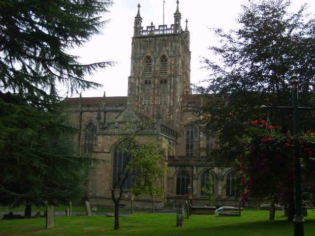
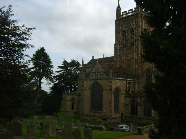
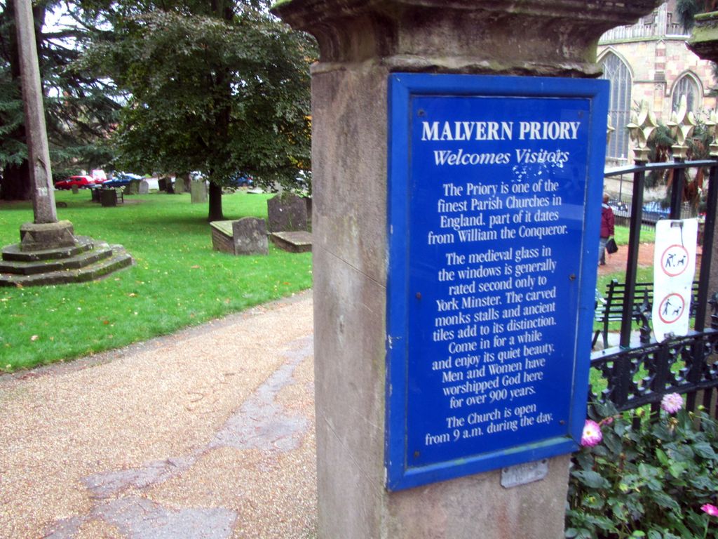
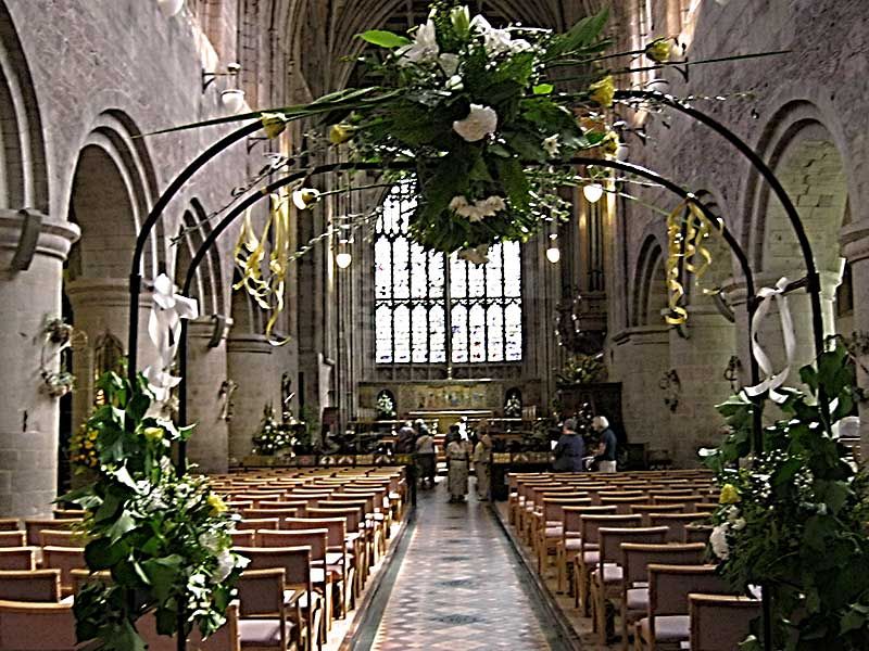
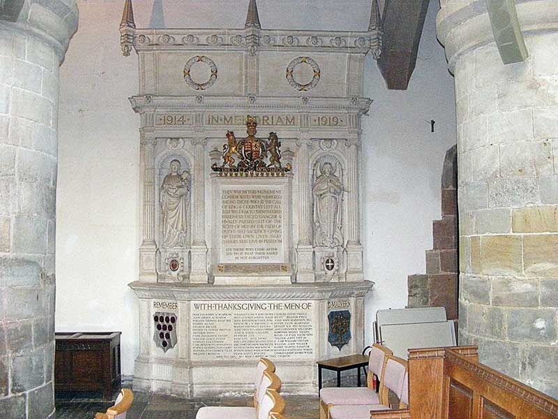
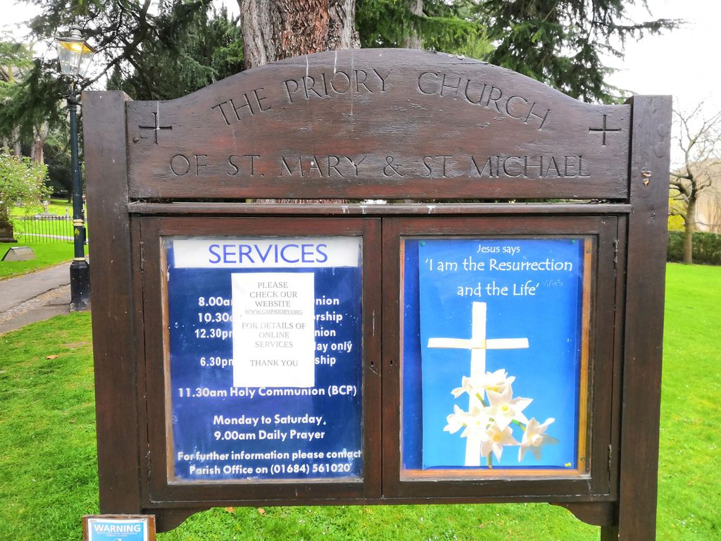
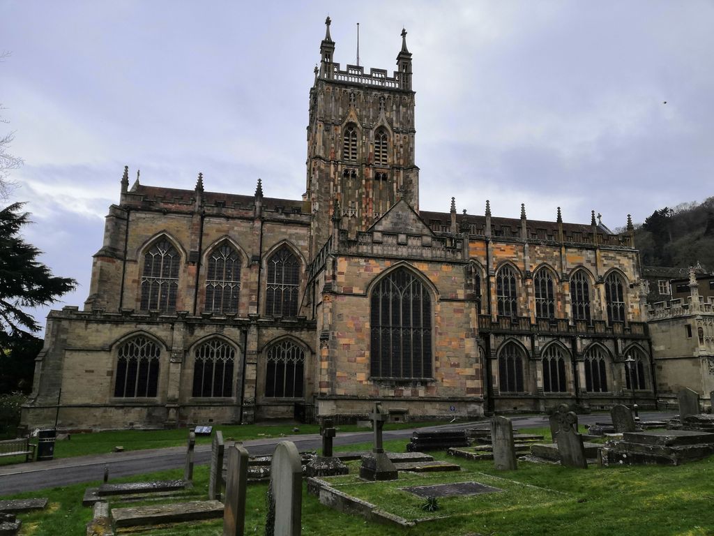
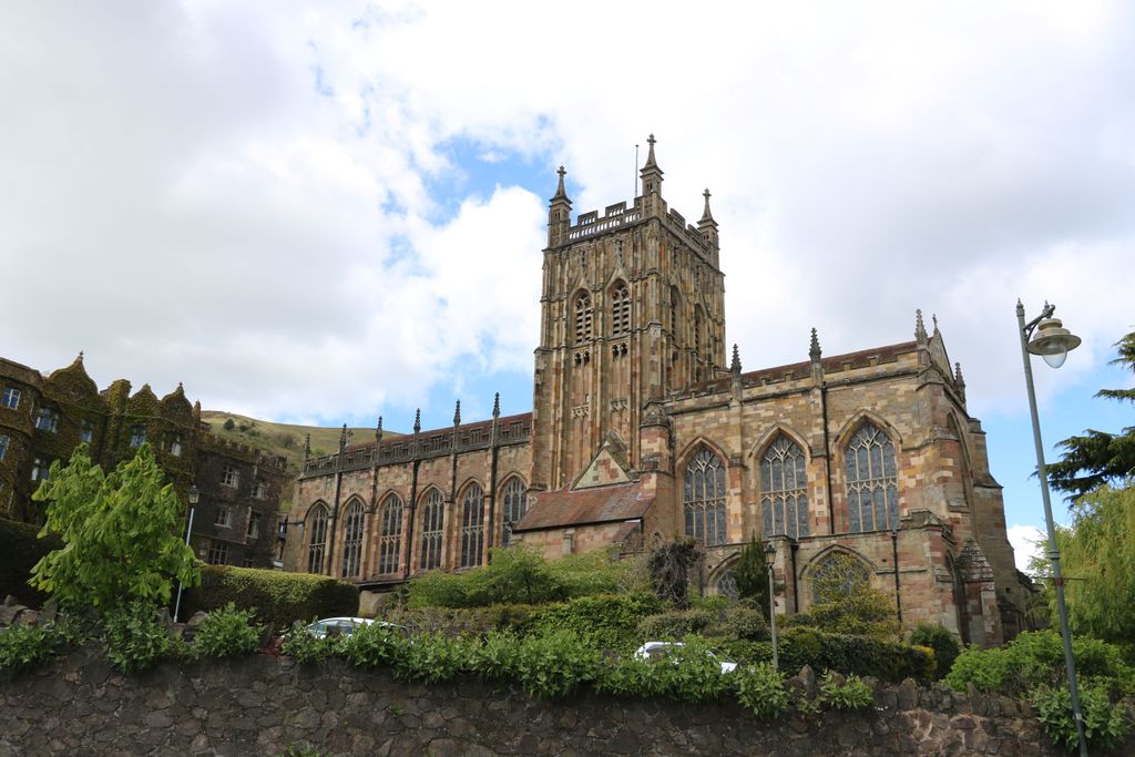
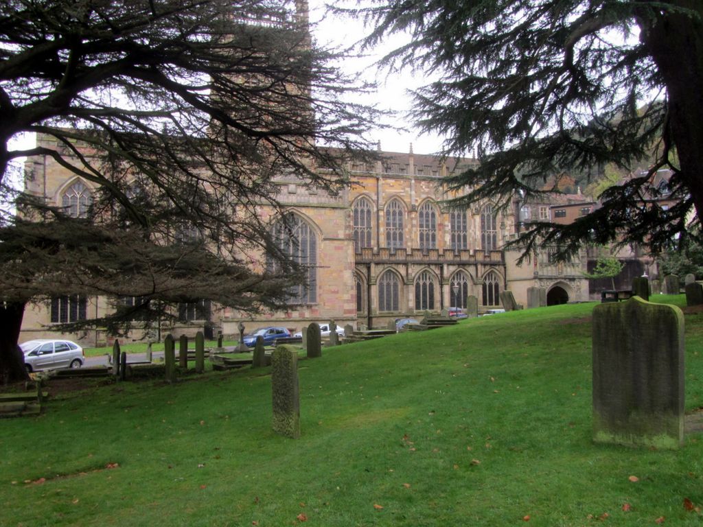
| Description | : | Great Malvern Priory, which occupies a prominent position on the south side of Church Street, was built as a monastery circa 1058 AD. Following the dissolution of the monasteries by Henry VIII, the present building was acquired by the townspeople about 1540 and became the parish church of Great Malvern, replacing the old church of St Thomas which stood on the site of the present Post Office. Within the church there are a few burials in vaults, a practice that ceased about 1851, and there is a war memorial remembering parishioners and their sons who fell in two World Wars. The... Read More |
frequently asked questions (FAQ):
-
Where is Great Malvern Priory Churchyard?
Great Malvern Priory Churchyard is located at Great Malvern, Malvern Hills District ,Worcestershire ,England.
-
Great Malvern Priory Churchyard cemetery's updated grave count on graveviews.com?
1 memorials
-
Where are the coordinates of the Great Malvern Priory Churchyard?
Latitude: 52.1106750
Longitude: -2.3284660


Nearby Cemetories:
1. St James Churchyard
Great Malvern, Malvern Hills District, England
Coordinate: 52.1197650, -2.3316900
2. Great Malvern Cemetery
Great Malvern, Malvern Hills District, England
Coordinate: 52.1133010, -2.3135120
3. St. James's Churchyard
West Malvern, Malvern Hills District, England
Coordinate: 52.1127220, -2.3469830
4. St. Peter's Churchyard
Malvern Link, Malvern Hills District, England
Coordinate: 52.1259530, -2.3380280
5. St. Matthias Churchyard
Malvern Link, Malvern Hills District, England
Coordinate: 52.1290490, -2.3178900
6. Convent of the Holy Name, Chapel and Cloister
Malvern Link, Malvern Hills District, England
Coordinate: 52.1304500, -2.3068900
7. St Mary the Virgin Churchyard
Madresfield, Malvern Hills District, England
Coordinate: 52.1252800, -2.2864800
8. Newland Cemetery
Newland, Malvern Hills District, England
Coordinate: 52.1342764, -2.2988052
9. St Peter's Churchyard
Malvern Wells, Malvern Hills District, England
Coordinate: 52.0783528, -2.3322165
10. Malvern Wells Cemetery
Malvern Wells, Malvern Hills District, England
Coordinate: 52.0779911, -2.3286663
11. St. Mary's Churchyard
Guarlford, Malvern Hills District, England
Coordinate: 52.1061887, -2.2738220
12. St. James' the Great Churchyard
Cradley, Herefordshire Unitary Authority, England
Coordinate: 52.1218440, -2.3870920
13. Our Lady & St Alphonsus Catholic Churchyard
Hanley Swan, Malvern Hills District, England
Coordinate: 52.0907960, -2.2753160
14. St. Gabriel's Churchyard
Hanley Swan, Malvern Hills District, England
Coordinate: 52.0829420, -2.2784110
15. St. Wulstan Roman Catholic Churchyard
Little Malvern, Malvern Hills District, England
Coordinate: 52.0666050, -2.3356450
16. Cradley Chapel
Cradley, Herefordshire Unitary Authority, England
Coordinate: 52.1215478, -2.4001078
17. St. James the Great Churchyard
Colwall, Herefordshire Unitary Authority, England
Coordinate: 52.0785300, -2.3821400
18. Little Malvern Priory
Little Malvern, Malvern Hills District, England
Coordinate: 52.0612500, -2.3365800
19. Welland Cemetery
Welland, Malvern Hills District, England
Coordinate: 52.0591625, -2.3021845
20. St. John the Baptist Churchyard
Bransford, Malvern Hills District, England
Coordinate: 52.1616486, -2.2981676
21. St. James Churchyard
Welland, Malvern Hills District, England
Coordinate: 52.0577700, -2.2974900
22. All Saints Churchyard
Coddington, Herefordshire Unitary Authority, England
Coordinate: 52.0820020, -2.4123970
23. Worcester County Pauper and Lunatic Asylum Cemetery
Powick, Malvern Hills District, England
Coordinate: 52.1530276, -2.2599550
24. Stanbrook Abbey
Callow End, Malvern Hills District, England
Coordinate: 52.1389670, -2.2398380