
| Memorials | : | 9 |
| Location | : | Swalcliffe, Cherwell District, England |
| Coordinate | : | 52.0380790, -1.4497340 |
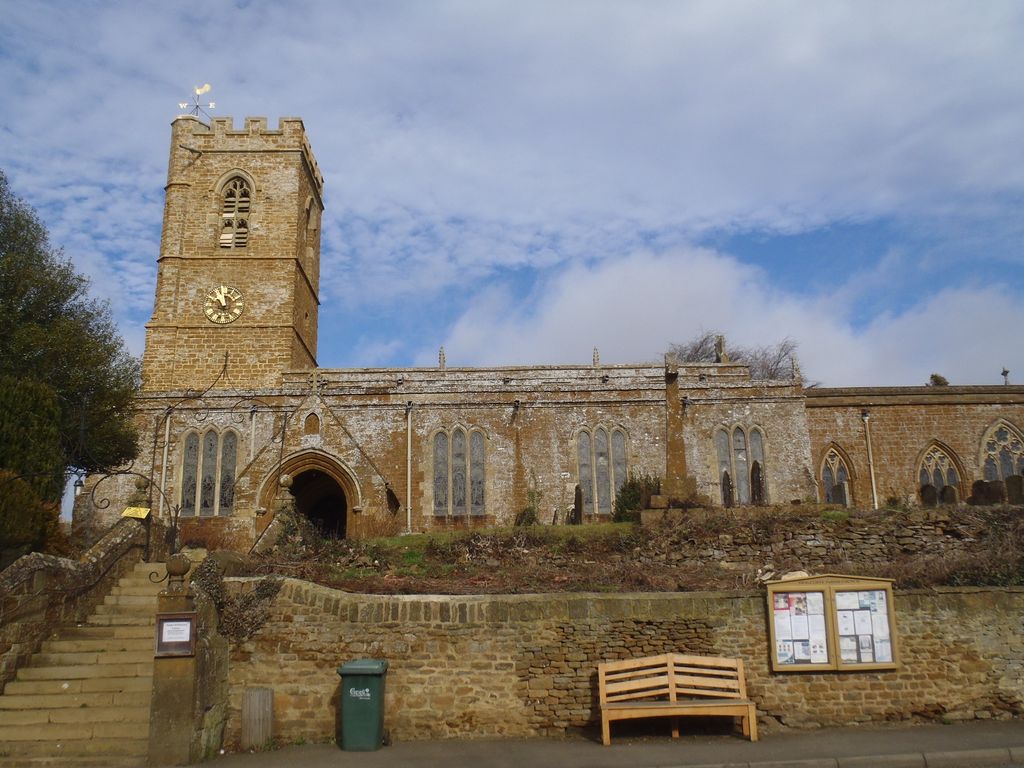
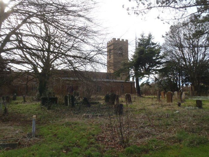
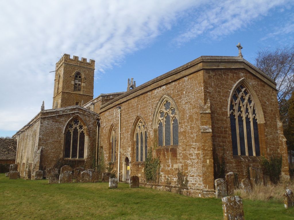
| Description | : | The Church of England parish church of St. Peter and St. Paul is Anglo-Saxon in origin but was rebuilt in the 12th and 14th centuries. The bell tower was built in the 13th century and made higher in the 15th century. It has a ring of six bells cast by Matthew I Bagley and Henry II Bagley of Chacombe, Northamptonshire in 1685. Richard Sanders of Bromsgrove recast one of them in 1720. |
frequently asked questions (FAQ):
-
Where is St. Peter and St. Paul Churchyard?
St. Peter and St. Paul Churchyard is located at B4035 Swalcliffe, Cherwell District ,Oxfordshire ,England.
-
St. Peter and St. Paul Churchyard cemetery's updated grave count on graveviews.com?
9 memorials
-
Where are the coordinates of the St. Peter and St. Paul Churchyard?
Latitude: 52.0380790
Longitude: -1.4497340
Nearby Cemetories:
1. St Nicholas Churchyard
Tadmarton, Cherwell District, England
Coordinate: 52.0377060, -1.4295690
2. Holy Trinity Churchyard
Sibford Gower, Cherwell District, England
Coordinate: 52.0374300, -1.4822670
3. Friends Burial Ground
Sibford Gower, Cherwell District, England
Coordinate: 52.0373140, -1.4889440
4. St Anne's Parish Church
Epwell, Cherwell District, England
Coordinate: 52.0615780, -1.4866280
5. St Mary the Virgin Churchyard
Broughton, Cherwell District, England
Coordinate: 52.0417020, -1.3912030
6. Saint Laurence Churchyard
Milcombe, Cherwell District, England
Coordinate: 52.0083060, -1.4033990
7. Saint Giles
Wigginton, Cherwell District, England
Coordinate: 51.9966400, -1.4324000
8. Hook Norton Cemetery
Hook Norton, Cherwell District, England
Coordinate: 51.9969440, -1.4787690
9. St Michael and All Angels Churchyard
Alkerton, Cherwell District, England
Coordinate: 52.0834080, -1.4509680
10. St Peters Churchyard
Hook Norton, Cherwell District, England
Coordinate: 51.9954200, -1.4842490
11. Hook Norton Baptist Burial Ground
Hook Norton, Cherwell District, England
Coordinate: 51.9953000, -1.4860900
12. South Newington St Peter ad Vincula
South Newington, Cherwell District, England
Coordinate: 51.9970000, -1.4082300
13. All Saints Churchyard
Wroxton, Cherwell District, England
Coordinate: 52.0726220, -1.3925790
14. St Mary's Churchyard
Bloxham, Cherwell District, England
Coordinate: 52.0181100, -1.3748900
15. St Peter's Churchyard
Drayton, Cherwell District, England
Coordinate: 52.0707360, -1.3764670
16. Compton Wynyates Burial Grounds
Compton Wynyates, Stratford-on-Avon District, England
Coordinate: 52.0747020, -1.5198000
17. St. George's Church of England
Brailes, Stratford-on-Avon District, England
Coordinate: 52.0515110, -1.5414420
18. St Mary Churchyard
Swerford, West Oxfordshire District, England
Coordinate: 51.9773470, -1.4593150
19. St Etheldreda Churchyard
Horley, Cherwell District, England
Coordinate: 52.0924610, -1.3930320
20. St. John's Churchyard
Hornton, Cherwell District, England
Coordinate: 52.1020090, -1.4287560
21. St. Michael's
Whichford, Stratford-on-Avon District, England
Coordinate: 52.0094910, -1.5467784
22. St Mary's churchyard
Tysoe, Stratford-on-Avon District, England
Coordinate: 52.0966300, -1.5036400
23. Bodicote Cemetery
Bodicote, Cherwell District, England
Coordinate: 52.0391710, -1.3397380
24. Barford St. Michael Churchyard
Barford St Michael, Cherwell District, England
Coordinate: 51.9903200, -1.3711500