
| Memorials | : | 0 |
| Location | : | Bloxham, Cherwell District, England |
| Coordinate | : | 52.0181100, -1.3748900 |
| Description | : | Bloxham is a village and civil parish in northern Oxfordshire on the edge of the Cotswolds, 3 miles (4.8 km) southwest of Banbury. |
frequently asked questions (FAQ):
-
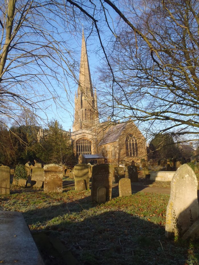
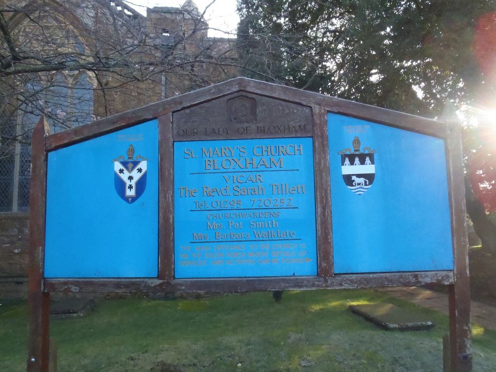
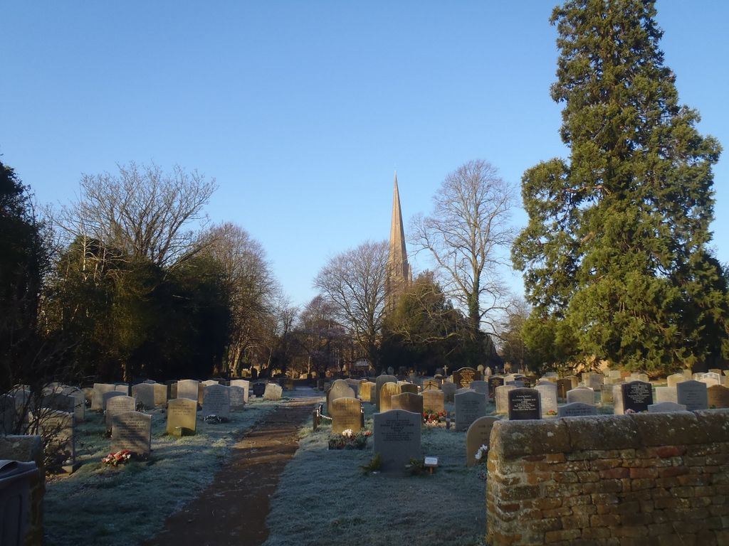
Where is St Mary's Churchyard?
St Mary's Churchyard is located at Church Street Bloxham, Cherwell District ,Oxfordshire , OX15 4PYEngland.
-
St Mary's Churchyard cemetery's updated grave count on graveviews.com?
0 memorials
-
Where are the coordinates of the St Mary's Churchyard?
Latitude: 52.0181100
Longitude: -1.3748900
Nearby Cemetories:
1. St John the Evangelist
Milton, Cherwell District, England
Coordinate: 52.0117900, -1.3452510
2. Saint Laurence Churchyard
Milcombe, Cherwell District, England
Coordinate: 52.0083060, -1.4033990
3. St John's Churchyard
Barford St John, Cherwell District, England
Coordinate: 51.9955050, -1.3620350
4. St Mary the Virgin Churchyard
Broughton, Cherwell District, England
Coordinate: 52.0417020, -1.3912030
5. Barford St. Michael Churchyard
Barford St Michael, Cherwell District, England
Coordinate: 51.9903200, -1.3711500
6. South Newington St Peter ad Vincula
South Newington, Cherwell District, England
Coordinate: 51.9970000, -1.4082300
7. Bodicote Cemetery
Bodicote, Cherwell District, England
Coordinate: 52.0391710, -1.3397380
8. Adderbury Parish Cemetery
Adderbury, Cherwell District, England
Coordinate: 52.0139537, -1.3246874
9. Saint John the Baptist Churchyard
Bodicote, Cherwell District, England
Coordinate: 52.0356100, -1.3305700
10. St Mary the Virgin Churchyard
Adderbury, Cherwell District, England
Coordinate: 52.0148420, -1.3152270
11. St Nicholas Churchyard
Tadmarton, Cherwell District, England
Coordinate: 52.0377060, -1.4295690
12. Saint Giles
Wigginton, Cherwell District, England
Coordinate: 51.9966400, -1.4324000
13. Deddington Cemetery
Deddington, Cherwell District, England
Coordinate: 51.9824490, -1.3338930
14. St. John the Evangelist Churchyard
Banbury, Cherwell District, England
Coordinate: 52.0598790, -1.3400100
15. St. Mary the Virgin Churchyard
Banbury, Cherwell District, England
Coordinate: 52.0614620, -1.3391870
16. Ss Peter and Paul Churchyard
Deddington, Cherwell District, England
Coordinate: 51.9817680, -1.3207470
17. St. Peter and St. Paul Churchyard
Swalcliffe, Cherwell District, England
Coordinate: 52.0380790, -1.4497340
18. St James Churchyard
Nether Worton, West Oxfordshire District, England
Coordinate: 51.9678100, -1.3807900
19. St Peter's Churchyard
Drayton, Cherwell District, England
Coordinate: 52.0707360, -1.3764670
20. Southam Road Cemetery
Banbury, Cherwell District, England
Coordinate: 52.0679120, -1.3405760
21. All Saints Churchyard
Wroxton, Cherwell District, England
Coordinate: 52.0726220, -1.3925790
22. Holy Trinity Churchyard
Over Worton, West Oxfordshire District, England
Coordinate: 51.9598240, -1.3753620
23. Ss Peter and Paul Churchyard
Kings Sutton, South Northamptonshire Borough, England
Coordinate: 52.0212000, -1.2763560
24. Kings Sutton Cemetery
Kings Sutton, South Northamptonshire Borough, England
Coordinate: 52.0151400, -1.2711000