
| Memorials | : | 172 |
| Location | : | Bridge, City of Canterbury, England |
| Coordinate | : | 51.2443730, 1.1271000 |
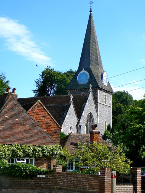
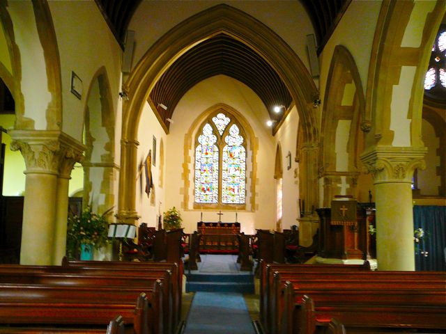
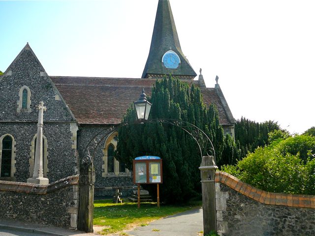
| Description | : | St Peter's Church, Bridge makes an immediate impression, as one comes down the hill from Canterbury; it is at the bottom of the hill, with houses grouped closely around the west end, though the churchyard opens onto fields to the south east. The Domesday Book records a church on the site, and the first named incumbent, Walter de Burne, became a Crusader. In 1852 a Mrs Gregory gave money for the building to be restored. The work was carried out under the supervision of George Gilbert Scott in 1858, cladding the exterior in Kentish flint. The interior is unexpectedly light,... Read More |
frequently asked questions (FAQ):
-
Where is St Peter Churchyard?
St Peter Churchyard is located at High Street Bridge, City of Canterbury ,Kent , CT4 5AREngland.
-
St Peter Churchyard cemetery's updated grave count on graveviews.com?
172 memorials
-
Where are the coordinates of the St Peter Churchyard?
Latitude: 51.2443730
Longitude: 1.1271000
Nearby Cemetories:
1. St Mary Churchyard
Patrixbourne, City of Canterbury, England
Coordinate: 51.2534430, 1.1364840
2. St Mary Churchyard
Bishopsbourne, City of Canterbury, England
Coordinate: 51.2307620, 1.1323170
3. St Peter Churchyard
Bekesbourne, City of Canterbury, England
Coordinate: 51.2563430, 1.1445750
4. St. Mary's Churchyard
Nackington, City of Canterbury, England
Coordinate: 51.2498670, 1.0892370
5. St. Giles Churchyard
Kingston, City of Canterbury, England
Coordinate: 51.2181750, 1.1463980
6. St Mary's Churchyard
Lower Hardres, City of Canterbury, England
Coordinate: 51.2371410, 1.0821320
7. Holy Innocents Churchyard
Adisham, City of Canterbury, England
Coordinate: 51.2440380, 1.1903320
8. St Martin Churchyard
Canterbury, City of Canterbury, England
Coordinate: 51.2780170, 1.0937160
9. St Peter and St Paul Churchyard
Upper Hardres, City of Canterbury, England
Coordinate: 51.2152380, 1.0811020
10. St Augustine Abbey Ruins
Canterbury, City of Canterbury, England
Coordinate: 51.2781280, 1.0882060
11. St Paul Without the Walls
Canterbury, City of Canterbury, England
Coordinate: 51.2779380, 1.0853180
12. St George's Church Demolished
Canterbury, City of Canterbury, England
Coordinate: 51.2773770, 1.0827380
13. Dane John Gardens
Canterbury, City of Canterbury, England
Coordinate: 51.2754210, 1.0780390
14. St John the Baptist Churchyard
Barham, City of Canterbury, England
Coordinate: 51.2065410, 1.1620830
15. St Mary Magdalene Church Demolished
Canterbury, City of Canterbury, England
Coordinate: 51.2784510, 1.0830170
16. St Mary Bredin Old Church (Defunct)
Canterbury, City of Canterbury, England
Coordinate: 51.2773455, 1.0803962
17. St Gregory Churchyard
Canterbury, City of Canterbury, England
Coordinate: 51.2816050, 1.0887840
18. St John the Baptist Church Cemetery
Barham, City of Canterbury, England
Coordinate: 51.2056600, 1.1629900
19. St Mary de Castro Churchyard
Canterbury, City of Canterbury, England
Coordinate: 51.2762400, 1.0766820
20. St Mary Northgate Cemetery
Canterbury, City of Canterbury, England
Coordinate: 51.2811320, 1.0859300
21. Canterbury Cathedral
Canterbury, City of Canterbury, England
Coordinate: 51.2796936, 1.0826840
22. St Margaret's Churchyard
Canterbury, City of Canterbury, England
Coordinate: 51.2781780, 1.0795840
23. Aylesham Cemetery
Aylesham, Dover District, England
Coordinate: 51.2126910, 1.1781980
24. St. Mildred with St. Mary de Castro Church
Canterbury, City of Canterbury, England
Coordinate: 51.2764810, 1.0743320