
| Memorials | : | 34 |
| Location | : | Upper Hardres, City of Canterbury, England |
| Coordinate | : | 51.2152380, 1.0811020 |
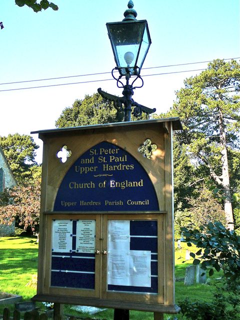
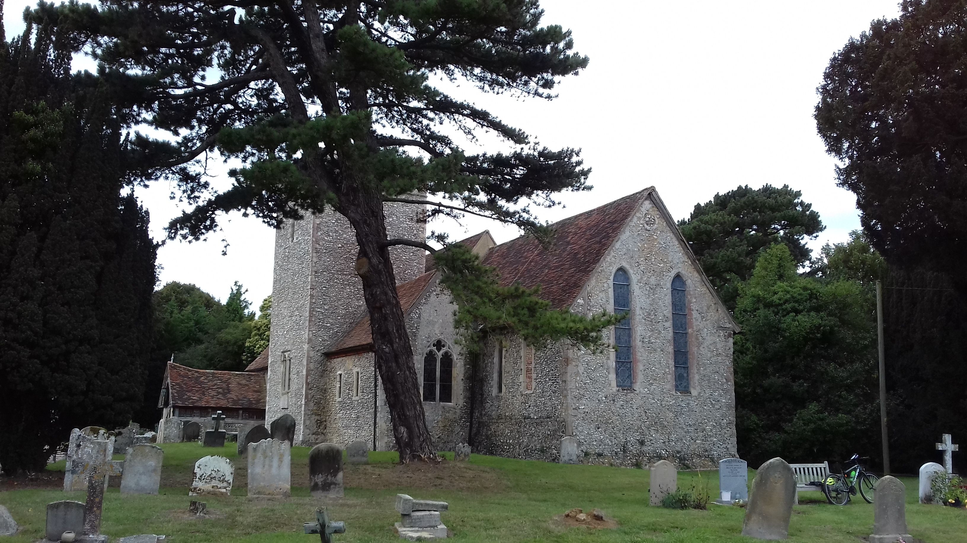
| Description | : | On the site of a church mentioned in the Doomsday Book, the present church is 12th century in origin, having been consecrated in 1160. It is part of the Parish of Upper Hardres and Stelling, in the Diocese of Canterbury. Probably its greatest treasure is the large and complete 'bracket brass', in memory of John Strete, a former rector of the parish who died in 1405. The churchyard lies around the church in a bend of the road, towards the end of the small village. (The name is locally pronounced "Hards", without the 'r'.) It has some large, shady trees, and... Read More |
frequently asked questions (FAQ):
-
Where is St Peter and St Paul Churchyard?
St Peter and St Paul Churchyard is located at Hardres Court Road Upper Hardres, City of Canterbury ,Kent , CT4 6ENEngland.
-
St Peter and St Paul Churchyard cemetery's updated grave count on graveviews.com?
34 memorials
-
Where are the coordinates of the St Peter and St Paul Churchyard?
Latitude: 51.2152380
Longitude: 1.0811020
Nearby Cemetories:
1. All Saints Churchyard
Petham, City of Canterbury, England
Coordinate: 51.2206030, 1.0496330
2. St Mary Churchyard
Stelling Minnis, Shepway District, England
Coordinate: 51.1963830, 1.0644830
3. St Mary's Churchyard
Lower Hardres, City of Canterbury, England
Coordinate: 51.2371410, 1.0821320
4. St. Mary's Churchyard
Nackington, City of Canterbury, England
Coordinate: 51.2498670, 1.0892370
5. St Mary Churchyard
Bishopsbourne, City of Canterbury, England
Coordinate: 51.2307620, 1.1323170
6. St Peter Churchyard
Bridge, City of Canterbury, England
Coordinate: 51.2443730, 1.1271000
7. St. Giles Churchyard
Kingston, City of Canterbury, England
Coordinate: 51.2181750, 1.1463980
8. St Bartholomew Churchyard
Waltham, City of Canterbury, England
Coordinate: 51.1961680, 1.0223940
9. St Augustine Hospital Burial Ground
Chartham, City of Canterbury, England
Coordinate: 51.2480170, 1.0342770
10. St John the Baptist Churchyard
Barham, City of Canterbury, England
Coordinate: 51.2065410, 1.1620830
11. St Mary Churchyard
Patrixbourne, City of Canterbury, England
Coordinate: 51.2534430, 1.1364840
12. St John the Baptist Church Cemetery
Barham, City of Canterbury, England
Coordinate: 51.2056600, 1.1629900
13. St. Mary the Virgin Churchyard
Chartham, City of Canterbury, England
Coordinate: 51.2558720, 1.0180810
14. St Peter Churchyard
Bekesbourne, City of Canterbury, England
Coordinate: 51.2563430, 1.1445750
15. Wincheap Non-Conformist Burial Ground
Canterbury, City of Canterbury, England
Coordinate: 51.2718430, 1.0672940
16. St Nicholas Churchyard
Thanington-Without, City of Canterbury, England
Coordinate: 51.2703550, 1.0544190
17. Dane John Gardens
Canterbury, City of Canterbury, England
Coordinate: 51.2754210, 1.0780390
18. Aylesham Cemetery
Aylesham, Dover District, England
Coordinate: 51.2126910, 1.1781980
19. St Mary de Castro Churchyard
Canterbury, City of Canterbury, England
Coordinate: 51.2762400, 1.0766820
20. St. Mildred with St. Mary de Castro Church
Canterbury, City of Canterbury, England
Coordinate: 51.2764810, 1.0743320
21. St Mary Bredin Old Church (Defunct)
Canterbury, City of Canterbury, England
Coordinate: 51.2773455, 1.0803962
22. St George's Church Demolished
Canterbury, City of Canterbury, England
Coordinate: 51.2773770, 1.0827380
23. St Paul Without the Walls
Canterbury, City of Canterbury, England
Coordinate: 51.2779380, 1.0853180
24. St Margaret's Churchyard
Canterbury, City of Canterbury, England
Coordinate: 51.2781780, 1.0795840