
| Memorials | : | 120 |
| Location | : | Kingston, City of Canterbury, England |
| Coordinate | : | 51.2181750, 1.1463980 |
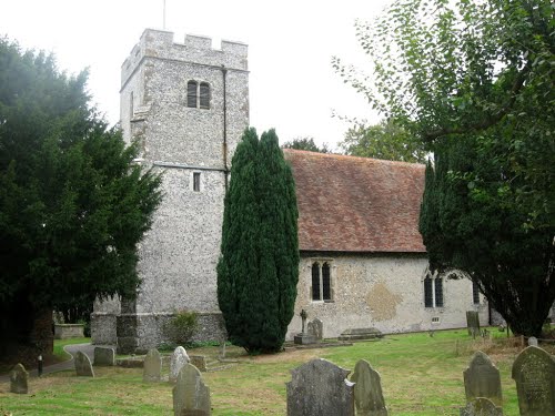
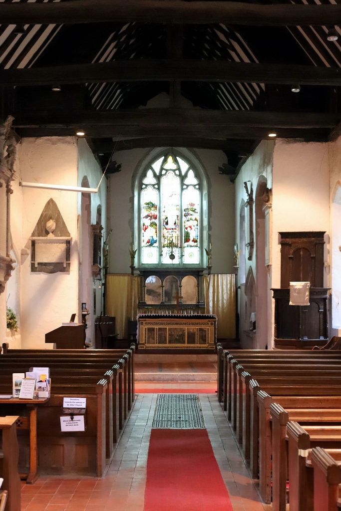
| Description | : | St Giles church was founded by the Norman's, and built of local flint and stones. In the 14th Century the church was remodeled; a chancel was added to the east wing and a tower to the west side of the building. Inside the church there are is a variety of stained glass windows and brasses. |
frequently asked questions (FAQ):
-
Where is St. Giles Churchyard?
St. Giles Churchyard is located at Church Lane Kingston, City of Canterbury ,Kent , CT4 6HYEngland.
-
St. Giles Churchyard cemetery's updated grave count on graveviews.com?
2 memorials
-
Where are the coordinates of the St. Giles Churchyard?
Latitude: 51.2181750
Longitude: 1.1463980
Nearby Cemetories:
1. St John the Baptist Churchyard
Barham, City of Canterbury, England
Coordinate: 51.2065410, 1.1620830
2. St Mary Churchyard
Bishopsbourne, City of Canterbury, England
Coordinate: 51.2307620, 1.1323170
3. St John the Baptist Church Cemetery
Barham, City of Canterbury, England
Coordinate: 51.2056600, 1.1629900
4. Aylesham Cemetery
Aylesham, Dover District, England
Coordinate: 51.2126910, 1.1781980
5. St Margaret of Antioch Churchyard
Womenswold, City of Canterbury, England
Coordinate: 51.2109850, 1.1878090
6. St Peter Churchyard
Bridge, City of Canterbury, England
Coordinate: 51.2443730, 1.1271000
7. Barham Crematorium
Barham, City of Canterbury, England
Coordinate: 51.1972610, 1.1800310
8. St Mary Churchyard
Patrixbourne, City of Canterbury, England
Coordinate: 51.2534430, 1.1364840
9. Holy Innocents Churchyard
Adisham, City of Canterbury, England
Coordinate: 51.2440380, 1.1903320
10. St Peter Churchyard
Bekesbourne, City of Canterbury, England
Coordinate: 51.2563430, 1.1445750
11. St Peter and St Paul Churchyard
Upper Hardres, City of Canterbury, England
Coordinate: 51.2152380, 1.0811020
12. St Mary Magdalene Churchyard
Denton, Dover District, England
Coordinate: 51.1767118, 1.1694535
13. St Mary's Churchyard
Lower Hardres, City of Canterbury, England
Coordinate: 51.2371410, 1.0821320
14. St. Mary's Churchyard
Nackington, City of Canterbury, England
Coordinate: 51.2498670, 1.0892370
15. St Mary the Virgin Churchyard
Nonington, Dover District, England
Coordinate: 51.2258300, 1.2253800
16. St Mary Churchyard
Stelling Minnis, Shepway District, England
Coordinate: 51.1963830, 1.0644830
17. Holy Cross
Goodnestone, Dover District, England
Coordinate: 51.2457190, 1.2290550
18. Saint Nicholas Churchyard
Eythorne, Dover District, England
Coordinate: 51.2055720, 1.2400490
19. St Nicholas’ Barfrestone Church Burial Ground
Eythorne, Dover District, England
Coordinate: 51.2056350, 1.2400870
20. All Saints Churchyard
Petham, City of Canterbury, England
Coordinate: 51.2206030, 1.0496330
21. Saint Andrew Churchyard
Shepherdswell, Dover District, England
Coordinate: 51.1841500, 1.2358000
22. Elham Methodist Church
Elham, Shepway District, England
Coordinate: 51.1542930, 1.1113970
23. St Mary the Virgin Churchyard
Wingham, Dover District, England
Coordinate: 51.2721220, 1.2128950
24. St Martin Churchyard
Canterbury, City of Canterbury, England
Coordinate: 51.2780170, 1.0937160