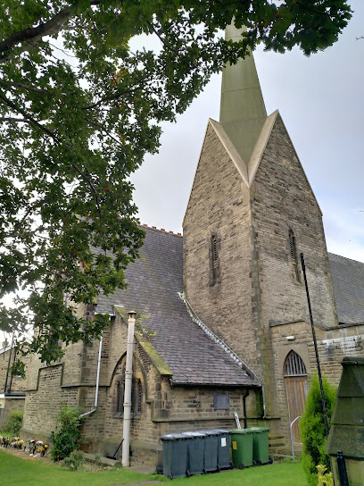
| Memorials | : | 0 |
| Location | : | Cleckheaton, Metropolitan Borough of Kirklees, England |
| Coordinate | : | 53.7291800, -1.7481500 |
| Description | : | There is no graveyard attached to this church but there are some stones laid in a garden of remembrance. |
frequently asked questions (FAQ):
-
Where is St Philip and St James Church Memorial Garden?
St Philip and St James Church Memorial Garden is located at Scholes Lane Cleckheaton, Metropolitan Borough of Kirklees ,West Yorkshire , BD19 6PAEngland.
-
St Philip and St James Church Memorial Garden cemetery's updated grave count on graveviews.com?
0 memorials
-
Where are the coordinates of the St Philip and St James Church Memorial Garden?
Latitude: 53.7291800
Longitude: -1.7481500
Nearby Cemetories:
1. Cleckheaton New Cemetery
Cleckheaton, Metropolitan Borough of Kirklees, England
Coordinate: 53.7298910, -1.7400120
2. Westfield United Reform Chapel
Wyke, Metropolitan Borough of Bradford, England
Coordinate: 53.7355456, -1.7629691
3. Whitechapel Churchyard
Cleckheaton, Metropolitan Borough of Kirklees, England
Coordinate: 53.7285500, -1.7295800
4. Lower Wyke Moravian Churchyard
Wyke, Metropolitan Borough of Bradford, England
Coordinate: 53.7295640, -1.7735920
5. St. Mary the Virgin Churchyard
Wyke, Metropolitan Borough of Bradford, England
Coordinate: 53.7363400, -1.7715600
6. Cleckheaton Old Cemetery
Cleckheaton, Metropolitan Borough of Kirklees, England
Coordinate: 53.7261100, -1.7213000
7. Quaker Meeting House
Liversedge, Metropolitan Borough of Kirklees, England
Coordinate: 53.7181500, -1.7147900
8. St John the Evangelist Churchyard
Cleckheaton, Metropolitan Borough of Kirklees, England
Coordinate: 53.7244050, -1.7099190
9. Wesley Place Methodist Chapelyard
Low Moor, Metropolitan Borough of Bradford, England
Coordinate: 53.7528600, -1.7573100
10. St. Matthew's Old Churchyard
Lightcliffe, Metropolitan Borough of Calderdale, England
Coordinate: 53.7245690, -1.7894920
11. The Sepulchre Quaker Burial Ground
Liversedge, Metropolitan Borough of Kirklees, England
Coordinate: 53.7080290, -1.7258720
12. St Mark Churchyard
Low Moor, Metropolitan Borough of Bradford, England
Coordinate: 53.7512500, -1.7696100
13. St. Peter's Churchyard
Hartshead Moorside, Metropolitan Borough of Kirklees, England
Coordinate: 53.7058900, -1.7303130
14. Clifton Cemetery
Clifton, Metropolitan Borough of Calderdale, England
Coordinate: 53.7022640, -1.7583680
15. St John Churchyard
Clifton, Metropolitan Borough of Calderdale, England
Coordinate: 53.7018610, -1.7572600
16. Holy Trinity Churchyard
Low Moor, Metropolitan Borough of Bradford, England
Coordinate: 53.7564900, -1.7590000
17. Brighouse Cemetery
Brighouse, Metropolitan Borough of Calderdale, England
Coordinate: 53.7126470, -1.7869960
18. Liversedge Cemetery
Liversedge, Metropolitan Borough of Kirklees, England
Coordinate: 53.7060590, -1.7146870
19. St. Martin’s Churchyard
Brighouse, Metropolitan Borough of Calderdale, England
Coordinate: 53.7041460, -1.7836290
20. North Bierley Municipal Cemetery
Bradford, Metropolitan Borough of Bradford, England
Coordinate: 53.7584470, -1.7781560
21. Gomersal Methodist Chapelyard
Gomersal, Metropolitan Borough of Kirklees, England
Coordinate: 53.7344070, -1.6907250
22. St. Mary the Blessed Virgin Churchyard
Gomersal, Metropolitan Borough of Kirklees, England
Coordinate: 53.7294170, -1.6886170
23. Friends Burial Ground
Brighouse, Metropolitan Borough of Calderdale, England
Coordinate: 53.6988100, -1.7784100
24. Christ Church Churchyard
Liversedge, Metropolitan Borough of Kirklees, England
Coordinate: 53.7119620, -1.6944580

