
| Memorials | : | 0 |
| Location | : | Wyke, Metropolitan Borough of Bradford, England |
| Website | : | www.moravian.org.uk |
| Coordinate | : | 53.7295640, -1.7735920 |
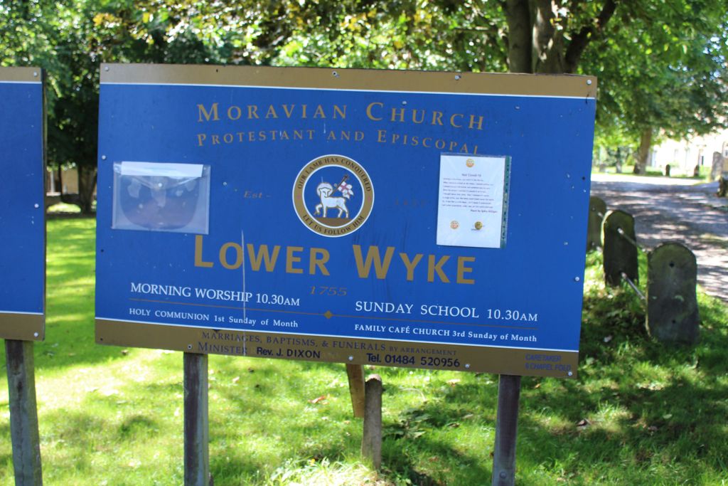
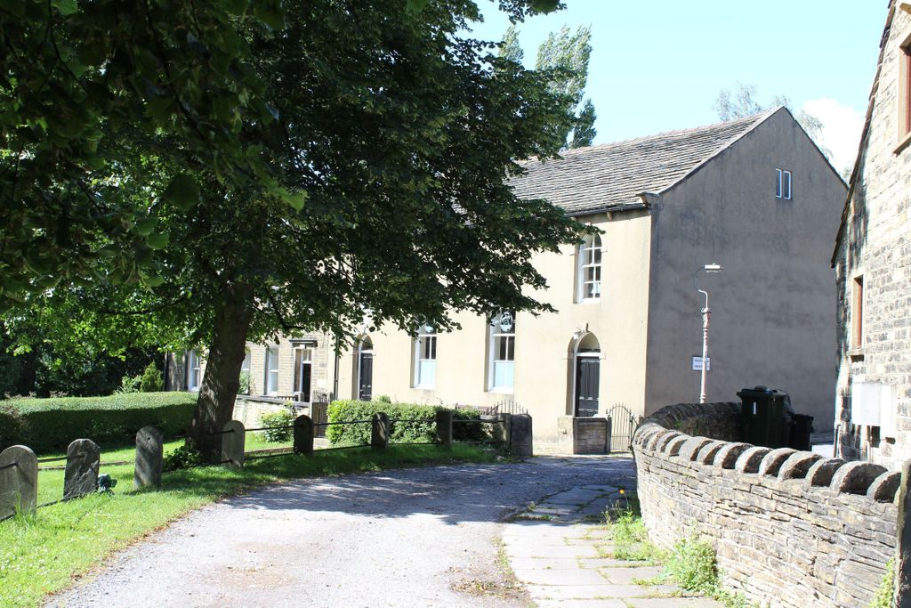
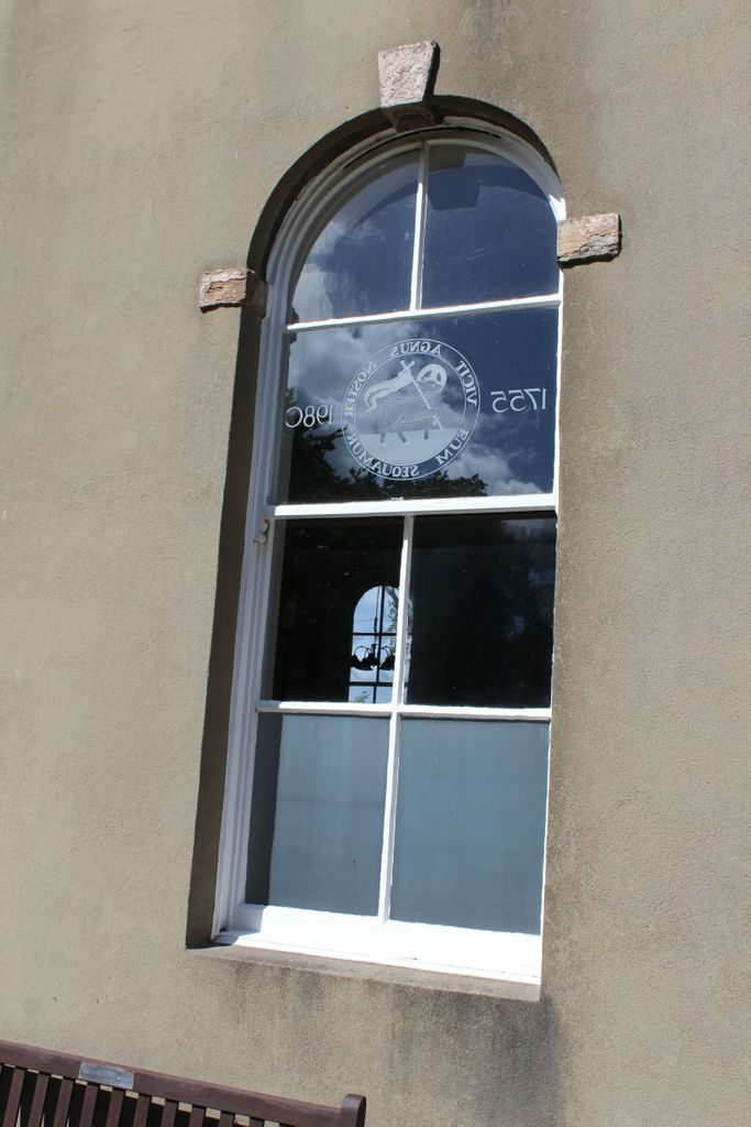
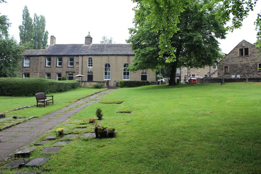
| Description | : | Lower Wyke Moravian Church was built in 1753 and officially recognised as a Moravian Congregation in 1755. The original building was replaced in 1775 by the present church. In 1782 the Sisters House was built for single ladies of the congregation to use as a residence and workshop. 12 years later a boarding school for girls was added but, as more secondary schools were built in the area, this was closed in 1893 and converted into residential use. Between 1881 and 1908 a Sunday School and Mens Institute were erected. Church services are held every Sunday at 10.30 a.m. |
frequently asked questions (FAQ):
-
Where is Lower Wyke Moravian Churchyard?
Lower Wyke Moravian Churchyard is located at Lower Wyke Lane, Lower Wyke Wyke, Metropolitan Borough of Bradford ,West Yorkshire , BD12 9AHEngland.
-
Lower Wyke Moravian Churchyard cemetery's updated grave count on graveviews.com?
0 memorials
-
Where are the coordinates of the Lower Wyke Moravian Churchyard?
Latitude: 53.7295640
Longitude: -1.7735920
Nearby Cemetories:
1. St. Mary the Virgin Churchyard
Wyke, Metropolitan Borough of Bradford, England
Coordinate: 53.7363400, -1.7715600
2. Westfield United Reform Chapel
Wyke, Metropolitan Borough of Bradford, England
Coordinate: 53.7355456, -1.7629691
3. St. Matthew's Old Churchyard
Lightcliffe, Metropolitan Borough of Calderdale, England
Coordinate: 53.7245690, -1.7894920
4. St Philip and St James Church Memorial Garden
Cleckheaton, Metropolitan Borough of Kirklees, England
Coordinate: 53.7291800, -1.7481500
5. Brighouse Cemetery
Brighouse, Metropolitan Borough of Calderdale, England
Coordinate: 53.7126470, -1.7869960
6. Cleckheaton New Cemetery
Cleckheaton, Metropolitan Borough of Kirklees, England
Coordinate: 53.7298910, -1.7400120
7. St Mark Churchyard
Low Moor, Metropolitan Borough of Bradford, England
Coordinate: 53.7512500, -1.7696100
8. St John the Baptist Churchyard
Coley, Metropolitan Borough of Calderdale, England
Coordinate: 53.7385570, -1.8119940
9. Wesley Place Methodist Chapelyard
Low Moor, Metropolitan Borough of Bradford, England
Coordinate: 53.7528600, -1.7573100
10. Whitechapel Churchyard
Cleckheaton, Metropolitan Borough of Kirklees, England
Coordinate: 53.7285500, -1.7295800
11. St. Martin’s Churchyard
Brighouse, Metropolitan Borough of Calderdale, England
Coordinate: 53.7041460, -1.7836290
12. Holy Trinity Churchyard
Low Moor, Metropolitan Borough of Bradford, England
Coordinate: 53.7564900, -1.7590000
13. Clifton Cemetery
Clifton, Metropolitan Borough of Calderdale, England
Coordinate: 53.7022640, -1.7583680
14. North Bierley Municipal Cemetery
Bradford, Metropolitan Borough of Bradford, England
Coordinate: 53.7584470, -1.7781560
15. St John Churchyard
Clifton, Metropolitan Borough of Calderdale, England
Coordinate: 53.7018610, -1.7572600
16. Friends Burial Ground
Brighouse, Metropolitan Borough of Calderdale, England
Coordinate: 53.6988100, -1.7784100
17. Cleckheaton Old Cemetery
Cleckheaton, Metropolitan Borough of Kirklees, England
Coordinate: 53.7261100, -1.7213000
18. Friends Burial Ground
Brighouse, Metropolitan Borough of Calderdale, England
Coordinate: 53.6969200, -1.7779800
19. St. Michael & All Angels Churchyard
Shelf, Metropolitan Borough of Calderdale, England
Coordinate: 53.7573400, -1.8030500
20. Bethel Methodist Chapelyard
Shelf, Metropolitan Borough of Calderdale, England
Coordinate: 53.7563530, -1.8079900
21. St Anne-in-the-Grove Churchyard
Southowram, Metropolitan Borough of Calderdale, England
Coordinate: 53.7090280, -1.8189630
22. Pollard Family Burial Ground
Shelf, Metropolitan Borough of Calderdale, England
Coordinate: 53.7570244, -1.8072409
23. St. Paul Churchyard
Wibsey, Metropolitan Borough of Bradford, England
Coordinate: 53.7636700, -1.7784700
24. Wade House Primitive Methodist Church
Shelf, Metropolitan Borough of Calderdale, England
Coordinate: 53.7543871, -1.8140742