
| Memorials | : | 0 |
| Location | : | Milnthorpe, South Lakeland District, England |
| Coordinate | : | 54.2267500, -2.7711100 |
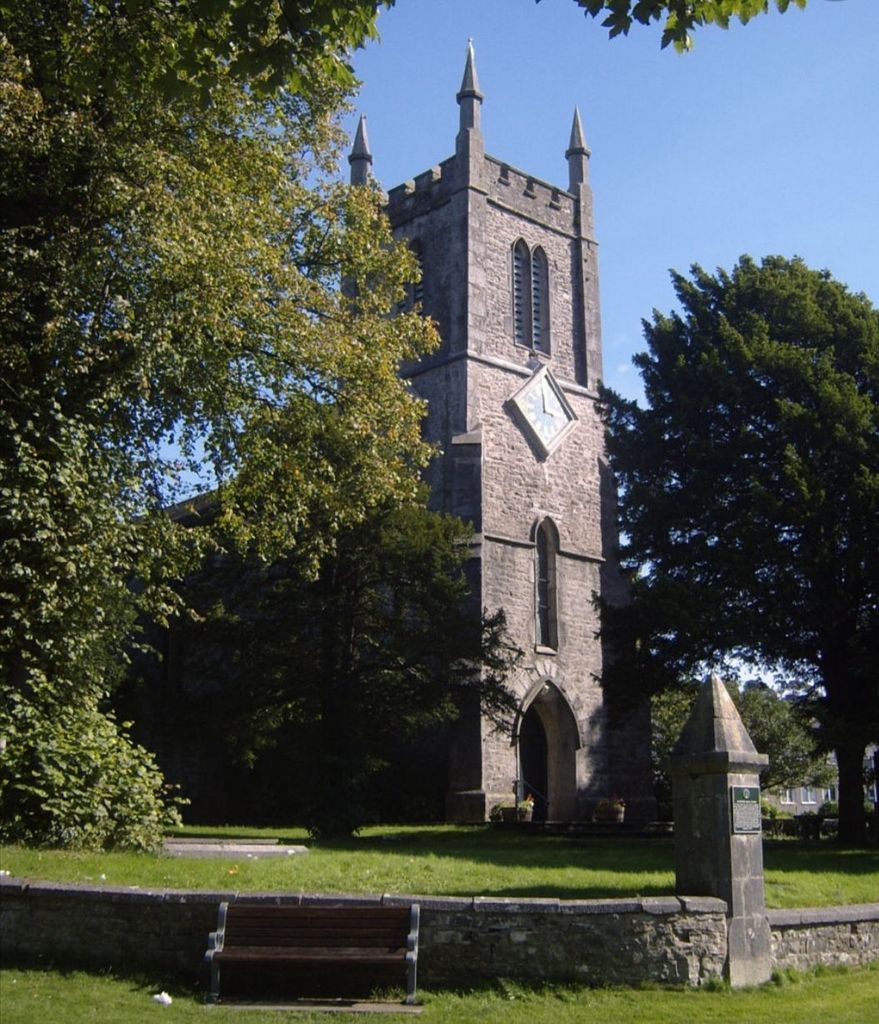
| Description | : | Milnthorpe is a large village within the South Lakeland district of Cumbria, formerly Westmorland, and straddling the A6 road, Milnthorpe is the site of the 19th century Church of St Thomas, which overlooks The Green and The Square. Not to be confused with Milnthorpe, St. Thomas Church Cemetery. Prior to its construction Milnthorpe was in the parish of Heversham. John Taylor third president of The Church of Jesus Christ of Latter-day Saints from 1880 to 1887 was born in and lived in Milnthorpe until he emigrated to Canada. |
frequently asked questions (FAQ):
-
Where is St. Thomas Churchyard?
St. Thomas Churchyard is located at Milnthorpe, South Lakeland District ,Cumbria ,England.
-
St. Thomas Churchyard cemetery's updated grave count on graveviews.com?
0 memorials
-
Where are the coordinates of the St. Thomas Churchyard?
Latitude: 54.2267500
Longitude: -2.7711100
Nearby Cemetories:
1. St. Thomas Church Cemetery
Milnthorpe, South Lakeland District, England
Coordinate: 54.2269300, -2.7651600
2. Beetham (St. Michael) Churchyard Extension
Beetham, South Lakeland District, England
Coordinate: 54.2100538, -2.7768882
3. St. Peter's Churchyard
Heversham, South Lakeland District, England
Coordinate: 54.2436690, -2.7749850
4. St Michael and All Angels Churchyard
Beetham, South Lakeland District, England
Coordinate: 54.2093740, -2.7741380
5. Beetham Hall Crematorium
Milnthorpe, South Lakeland District, England
Coordinate: 54.2066938, -2.7690287
6. Holy Trinity Churchyard
Holme, South Lakeland District, England
Coordinate: 54.2030730, -2.7318680
7. St. Patrick's Churchyard
Preston Patrick, South Lakeland District, England
Coordinate: 54.2451230, -2.7120480
8. St John the Evangelist Churchyard
Levens, South Lakeland District, England
Coordinate: 54.2647380, -2.7920660
9. Friends Meeting House Burial Ground
Preston Patrick, South Lakeland District, England
Coordinate: 54.2499970, -2.7042040
10. Arnside Cemetery
Arnside, South Lakeland District, England
Coordinate: 54.1922975, -2.8278230
11. St James Churchyard
Burton-in-Kendal, South Lakeland District, England
Coordinate: 54.1859270, -2.7210310
12. St. Thomas' Churchyard
Crosscrake, South Lakeland District, England
Coordinate: 54.2763700, -2.7335300
13. St. John Old Churchyard Extension
Silverdale, City of Lancaster, England
Coordinate: 54.1738400, -2.8213300
14. St. John the Evangelist Churchyard
Yealand Conyers, City of Lancaster, England
Coordinate: 54.1667470, -2.7565170
15. All Saints Churchyard
Lupton, South Lakeland District, England
Coordinate: 54.2217340, -2.6649730
16. Saint John Churchyard
Silverdale, City of Lancaster, England
Coordinate: 54.1716000, -2.8238000
17. Yealand Quaker Meeting Burial Ground
Yealand Conyers, City of Lancaster, England
Coordinate: 54.1631730, -2.7618190
18. St. Paul's Churchyard
Witherslack, South Lakeland District, England
Coordinate: 54.2504370, -2.8737000
19. Saint Mary's Churchyard
Yealand Conyers, City of Lancaster, England
Coordinate: 54.1604400, -2.7612900
20. Helsington Churchyard
Helsington, South Lakeland District, England
Coordinate: 54.2934390, -2.7871630
21. St John's Churchyard
Hutton Roof, South Lakeland District, England
Coordinate: 54.2029600, -2.6615600
22. St Mark's Churchyard
Natland, South Lakeland District, England
Coordinate: 54.2961380, -2.7374200
23. John Wilkinson Memorial
Lindale, South Lakeland District, England
Coordinate: 54.2153750, -2.8933350
24. St Paul's Churchyard
Lindale, South Lakeland District, England
Coordinate: 54.2159090, -2.8999800