
| Memorials | : | 0 |
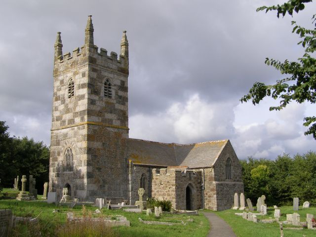
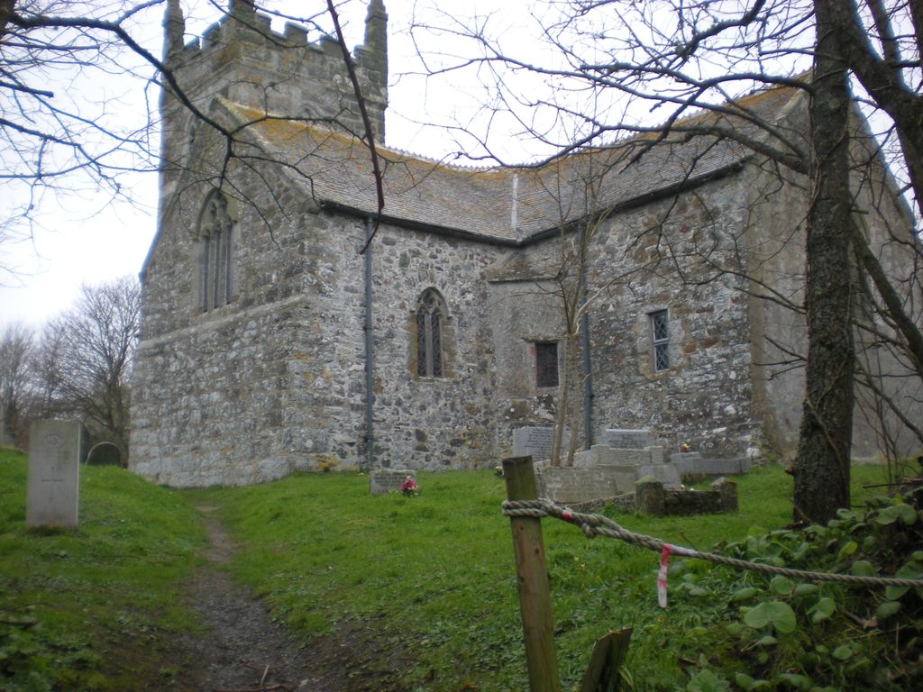
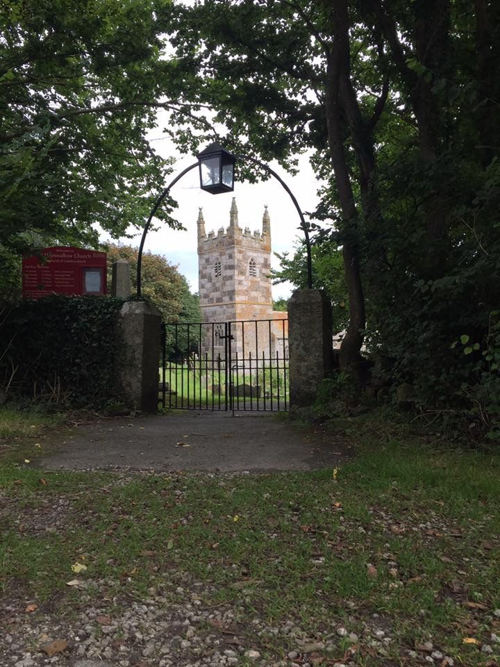
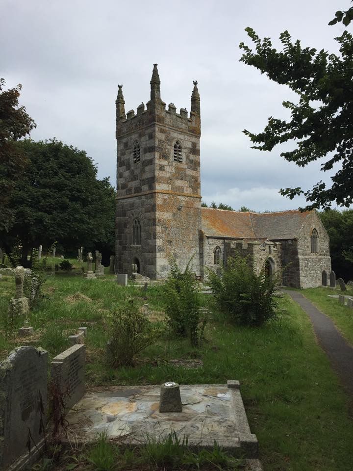
| Location | : | Landewednack, Cornwall Unitary Authority, England |
| Description | : | This is the parish church of the most southerly parish on the British mainland - Landewednack. Other claims to fame are that here was preached the last sermon in the Cornish language (in 1670). The fabric of the building spans many centuries, with a good deal of Victorian restoration. The tower is built from blocks of traditional Lizard stone (granite and serpentine). |
frequently asked questions (FAQ):
-
Where is St. Wynwallow Churchyard?
St. Wynwallow Churchyard is located at Landewednack, Cornwall Unitary Authority, England.
-
St. Wynwallow Churchyard cemetery's updated grave count on graveviews.com?
0 memorials
Nearby Cemetories:
1. St. Adwenna Churchyard
Advent, Cornwall Unitary Authority, England
Coordinate: 50.1083210, -5.3321080
2. Bodmin Jail
Bodmin, Cornwall Unitary Authority, England
Coordinate: 50.1088900, -5.3316800
3. Bodmin New Cemetery
Bodmin, Cornwall Unitary Authority, England
4. Bodmin Old Cemetery
Bodmin, Cornwall Unitary Authority, England
Coordinate: 50.2201180, -5.2858190
5. Centenary Methodist Chapel
Bodmin, Cornwall Unitary Authority, England
Coordinate: 50.2157510, -5.3098940
6. Glynn Valley Crematorium
Bodmin, Cornwall Unitary Authority, England
Coordinate: 50.2147340, -5.2928470
7. Grey Friars
Bodmin, Cornwall Unitary Authority, England
Coordinate: 50.2027700, -5.3036500
8. Gunwen Methodist Chapel
Bodmin, Cornwall Unitary Authority, England
Coordinate: 50.1935761, -5.2931032
9. St Lawrence Community Churchyard
Bodmin, Cornwall Unitary Authority, England
Coordinate: 50.2134190, -5.3020460
10. St Petroc Churchyard
Bodmin, Cornwall Unitary Authority, England
11. Breage Parish Council Cemetery
Breage, Cornwall Unitary Authority, England
Coordinate: 50.2303130, -5.2734090
12. Breage War Memorial Cemetery
Breage, Cornwall Unitary Authority, England
13. St. Breaca Churchyard
Breage, Cornwall Unitary Authority, England
Coordinate: 50.1083210, -5.3321080
14. St. Breaca New Church Cemetery
Breage, Cornwall Unitary Authority, England
Coordinate: 50.1088900, -5.3316800
16. All Saints Churchyard
Camborne, Cornwall Unitary Authority, England
Coordinate: 50.2201180, -5.2858190
17. Camborne Cemetery
Camborne, Cornwall Unitary Authority, England
Coordinate: 50.2157510, -5.3098940
18. Centenary Methodist Chapel & Cemetery
Camborne, Cornwall Unitary Authority, England
Coordinate: 50.2147340, -5.2928470
19. Killivose Cemetery
Camborne, Cornwall Unitary Authority, England
Coordinate: 50.2027700, -5.3036500
20. St. John the Evangelist Churchyard
Camborne, Cornwall Unitary Authority, England
Coordinate: 50.1935761, -5.2931032
21. St. Martin and St. Meriadoc Churchyard
Camborne, Cornwall Unitary Authority, England
Coordinate: 50.2134190, -5.3020460
22. Treswithian Downs
Camborne, Cornwall Unitary Authority, England
23. Trevenson Churchyard
Camborne, Cornwall Unitary Authority, England
Coordinate: 50.2303130, -5.2734090
24. Rame Church
Cawsand, Cornwall Unitary Authority, England