
| Memorials | : | 0 |
| Location | : | Strandlykkja, Stange kommune, Norway |
| Coordinate | : | 60.5138100, 11.2472333 |
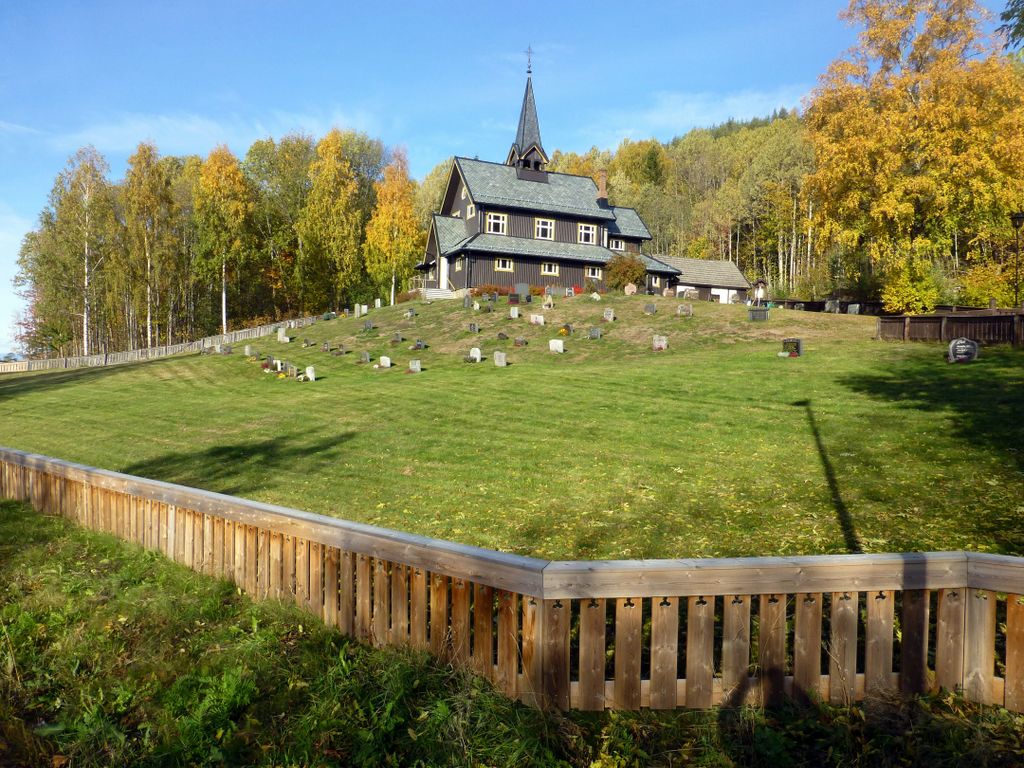
| Description | : | It is thanks to Berthe Marie Strandløkken (1842 - 1932) that Strandlykkja had its own chapel and cemetery - before Strandlykkja's inhabitants used to use Tangen church, 10 kilometers away. B. M. Strandløkken gave part of her farm to seat the chapel and cemetery - and is even buried here. Strandlykkja Chapel and Cemetery was inaugurated on August 12, 1915 by Hamar Bishop Christen Brun (1842 - 1917). The chapel was designed by architect Haldor Larsen Børve (1857-1933), carpenter was builder Ole Engen (1865-1957) of Ottestad and his son Ivar Engen (1886-1971). The chapel is... Read More |
frequently asked questions (FAQ):
-
Where is Strandlykkja cemetery?
Strandlykkja cemetery is located at Spitalsvegen 64 Strandlykkja, Stange kommune ,Hedmark fylke , 2338Norway.
-
Strandlykkja cemetery cemetery's updated grave count on graveviews.com?
0 memorials
-
Where are the coordinates of the Strandlykkja cemetery?
Latitude: 60.5138100
Longitude: 11.2472333
Nearby Cemetories:
1. Feiring Kirke
Feiring, Eidsvoll kommune, Norway
Coordinate: 60.4847000, 11.1495000
2. Tangen kirkegård
Stange, Stange kommune, Norway
Coordinate: 60.6167300, 11.2653600
3. Langset Parish
Minnesund, Eidsvoll kommune, Norway
Coordinate: 60.4073113, 11.2427180
4. Eidsvoll Church Cemetery
Eidsvoll, Eidsvoll kommune, Norway
Coordinate: 60.3234700, 11.2434500
5. Sand Church
Sand, Nord-Odal kommune, Norway
Coordinate: 60.3906480, 11.5431170
6. Vallset kirkegård
Stange, Stange kommune, Norway
Coordinate: 60.7012600, 11.3286000
7. Stange Church Cemetery
Stange, Stange kommune, Norway
Coordinate: 60.7098210, 11.1373780
8. Mo Churchyard
Sand, Nord-Odal kommune, Norway
Coordinate: 60.4288290, 11.6350790
9. Balke Kirkegaard
Skreia, Østre Toten kommune, Norway
Coordinate: 60.6681415, 10.9499695
10. Romedal Kirkegård
Romedal, Stange kommune, Norway
Coordinate: 60.7517000, 11.2614400
11. Raaholt Cemetery
Raholt, Eidsvoll kommune, Norway
Coordinate: 60.2751000, 11.1790000
12. Ottestad kirkegård
Ottestad, Stange kommune, Norway
Coordinate: 60.7573100, 11.1447300
13. Stensgård Kirkegård
Nannestad kommune, Norway
Coordinate: 60.2775540, 11.0882430
14. Kolbu Kirke Churchyard
Østre Toten kommune, Norway
Coordinate: 60.6293210, 10.7737690
15. Hoff Church Cemetery
Lena, Østre Toten kommune, Norway
Coordinate: 60.6847580, 10.8444930
16. Helgøya kirkegård
Nes, Ringsaker kommune, Norway
Coordinate: 60.7446645, 10.9585367
17. Nes kirkegård
Nes, Ringsaker kommune, Norway
Coordinate: 60.7625700, 10.9429500
18. Hamar Kirkegaard
Hamar, Hamar kommune, Norway
Coordinate: 60.7991950, 11.0698420
19. Bjørke Kirke
Nannestad kommune, Norway
Coordinate: 60.2342490, 11.0121679
20. Aas Churchyard
Raufoss, Vestre Toten kommune, Norway
Coordinate: 60.6693210, 10.6990180
21. Løten Kirke Cemetery
Loten, Løten kommune, Norway
Coordinate: 60.8268950, 11.3172070
22. Hol Cemetery
Hamar, Hamar kommune, Norway
Coordinate: 60.8154900, 11.0450600
23. Nannestad
Nannestad kommune, Norway
Coordinate: 60.2144610, 11.0051450
24. Nordli Cemetery
Nordlia, Østre Toten kommune, Norway
Coordinate: 60.7432240, 10.7695170