
| Memorials | : | 0 |
| Location | : | Carroll County, USA |
| Coordinate | : | 39.5449000, -93.5993000 |
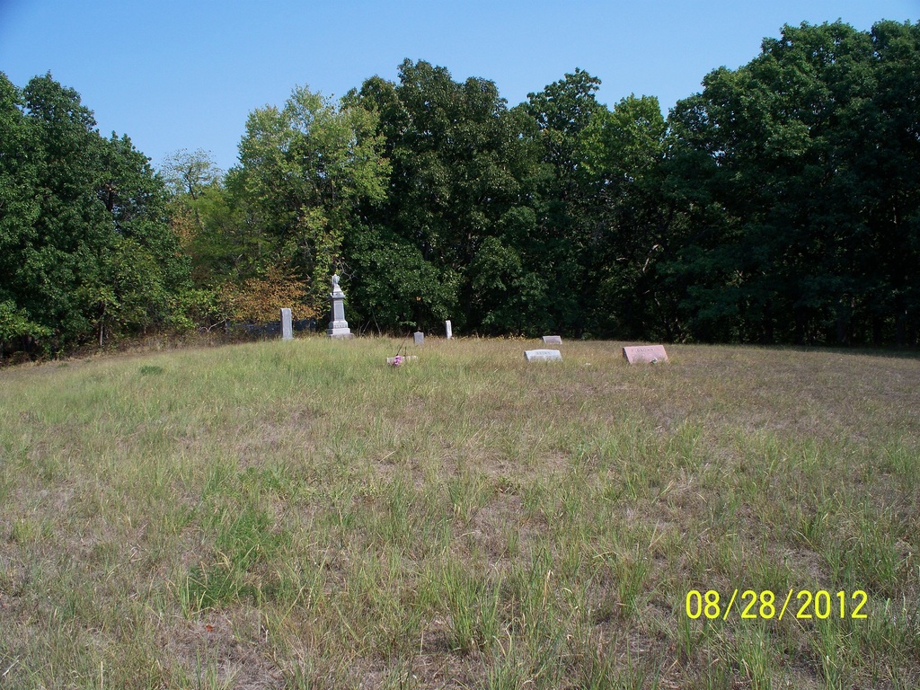
| Description | : | Sykes Cemetery was originally named Hill Cemetery, and it still shows as Hill Cemetery on some maps. According to family history, the land was donated by the Hill family for whom Hill Township was named (brothers George W., Richard W., and Nathan Hill settled there in about 1836). The Sykes family decided at some point to call it the Sykes Cemetery instead. Location: Hill Township, Section 28, Carroll County, Missouri. South side of C Hwy, 0.8 mi west of County Road 191. Because of trees, the cemetery is not visible from C Hwy, but is just a short distance from it on... Read More |
frequently asked questions (FAQ):
-
Where is Sykes Cemetery?
Sykes Cemetery is located at Carroll County ,Missouri ,USA.
-
Sykes Cemetery cemetery's updated grave count on graveviews.com?
0 memorials
-
Where are the coordinates of the Sykes Cemetery?
Latitude: 39.5449000
Longitude: -93.5993000
Nearby Cemetories:
1. Unnamed Cemetery #5
Carroll County, USA
Coordinate: 39.5480995, -93.5820007
2. New Salem Cemetery
Carroll County, USA
Coordinate: 39.5705681, -93.5641022
3. Braden Cemetery
Coloma, Carroll County, USA
Coordinate: 39.5393982, -93.5460968
4. Enon Cemetery
Carroll County, USA
Coordinate: 39.5758000, -93.6366000
5. Harris Cemetery
Mandeville, Carroll County, USA
Coordinate: 39.5083680, -93.6314570
6. Marple Cemetery
Carroll County, USA
Coordinate: 39.5014992, -93.5702972
7. Unnamed Cemetery #32
Carroll County, USA
Coordinate: 39.5028992, -93.5487976
8. Glaze Cemetery
Carroll County, USA
Coordinate: 39.4908000, -93.5720000
9. Coloma Cemetery
Coloma, Carroll County, USA
Coordinate: 39.5342178, -93.5233154
10. Hawkins Cemetery
Carroll County, USA
Coordinate: 39.5014000, -93.6569977
11. Unnamed Cemetery #26
Carroll County, USA
Coordinate: 39.4808006, -93.5985031
12. Smith Cemetery
Carroll County, USA
Coordinate: 39.4813995, -93.6205978
13. Gudgel Cemetery
Carroll County, USA
Coordinate: 39.5993996, -93.6660995
14. Ebenezer Cemetery
Bogard, Carroll County, USA
Coordinate: 39.4692001, -93.5691986
15. Low Gap Cemetery
Norborne, Carroll County, USA
Coordinate: 39.5244000, -93.7024000
16. Street Cemetery
Bogard, Carroll County, USA
Coordinate: 39.4606018, -93.5969009
17. Kasriek Cemetery
Carroll County, USA
Coordinate: 39.4556999, -93.5977020
18. Blue Mound Cemetery
Dawn, Livingston County, USA
Coordinate: 39.6352997, -93.5625000
19. Collar Cemetery
Dawn, Livingston County, USA
Coordinate: 39.6345700, -93.6418300
20. Plymouth Cemetery
Plymouth, Carroll County, USA
Coordinate: 39.6006012, -93.7014008
21. Johnson Cemetery
Carroll County, USA
Coordinate: 39.6136017, -93.4985962
22. Brown Family Cemetery
Caldwell County, USA
Coordinate: 39.5978851, -93.7202454
23. Rock Branch Cemetery
Tina, Carroll County, USA
Coordinate: 39.5283012, -93.4569016
24. Van Horn Cemetery
Van Horn Township, Carroll County, USA
Coordinate: 39.4850000, -93.4760000