
| Memorials | : | 8 |
| Location | : | Norborne, Carroll County, USA |
| Coordinate | : | 39.5244000, -93.7024000 |
frequently asked questions (FAQ):
-
Where is Low Gap Cemetery?
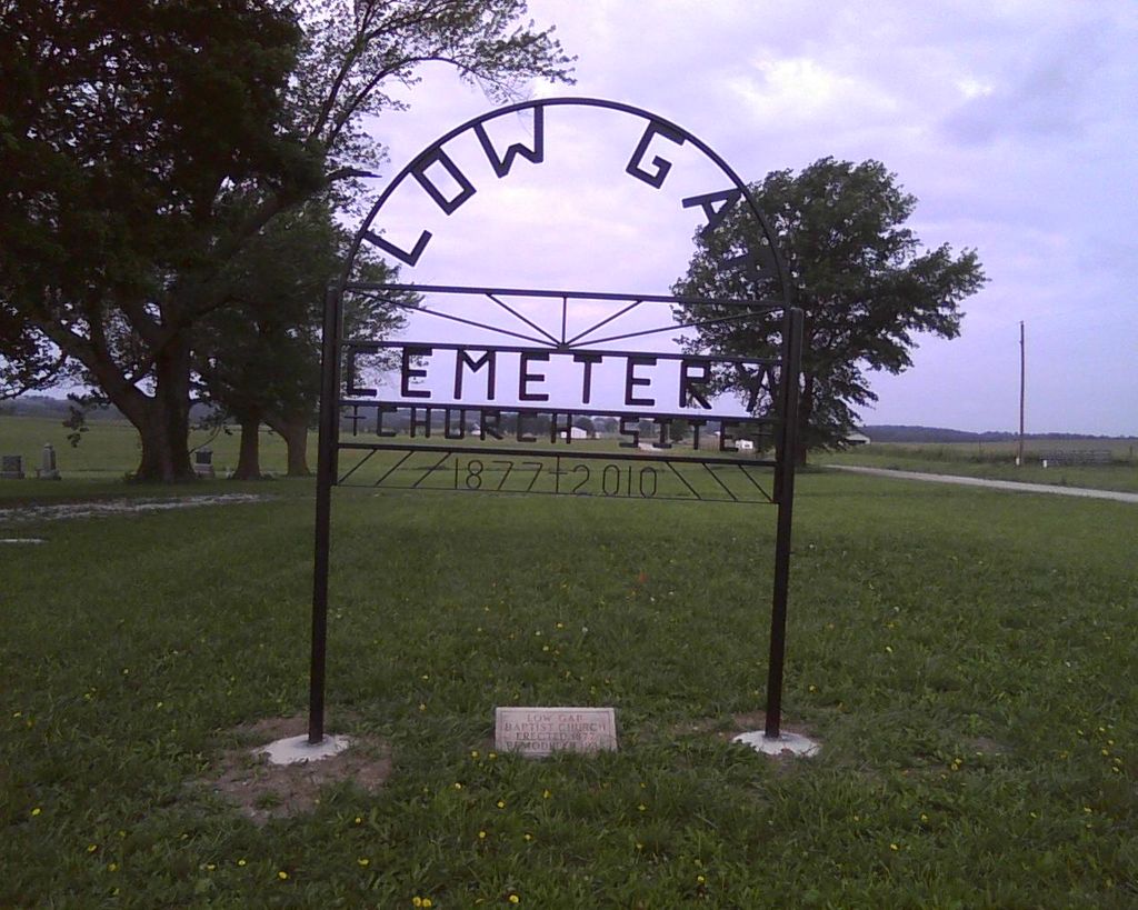
Low Gap Cemetery is located at Norborne, Carroll County ,Missouri ,USA.
-
Low Gap Cemetery cemetery's updated grave count on graveviews.com?
6 memorials
-
Where are the coordinates of the Low Gap Cemetery?
Latitude: 39.5244000
Longitude: -93.7024000
Nearby Cemetories:
1. McBee Chapel Cemetery
Carroll County, USA
Coordinate: 39.5239983, -93.7559967
2. Hawkins Cemetery
Carroll County, USA
Coordinate: 39.5014000, -93.6569977
3. Harris Cemetery
Mandeville, Carroll County, USA
Coordinate: 39.5083680, -93.6314570
4. Oster Cemetery
Caldwell County, USA
Coordinate: 39.5684400, -93.7622100
5. Tevalt-Northern Sympathizers Cemetery
Carroll County, USA
Coordinate: 39.4593010, -93.7379990
6. Enon Cemetery
Carroll County, USA
Coordinate: 39.5758000, -93.6366000
7. Brown Family Cemetery
Caldwell County, USA
Coordinate: 39.5978851, -93.7202454
8. Union Baptist Church Cemetery
Roads, Carroll County, USA
Coordinate: 39.4486008, -93.7021027
9. Plymouth Cemetery
Plymouth, Carroll County, USA
Coordinate: 39.6006012, -93.7014008
10. Smith Cemetery
Carroll County, USA
Coordinate: 39.4813995, -93.6205978
11. Gudgel Cemetery
Carroll County, USA
Coordinate: 39.5993996, -93.6660995
12. Tinney Grove Cemetery
Tinney Grove, Ray County, USA
Coordinate: 39.5066280, -93.8050000
13. Sykes Cemetery
Carroll County, USA
Coordinate: 39.5449000, -93.5993000
14. Elder Cemetery
Grape Grove Township, Ray County, USA
Coordinate: 39.5015259, -93.8108826
15. Unnamed Cemetery #26
Carroll County, USA
Coordinate: 39.4808006, -93.5985031
16. Mount Olivet Cemetery
Stet, Carroll County, USA
Coordinate: 39.4366000, -93.7403000
17. Graff Cemetery
Grape Grove Township, Ray County, USA
Coordinate: 39.4909286, -93.8144836
18. Unnamed Cemetery #5
Carroll County, USA
Coordinate: 39.5480995, -93.5820007
19. Street Cemetery
Bogard, Carroll County, USA
Coordinate: 39.4606018, -93.5969009
20. Marple Cemetery
Carroll County, USA
Coordinate: 39.5014992, -93.5702972
21. Evergreen Cemetery
Braymer, Caldwell County, USA
Coordinate: 39.5986290, -93.7981720
22. Kasriek Cemetery
Carroll County, USA
Coordinate: 39.4556999, -93.5977020
23. Glaze Cemetery
Carroll County, USA
Coordinate: 39.4908000, -93.5720000
24. Black Oak Cemetery
Braymer, Caldwell County, USA
Coordinate: 39.5469017, -93.8403473