
| Memorials | : | 0 |
| Location | : | Campbell County, USA |
| Coordinate | : | 38.9665480, -84.3935800 |
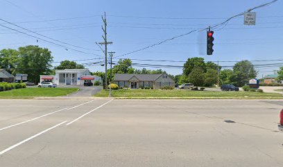
| Description | : | This cemetery was located on the Thatcher property known as "High View" across from the Campbell County Middle School on Alexandria Pike. It was reported that the cemetery was enclosed with a wrought iron fence with a gate with a five-foot tall pyramid monument eighteen inches at the base in the center of the enclosure. The property was sold in 1945. The cemetery, located at the southwest corner of the intersection of Alexandria Pike and Trapp Court, was paved over. The building housing Four Season Florist and Formals (in 2007) and Farley Family Orthodontics (in 2014) sits on top of... Read More |
frequently asked questions (FAQ):
-
Where is Thatcher Family Cemetery?
Thatcher Family Cemetery is located at 7963 Alexandria Pike (US 27) Campbell County ,Kentucky , 41001USA.
-
Thatcher Family Cemetery cemetery's updated grave count on graveviews.com?
0 memorials
-
Where are the coordinates of the Thatcher Family Cemetery?
Latitude: 38.9665480
Longitude: -84.3935800
Nearby Cemetories:
1. Old Baptist Cemetery
Alexandria, Campbell County, USA
Coordinate: 38.9603890, -84.3880590
2. Saint Paul's Church Cemetery
Alexandria, Campbell County, USA
Coordinate: 38.9582720, -84.3877080
3. Saint Mary's Cemetery
Alexandria, Campbell County, USA
Coordinate: 38.9559100, -84.3877800
4. Alexandria Cemetery
Alexandria, Campbell County, USA
Coordinate: 38.9536100, -84.3972300
5. Boyles Maxwell Family Cemetery
Alexandria, Campbell County, USA
Coordinate: 38.9553900, -84.3804900
6. Robert Shaw Family Cemetery
Alexandria, Campbell County, USA
Coordinate: 38.9623330, -84.3635670
7. Grant Family Cemetery
Grant, Kenton County, USA
Coordinate: 38.9743710, -84.4326160
8. Stamper Family Cemetery
Grant, Kenton County, USA
Coordinate: 38.9746130, -84.4338000
9. Stephens Farm Cemetery
Alexandria, Campbell County, USA
Coordinate: 38.9566350, -84.3528650
10. Saint Josephs Cemetery
Camp Springs, Campbell County, USA
Coordinate: 38.9953570, -84.3625520
11. Saint John Lutheran Church Cemetery
Camp Springs, Campbell County, USA
Coordinate: 39.0144150, -84.3826140
12. Tucker Family Cemetery
Melbourne, Campbell County, USA
Coordinate: 39.0157000, -84.3788010
13. White Cemetery
Ryland Heights, Kenton County, USA
Coordinate: 38.9625000, -84.4583330
14. Carmack Cemetery
Carthage, Campbell County, USA
Coordinate: 38.9582510, -84.3272630
15. Willard Neal Farm Cemetery
Alexandria, Campbell County, USA
Coordinate: 38.9571660, -84.3254490
16. Weinel Family Graveyard
Claryville, Campbell County, USA
Coordinate: 38.9181780, -84.4245220
17. White Cemetery
Ryland Heights, Kenton County, USA
Coordinate: 38.9628600, -84.4642900
18. Murnan Cemetery
Cold Spring, Campbell County, USA
Coordinate: 39.0064690, -84.4436530
19. Kuhl Farm Cemetery
Claryville, Campbell County, USA
Coordinate: 38.9108330, -84.4064840
20. William Culbertson Family Cemetery (Defunct)
Springlake, Kenton County, USA
Coordinate: 38.9971400, -84.4592900
21. Culbertson Cemetery
Taylor Mill, Kenton County, USA
Coordinate: 38.9939390, -84.4629340
22. Locust Pike Pentecostal Church Cemetery
Kenton County, USA
Coordinate: 38.9940500, -84.4630000
23. Armstrong Cemetery #2
Ryland Heights, Kenton County, USA
Coordinate: 38.9820600, -84.4695400
24. Saint Anne Convent Cemetery
Melbourne, Campbell County, USA
Coordinate: 39.0284030, -84.3801510