
| Memorials | : | 4 |
| Location | : | Witney, West Oxfordshire District, England |
| Website | : | www.witney-tc.gov.uk/services/cemeteries/ |
| Coordinate | : | 51.7852950, -1.4999610 |
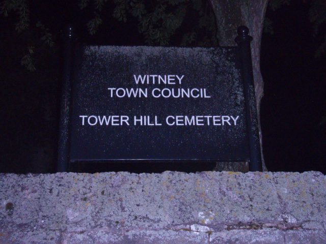
| Description | : | The council maintains a 4 hectare cemetery at Tower Hill. This site has been used as a cemetery since 1857 and is now full. Beside the old chapel is a tree that appears as a ‘Champion Tree on www.treeregister.org. It is a Golden Chinese Juniper which dates from the original Victorian plantings and at 13m high and with a 65cm trunk is the largest specimen of its kind in Britain. |
frequently asked questions (FAQ):
-
Where is Tower Hill Cemetery?
Tower Hill Cemetery is located at Curbridge Road Witney, West Oxfordshire District ,Oxfordshire , OX28 5ESEngland.
-
Tower Hill Cemetery cemetery's updated grave count on graveviews.com?
4 memorials
-
Where are the coordinates of the Tower Hill Cemetery?
Latitude: 51.7852950
Longitude: -1.4999610
Nearby Cemetories:
1. St. Mary's Churchyard
Witney, West Oxfordshire District, England
Coordinate: 51.7807116, -1.4850508
2. St Mary Churchyard
Cogges, West Oxfordshire District, England
Coordinate: 51.7839280, -1.4782010
3. Woodgreen (Holy Trinity) Churchyard
West Oxfordshire District, England
Coordinate: 51.7918400, -1.4793500
4. St John The Baptist
Curbridge, West Oxfordshire District, England
Coordinate: 51.7764570, -1.5203140
5. St Peter's Churchyard
Crawley, West Oxfordshire District, England
Coordinate: 51.8069700, -1.5100400
6. St. Bartholomew Churchyard
Ducklington, West Oxfordshire District, England
Coordinate: 51.7658689, -1.4810340
7. Saint Kenelm's Churchyard
Minster Lovell, West Oxfordshire District, England
Coordinate: 51.8000620, -1.5314550
8. St John the Evangelist
Hailey, West Oxfordshire District, England
Coordinate: 51.8107740, -1.4879260
9. St. James the Great Churchyard
South Leigh, West Oxfordshire District, England
Coordinate: 51.7781050, -1.4298950
10. St. Britius Churchyard Extension
Brize Norton, West Oxfordshire District, England
Coordinate: 51.7660800, -1.5662600
11. St. Britius Churchyard
Brize Norton, West Oxfordshire District, England
Coordinate: 51.7662000, -1.5667000
12. St James's Church
Ramsden, West Oxfordshire District, England
Coordinate: 51.8340622, -1.4841064
13. St Mary Churchyard
North Leigh, West Oxfordshire District, England
Coordinate: 51.8201820, -1.4396170
14. St Nicholas Parish Church
Asthall, West Oxfordshire District, England
Coordinate: 51.8003600, -1.5850500
15. Saint Michaels and All Angels Churchyard
Leafield, West Oxfordshire District, England
Coordinate: 51.8355550, -1.5390810
16. Cote Baptist Chapel
Cote, West Oxfordshire District, England
Coordinate: 51.7254430, -1.4929510
17. St. James the Great Churchyard
Aston, West Oxfordshire District, England
Coordinate: 51.7252620, -1.5059510
18. Holy Trinity Churchyard
Finstock, West Oxfordshire District, England
Coordinate: 51.8459910, -1.4801260
19. St Mary Churchyard
Swinbrook, West Oxfordshire District, England
Coordinate: 51.8072090, -1.5954540
20. Bampton Cemetery
Bampton, West Oxfordshire District, England
Coordinate: 51.7296400, -1.5490200
21. St. Mary the Virgin Churchyard
Bampton, West Oxfordshire District, England
Coordinate: 51.7278250, -1.5487270
22. St Mary the Virgin Churchyard
Freeland, West Oxfordshire District, England
Coordinate: 51.8116300, -1.4004700
23. St Oswald's Churchyard
Widford, West Oxfordshire District, England
Coordinate: 51.8067780, -1.6047160
24. St. Giles' Churchyard
Standlake, West Oxfordshire District, England
Coordinate: 51.7299550, -1.4262300