
| Memorials | : | 3 |
| Location | : | Watsonville, Santa Cruz County, USA |
| Coordinate | : | 36.9415932, -121.7405777 |
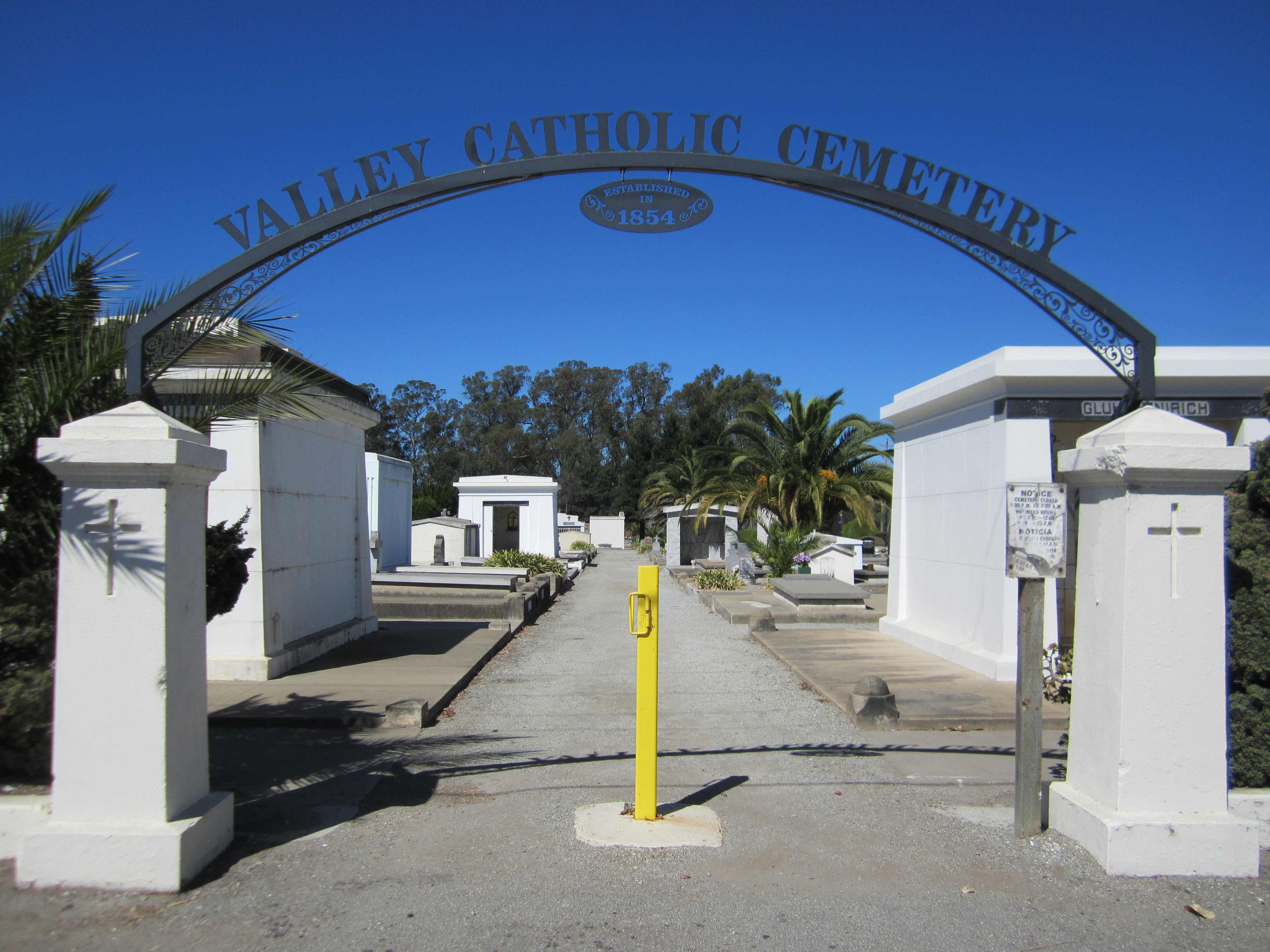
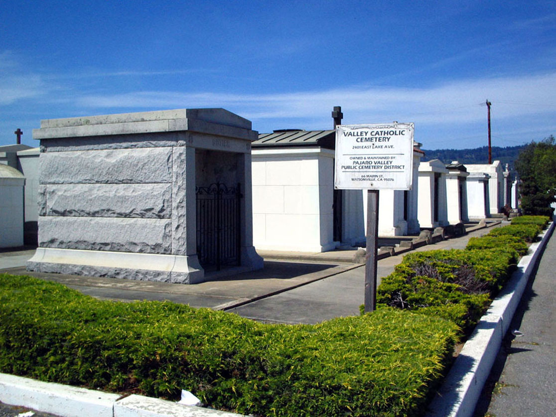
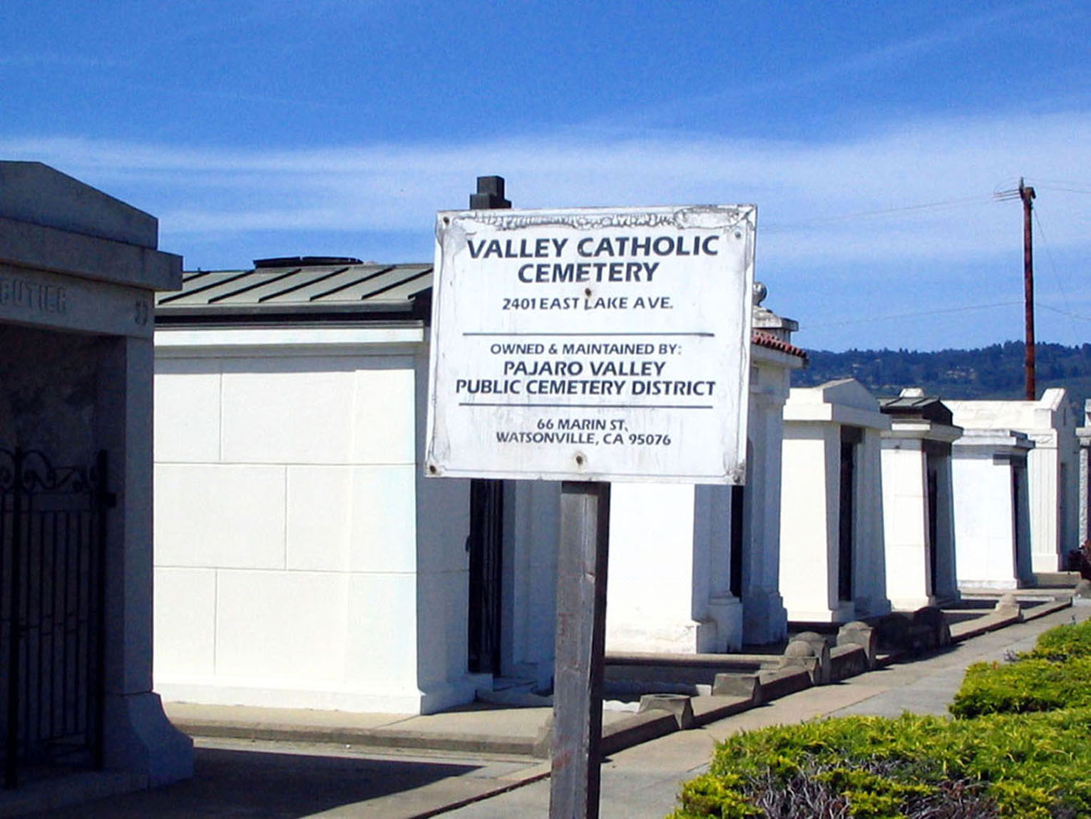
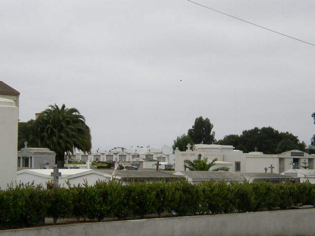
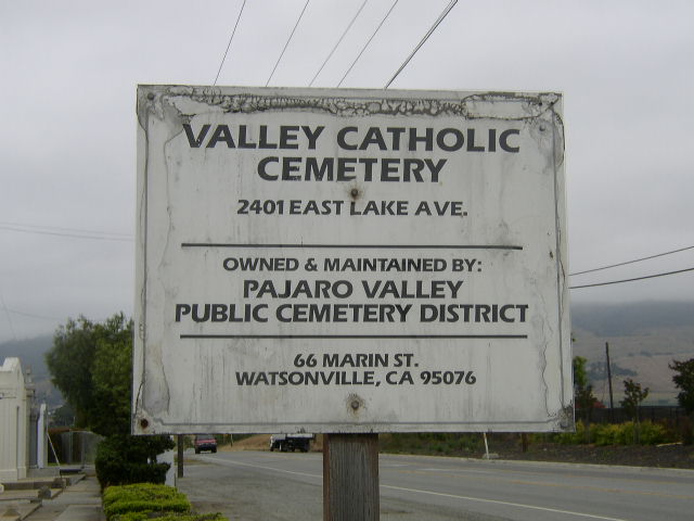
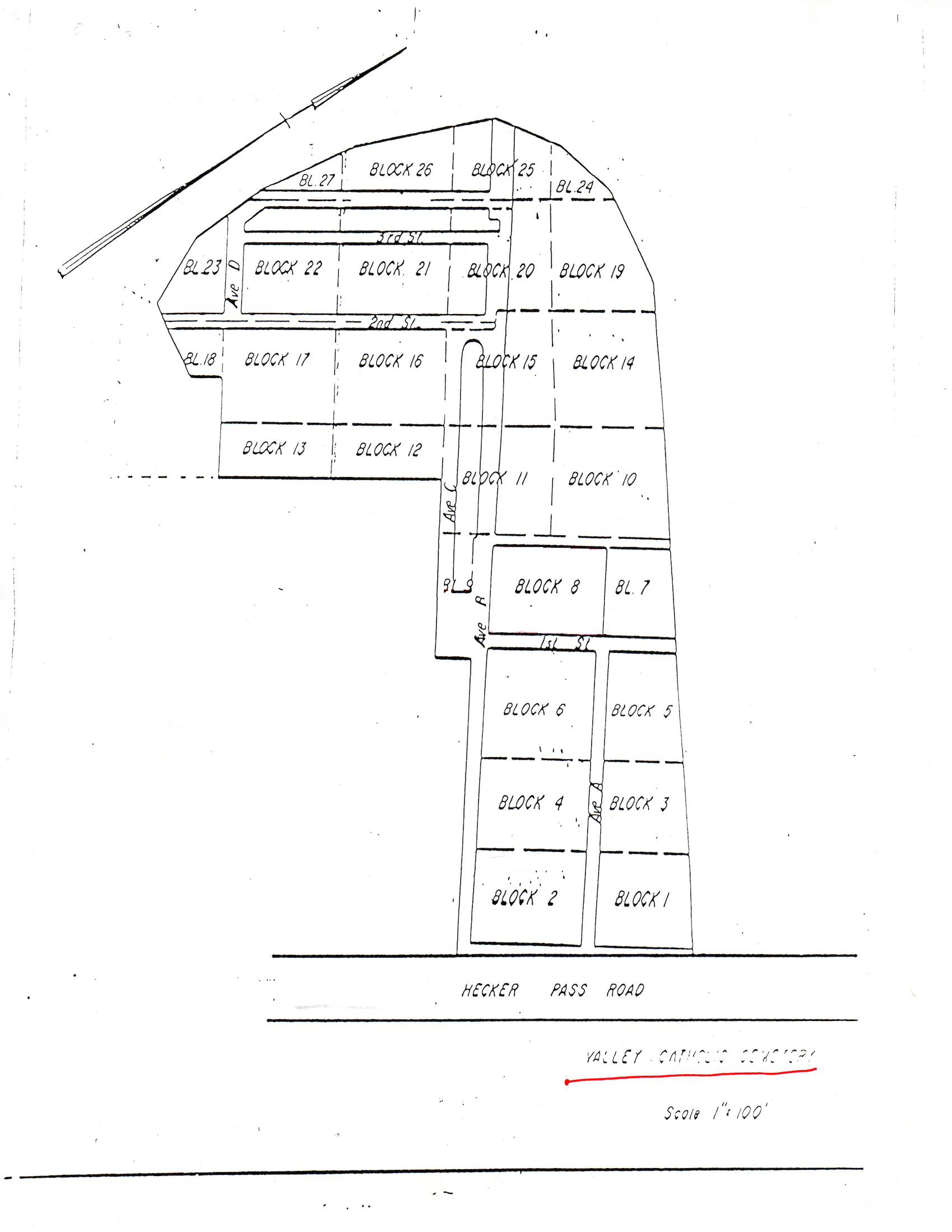
| Description | : | Valley Catholic Cemetery, also known as St. Francis Cemetery after the nearby church that also served as an orphan asylum, reflects the early influence of the Irish and Croatian immigrants that came to the Pajaro Valley, together with the more recent immigrants from Mexico. The elaborate family crypts that the cemetery is known for show that these are not only lasting resting places for loved ones, but also statements of economic and political status. Owned and maintained by: Pajaro Valley Public Cemetery District 66 Marin Street Watsonville, CA 95076 (831) 722-0310 |
frequently asked questions (FAQ):
-
Where is Valley Catholic Cemetery?
Valley Catholic Cemetery is located at 2401 East Lake Avenue Watsonville, Santa Cruz County ,California , 95076USA.
-
Valley Catholic Cemetery cemetery's updated grave count on graveviews.com?
3 memorials
-
Where are the coordinates of the Valley Catholic Cemetery?
Latitude: 36.9415932
Longitude: -121.7405777
Nearby Cemetories:
1. Valley Public Cemetery
Watsonville, Santa Cruz County, USA
Coordinate: 36.9418983, -121.7400513
2. Watsonville Catholic Cemetery
Watsonville, Santa Cruz County, USA
Coordinate: 36.9278564, -121.7658463
3. Pioneer Cemetery
Watsonville, Santa Cruz County, USA
Coordinate: 36.9258560, -121.7642790
4. Pajaro Valley Memorial Park
Watsonville, Santa Cruz County, USA
Coordinate: 36.9629669, -121.7219391
5. All Saints Episcopal Church Memorial Garden
Watsonville, Santa Cruz County, USA
Coordinate: 36.9102310, -121.7568950
6. Saint Josephs Monastery Cemetery
Aptos, Santa Cruz County, USA
Coordinate: 36.9947200, -121.8361700
7. Day Valley Cemetery
Aptos, Santa Cruz County, USA
Coordinate: 36.9974050, -121.8503360
8. Christ Lutheran Church Columbarium
Aptos, Santa Cruz County, USA
Coordinate: 36.9700550, -121.8704370
9. Hambey Cemetery
Monterey County, USA
Coordinate: 36.8372002, -121.6793976
10. Monterey Bay Loved Pet Cemetery
Monterey County, USA
Coordinate: 36.8326160, -121.6812820
11. Stephen Norriss Gravesite
Monterey County, USA
Coordinate: 36.8214110, -121.7601080
12. Gavilan Hills Memorial Park
Gilroy, Santa Clara County, USA
Coordinate: 37.0124000, -121.5909200
13. Our Lady of Mount Carmel Cemetery
Aptos, Santa Cruz County, USA
Coordinate: 36.9806366, -121.9095993
14. Saint Mary Cemetery
Gilroy, Santa Clara County, USA
Coordinate: 37.0134300, -121.5882000
15. Saint Mary Church Cemetery
Gilroy, Santa Clara County, USA
Coordinate: 37.0155970, -121.5765950
16. Castroville Public Cemetery
Moss Landing, Monterey County, USA
Coordinate: 36.7930145, -121.7851410
17. Land of Medicine Buddha Stupa
Soquel, Santa Cruz County, USA
Coordinate: 37.0125950, -121.9336400
18. Beit Olam Cemetery
Soquel, Santa Cruz County, USA
Coordinate: 36.9967700, -121.9557300
19. Soquel Cemetery
Soquel, Santa Cruz County, USA
Coordinate: 36.9961624, -121.9562912
20. San Juan Bautista Cemetery
San Juan Bautista, San Benito County, USA
Coordinate: 36.8457985, -121.5438995
21. Mission San Juan Bautista Cemetery
San Juan Bautista, San Benito County, USA
Coordinate: 36.8460007, -121.5339966
22. Mount Hope Cemetery
Morgan Hill, Santa Clara County, USA
Coordinate: 37.1195900, -121.6530000
23. Queen of Heaven Cemetery
Prunedale, Monterey County, USA
Coordinate: 36.7602425, -121.6611252
24. Oakwood Memorial Park
Santa Cruz, Santa Cruz County, USA
Coordinate: 36.9904709, -121.9850159