
| Memorials | : | 0 |
| Location | : | Oxford, City of Oxford, England |
| Coordinate | : | 51.7710000, -0.9288600 |
| Description | : | Nicholas de Meules or de Molis, formerly custodian of Oxford Castle, granted the Carmelite Friars a place near the hospital in Stockwell Street, in the parish of St. George, in 1256, and on 21 August the provincial prior sent Friar John of Rochester to take possession of the site and make arrangements for the new friary. The greater part of the buildings was pulled down, much of the stone being carried to St. Frideswide's in 1546; the refectory remained standing till about 1596, and was used as a poor-house for the parish of St. Mary Magdalen; it was then demolished and... Read More |
frequently asked questions (FAQ):
-
Where is White Friar's Church?
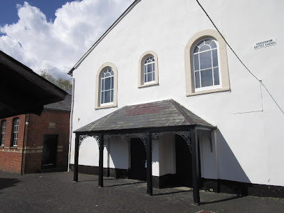
White Friar's Church is located at Stockwell StreetHaddenham Oxford, City of Oxford ,Oxfordshire ,England.
-
White Friar's Church cemetery's updated grave count on graveviews.com?
0 memorials
-
Where are the coordinates of the White Friar's Church?
Latitude: 51.7710000
Longitude: -0.9288600
Nearby Cemetories:
1. Haddenham Baptist Church Graveyard
Haddenham, Aylesbury Vale District, England
Coordinate: 51.7706830, -0.9274900
2. St. Mary the Virgin Churchyard
Haddenham, Aylesbury Vale District, England
Coordinate: 51.7658180, -0.9266980
3. St Nicholas Churchyard
Kingsey, Aylesbury Vale District, England
Coordinate: 51.7545190, -0.9246110
4. Aston Sandford St Michael and all Angels
Aston Sandford, Aylesbury Vale District, England
Coordinate: 51.7651962, -0.9024482
5. St. Nicholas Churchyard
Cuddington, Aylesbury Vale District, England
Coordinate: 51.7944300, -0.9320400
6. St Nicholas Churchyard
Chearsley, Aylesbury Vale District, England
Coordinate: 51.7868900, -0.9571600
7. St. Catherine Churchyard
Towersey, South Oxfordshire District, England
Coordinate: 51.7411700, -0.9360300
8. Saint Peter and Saint Paul Churchyard
Dinton, Aylesbury Vale District, England
Coordinate: 51.7931690, -0.8901620
9. St. Nicholas' Churchyard
Nether Winchendon, Aylesbury Vale District, England
Coordinate: 51.8041000, -0.9388000
10. St Mary the Virgin Churchyard
Long Crendon, Aylesbury Vale District, England
Coordinate: 51.7758380, -0.9890670
11. St. Peter's Churchyard
Ilmer, Wycombe District, England
Coordinate: 51.7428914, -0.8873946
12. Thame War Memorial
Thame, South Oxfordshire District, England
Coordinate: 51.7452570, -0.9743330
13. Saint Mary The Virgin Churchyard
Thame, South Oxfordshire District, England
Coordinate: 51.7511750, -0.9819190
14. Baptist Chapel Burial Ground
Long Crendon, Aylesbury Vale District, England
Coordinate: 51.7730713, -0.9929426
15. Thame Park Chapel
Thame, South Oxfordshire District, England
Coordinate: 51.7290130, -0.9650540
16. St. John the Baptist Churchyard
Stone, Aylesbury Vale District, England
Coordinate: 51.8034640, -0.8644200
17. Eythrope Road Cemetery
Stone, Aylesbury Vale District, England
Coordinate: 51.8068250, -0.8652493
18. St Mary Magdalene Churchyard
Upper Winchendon, Aylesbury Vale District, England
Coordinate: 51.8240620, -0.9192140
19. St. Mary's Churchyard
Chilton, Aylesbury Vale District, England
Coordinate: 51.7988760, -1.0055490
20. Waddesdon Hill Strict Baptist Chapel Chapelyard
Waddesdon, Aylesbury Vale District, England
Coordinate: 51.8289880, -0.9083030
21. St Marys Churchyard
Ashendon, Aylesbury Vale District, England
Coordinate: 51.8221320, -0.9784380
22. St Mary's Churchyard
Sydenham, South Oxfordshire District, England
Coordinate: 51.7112360, -0.9398460
23. North Weston Chapel
Thame, South Oxfordshire District, England
Coordinate: 51.7433420, -1.0153490
24. St. Mary's Churchyard
Hartwell, Aylesbury Vale District, England
Coordinate: 51.8052662, -0.8484938