
| Memorials | : | 2 |
| Location | : | Good Hope Township, Hocking County, USA |
| Coordinate | : | 39.5499687, -82.5613708 |
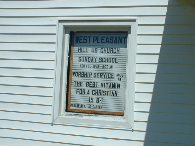
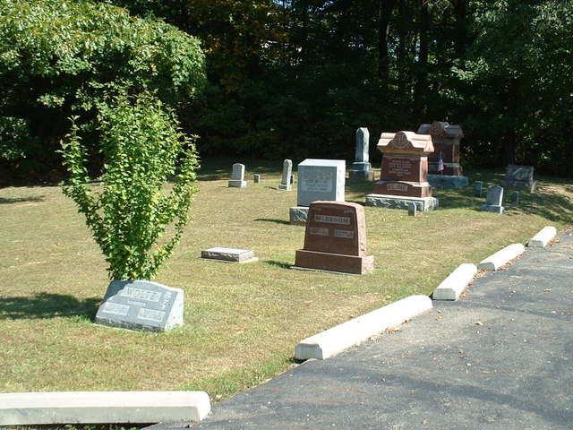
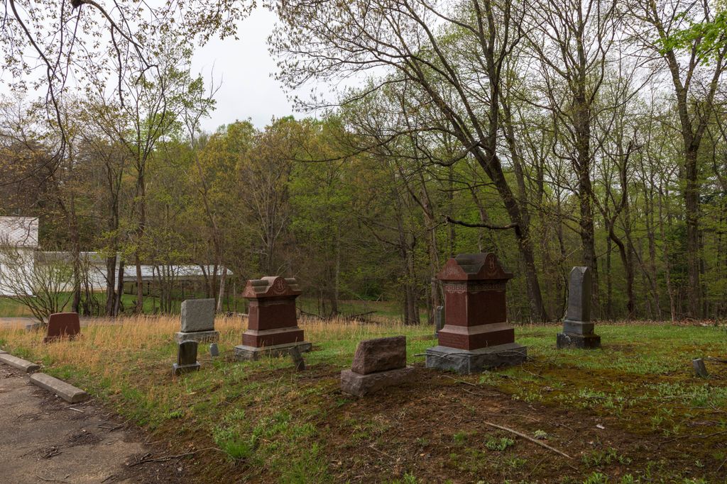
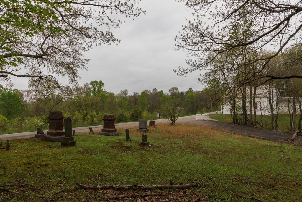
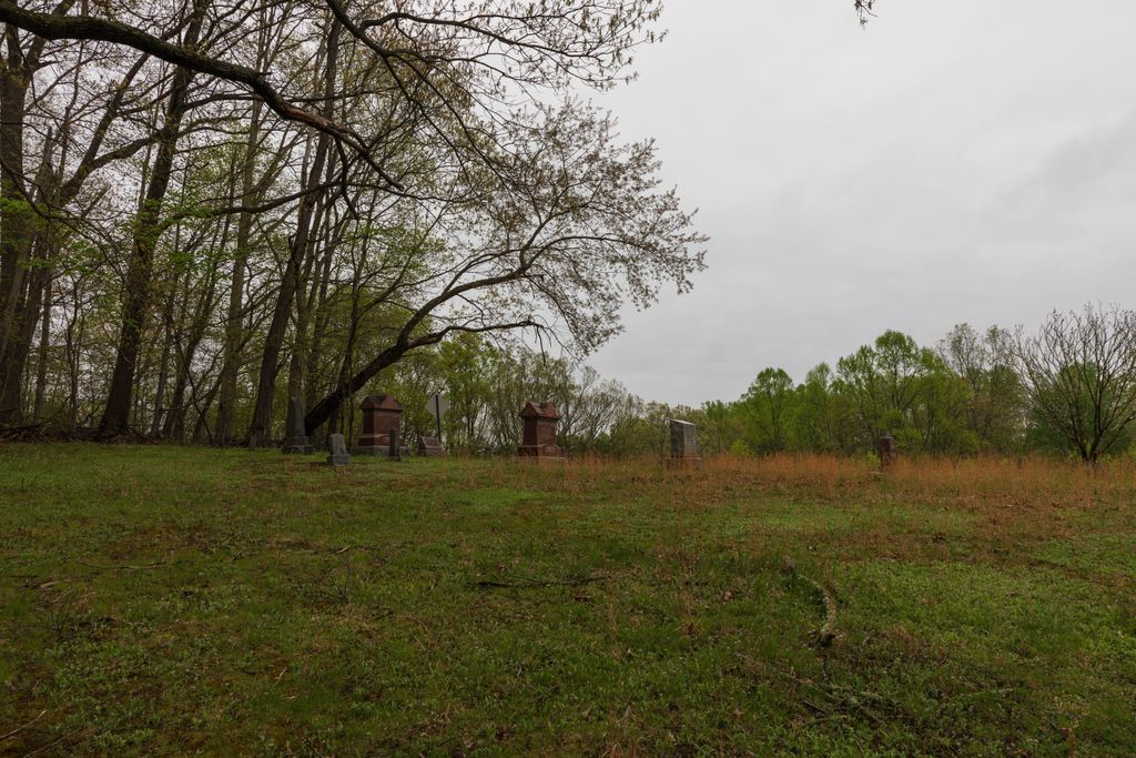
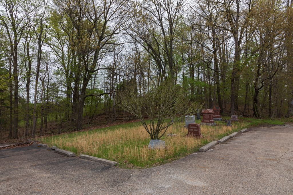
| Description | : | The cemetery is located on the northeast corner of the intersection of Woltz Road (Township Road 123) and Miler Road (County Road 33). The cemetery is located in Good Hope Township, Hocking County, Ohio, and is # 5403 (West Pleasant Hill Cemetery / Pleasant Hill Cemetery) in “Ohio Cemeteries 1803-2003”, compiled by the Ohio Genealogical Society. |
frequently asked questions (FAQ):
-
Where is West Pleasant Hill Cemetery?
West Pleasant Hill Cemetery is located at Woltz Road (Township Road 123) and Miler Road (County Road 33) Good Hope Township, Hocking County ,Ohio , 43149USA.
-
West Pleasant Hill Cemetery cemetery's updated grave count on graveviews.com?
2 memorials
-
Where are the coordinates of the West Pleasant Hill Cemetery?
Latitude: 39.5499687
Longitude: -82.5613708
Nearby Cemetories:
1. McBroom Cemetery
Laurel Township, Hocking County, USA
Coordinate: 39.5346985, -82.5643997
2. Whippoorwill Cemetery
Good Hope Township, Hocking County, USA
Coordinate: 39.5677986, -82.5430984
3. Union Church Cemetery
Good Hope Township, Hocking County, USA
Coordinate: 39.5774498, -82.5608368
4. Union Grove Cemetery
Rockbridge, Hocking County, USA
Coordinate: 39.5776520, -82.5558070
5. Hansen Cemetery
Laurel Township, Hocking County, USA
Coordinate: 39.5253340, -82.5788750
6. Brown Cemetery
Good Hope Township, Hocking County, USA
Coordinate: 39.5647583, -82.6028824
7. Homestead Crossing Cemetery
Rockbridge, Hocking County, USA
Coordinate: 39.5212690, -82.5891820
8. Richards Family Cemetery
Rockbridge, Hocking County, USA
Coordinate: 39.5853680, -82.5390430
9. Pisgah Cemetery
Good Hope Township, Hocking County, USA
Coordinate: 39.5610199, -82.6120224
10. Laurel Cemetery
Gibisonville, Hocking County, USA
Coordinate: 39.5073350, -82.5557060
11. Mount Olive Cemetery
Gibisonville, Hocking County, USA
Coordinate: 39.5071983, -82.5567017
12. Boling Cemetery
Rockbridge, Hocking County, USA
Coordinate: 39.5108500, -82.5347700
13. Kline Cemetery
Good Hope Township, Hocking County, USA
Coordinate: 39.5588070, -82.5035510
14. Fairview Memorial Gardens
Rockbridge, Hocking County, USA
Coordinate: 39.5594510, -82.5028920
15. Fairview Methodist Church Cemetery
Good Hope Township, Hocking County, USA
Coordinate: 39.5592499, -82.5011902
16. Saint John Lutheran Cemetery
Maysville, Hocking County, USA
Coordinate: 39.5314370, -82.5032140
17. Old Gibisonville ME United Brethren Cemetery
Gibisonville, Hocking County, USA
Coordinate: 39.4990770, -82.5651490
18. Old Lutheran Cemetery
Falls Township, Hocking County, USA
Coordinate: 39.5262900, -82.5027700
19. Conrad Cemetery
Hocking County, USA
Coordinate: 39.5003400, -82.5277830
20. Nihizer Cemetery
Falls Township, Hocking County, USA
Coordinate: 39.5145510, -82.5039870
21. Grant-Moore Cemetery
Laurel Township, Hocking County, USA
Coordinate: 39.4993680, -82.5971620
22. Morgan Chapel Cemetery
Rockbridge, Hocking County, USA
Coordinate: 39.5542908, -82.6383438
23. Centenary Cemetery
Enterprise, Hocking County, USA
Coordinate: 39.5802994, -82.4946976
24. Our Lady of Good Hope Catholic Cemetery
Good Hope Township, Hocking County, USA
Coordinate: 39.6036797, -82.6033020