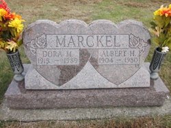
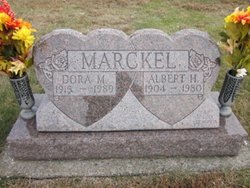
Albert H. Marckel
| Birth | : | 5 Jan 1904 Defiance, Defiance County, Ohio, USA |
| Death | : | 28 May 1980 Defiance, Defiance County, Ohio, USA |
| Burial | : | St Peter and St Paul Churchyard, Oxton, Newark and Sherwood District, England |
| Coordinate | : | 53.0560880, -1.0613440 |
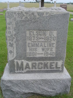
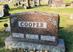
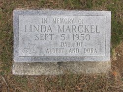
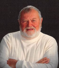
| Description | : | Albert H. Marckel, 76, of rt. 3, Moser Road, died at 2:30 PM Wednesday in Defiance hospital. He was a past Adams Township trustee for 33 years until 1977. Born in Adams Township on January 5, 1904, he was the son of Nelson and Emmaline (Linebrink) Marckel. On September 30, 1937, he married Dora Meyer who survives. Also surviving are a son, Larry, of rt. 3 and one grandson. He was preceded in death by one daughter and a sister, Francis Cooper. Marckel lived in Adams Township all his life and was engaged in farming. He was a member of... Read More |
frequently asked questions (FAQ):
-
Where is Albert H. Marckel's memorial?
Albert H. Marckel's memorial is located at: St Peter and St Paul Churchyard, Oxton, Newark and Sherwood District, England.
-
When did Albert H. Marckel death?
Albert H. Marckel death on 28 May 1980 in Defiance, Defiance County, Ohio, USA
-
Where are the coordinates of the Albert H. Marckel's memorial?
Latitude: 53.0560880
Longitude: -1.0613440
Family Members:
Parent
Spouse
Siblings
Children
Flowers:
Nearby Cemetories:
1. St Peter and St Paul Churchyard
Oxton, Newark and Sherwood District, England
Coordinate: 53.0560880, -1.0613440
2. Tithe Green Burial Ground
Calverton, Gedling Borough, England
Coordinate: 53.0672540, -1.0949290
3. Woodborough Cemetery
Woodborough, Gedling Borough, England
Coordinate: 53.0272840, -1.0600540
4. St Michael Churchyard
Farnsfield, Newark and Sherwood District, England
Coordinate: 53.1021600, -1.0363990
5. St Mary the Virgin Churchyard
Lowdham, Newark and Sherwood District, England
Coordinate: 53.0146670, -1.0135510
6. St Michael the Archangel Churchyard
Halam, Newark and Sherwood District, England
Coordinate: 53.0822150, -0.9891350
7. St Giles Churchyard
Edingley, Newark and Sherwood District, England
Coordinate: 53.0958400, -1.0082600
8. Lowdham Saint Mary Churchyard Extension
Lowdham, Newark and Sherwood District, England
Coordinate: 53.0143500, -1.0125800
9. St Mary of the Purification Churchyard
Blidworth, Newark and Sherwood District, England
Coordinate: 53.0946620, -1.1269380
10. St Laurence's Churchyard
Gonalston, Newark and Sherwood District, England
Coordinate: 53.0201000, -0.9845830
11. Redhill Cemetery
Arnold, Nottingham Unitary Authority, England
Coordinate: 53.0066910, -1.1382950
12. Southwell Minster Churchyard
Southwell, Newark and Sherwood District, England
Coordinate: 53.0735100, -0.9524500
13. St. Helen's Churchyard
Burton Joyce, Gedling Borough, England
Coordinate: 52.9866700, -1.0365400
14. St Swithin Churchyard
Kirklington, Newark and Sherwood District, England
Coordinate: 53.1113200, -0.9868040
15. Burton Joyce Cemetery
Burton Joyce, Gedling Borough, England
Coordinate: 52.9863100, -1.0370710
16. St Michael Churchyard
Hoveringham, Newark and Sherwood District, England
Coordinate: 53.0124370, -0.9603240
17. St. James Churchyard
Papplewick, Gedling Borough, England
Coordinate: 53.0582060, -1.1872990
18. Gedling Cemetery
Gedling, Gedling Borough, England
Coordinate: 52.9806930, -1.0870670
19. St John the Baptist Gunthorpe
Gunthorpe, Newark and Sherwood District, England
Coordinate: 52.9925600, -0.9877400
20. All Hallows Churchyard
Gedling, Gedling Borough, England
Coordinate: 52.9769400, -1.0805130
21. St Mary's Churchyard
Bleasby, Newark and Sherwood District, England
Coordinate: 53.0386900, -0.9310700
22. Shelford Priory
Shelford, Rushcliffe Borough, England
Coordinate: 52.9830600, -0.9994100
23. Newstead Abbey
Newstead, Gedling Borough, England
Coordinate: 53.0783450, -1.1931120
24. SS Peter & Paul Churchyard
Shelford, Rushcliffe Borough, England
Coordinate: 52.9745600, -1.0161200

