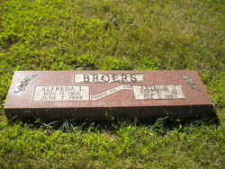
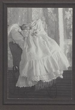
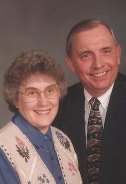
Alfreda Louise “Fritzi” Halboth Broers
| Birth | : | 11 Nov 1915 Potter County, South Dakota, USA |
| Death | : | 7 Jun 1989 Cerro Gordo County, Iowa, USA |
| Burial | : | Saint Peter & Saint Paul Churchyard, Eythorne, Dover District, England |
| Coordinate | : | 51.2011990, 1.2616710 |
| Plot | : | Crown Hill B Lot 7 - 7 |
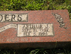
| Description | : | Alfreda, known to family and friends as 'Fritzi', married Arthur on 01 February, 1936 in Valley Junction, West Des Moines. She and Arthur farmed a century farm near Mason City. Fritzi was an active member of St. James Lutheran Church and the Bath Farm Women's club. She is survived by her husband Arthur, her loving children and their families. She was a devoted wife, mother, grandmother and a friend to many. |
frequently asked questions (FAQ):
-
Where is Alfreda Louise “Fritzi” Halboth Broers's memorial?
Alfreda Louise “Fritzi” Halboth Broers's memorial is located at: Saint Peter & Saint Paul Churchyard, Eythorne, Dover District, England.
-
When did Alfreda Louise “Fritzi” Halboth Broers death?
Alfreda Louise “Fritzi” Halboth Broers death on 7 Jun 1989 in Cerro Gordo County, Iowa, USA
-
Where are the coordinates of the Alfreda Louise “Fritzi” Halboth Broers's memorial?
Latitude: 51.2011990
Longitude: 1.2616710
Family Members:
Parent
Spouse
Siblings
Children
Flowers:
Nearby Cemetories:
1. Saint Peter & Saint Paul Churchyard
Eythorne, Dover District, England
Coordinate: 51.2011990, 1.2616710
2. Eythorne Baptist Church Cemetery
Eythorne, Dover District, England
Coordinate: 51.1982330, 1.2661470
3. St Nicholas’ Barfrestone Church Burial Ground
Eythorne, Dover District, England
Coordinate: 51.2056350, 1.2400870
4. Saint Nicholas Churchyard
Eythorne, Dover District, England
Coordinate: 51.2055720, 1.2400490
5. Saint Pancras Churchyard
Coldred, Dover District, England
Coordinate: 51.1822600, 1.2529260
6. All Saints Churchyard
Waldershare, Dover District, England
Coordinate: 51.1875170, 1.2857870
7. Saint Andrew Churchyard
Shepherdswell, Dover District, England
Coordinate: 51.1841500, 1.2358000
8. Saint Andrew Churchyard
Tilmanstone, Dover District, England
Coordinate: 51.2159790, 1.2950400
9. St Mary the Virgin Churchyard
Nonington, Dover District, England
Coordinate: 51.2258300, 1.2253800
10. St Clement Church
Knowlton, Dover District, England
Coordinate: 51.2348930, 1.2652130
11. Saint Mary the Virgin Churchyard
Lydden, Dover District, England
Coordinate: 51.1658200, 1.2373050
12. St Mary the Virgin Churchyard
Betteshanger, Dover District, England
Coordinate: 51.2251200, 1.3118800
13. St Peter Churchyard
Whitfield, Dover District, England
Coordinate: 51.1655000, 1.3037000
14. St Margaret of Antioch Churchyard
Womenswold, City of Canterbury, England
Coordinate: 51.2109850, 1.1878090
15. Holy Cross
Goodnestone, Dover District, England
Coordinate: 51.2457190, 1.2290550
16. St. Peter and St. Paul Churchyard
Sutton, Dover District, England
Coordinate: 51.1955800, 1.3397700
17. St. Peter and St. Paul's Churchyard
Temple Ewell, Dover District, England
Coordinate: 51.1515565, 1.2675213
18. Barham Crematorium
Barham, City of Canterbury, England
Coordinate: 51.1972610, 1.1800310
19. St Mary the Virgin Churchyard
Eastry, Dover District, England
Coordinate: 51.2453000, 1.3100000
20. Aylesham Cemetery
Aylesham, Dover District, England
Coordinate: 51.2126910, 1.1781980
21. St Augustine Churchyard
Northbourne, Dover District, England
Coordinate: 51.2221700, 1.3403500
22. St Peter and St Paul Churchyard
River, Dover District, England
Coordinate: 51.1447480, 1.2733710
23. St Augustine's Church
East Langdon, Dover District, England
Coordinate: 51.1654990, 1.3357270
24. Church of Saint George at Ham
Eastry, Dover District, England
Coordinate: 51.2444830, 1.3319350

