
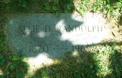
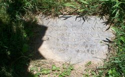
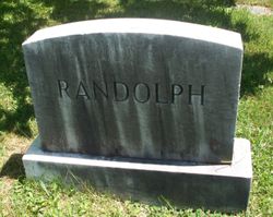
Alice M. “Allie” Davis Randolph
| Birth | : | 5 Jul 1870 |
| Death | : | 5 May 1960 |
| Burial | : | Cheriton Road Cemetery, Folkestone, Shepway District, England |
| Coordinate | : | 51.0846000, 1.1615100 |
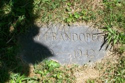
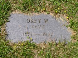
| Description | : | Mrs. Ray (Aunt Allie) Randolph, age 89, of 187 West Main St., Salem, died at her home at 6:25 p.m. Thursday. She was born at Lost Creek, July 5, 1870, a daughter of the late Levi B. and Sarah Jane Rymer Davis. On June 25, 1896, she was married to Ray Randolph, who died in 1942. She is survived by one daughter-in-law, Mrs. Madge Randolph, St. Petersburg, Fla.; two sisters, Mrs. Charles A.F. (Althea) Randolph, Mis Girthea S. Davis, both of Salem; one sister-in-law, Mrs. Okey W. (Frances) Davis, of Salem and several nieces and nephews. ... Read More |
frequently asked questions (FAQ):
-
Where is Alice M. “Allie” Davis Randolph's memorial?
Alice M. “Allie” Davis Randolph's memorial is located at: Cheriton Road Cemetery, Folkestone, Shepway District, England.
-
When did Alice M. “Allie” Davis Randolph death?
Alice M. “Allie” Davis Randolph death on 5 May 1960 in
-
Where are the coordinates of the Alice M. “Allie” Davis Randolph's memorial?
Latitude: 51.0846000
Longitude: 1.1615100
Family Members:
Parent
Spouse
Siblings
Children
Flowers:


Nearby Cemetories:
1. Cheriton Road Cemetery
Folkestone, Shepway District, England
Coordinate: 51.0846000, 1.1615100
2. Holy Trinity Church
Folkestone, Shepway District, England
Coordinate: 51.0767190, 1.1674100
3. St John the Baptist Churchyard
Folkestone, Shepway District, England
Coordinate: 51.0858580, 1.1760900
4. Christ Church Graveyard
Folkestone, Shepway District, England
Coordinate: 51.0776520, 1.1735470
5. Bradstone Baptist Burial Ground
Folkestone, Shepway District, England
Coordinate: 51.0830220, 1.1803570
6. St Paul's Church
Sandgate, Shepway District, England
Coordinate: 51.0744900, 1.1495700
7. St Michael & All Angels Churchyard
Folkestone, Shepway District, England
Coordinate: 51.0821600, 1.1820300
8. St. Mary and St. Eanswythe Churchyard
Folkestone, Shepway District, England
Coordinate: 51.0787740, 1.1817510
9. Folkestone Friends Burial Ground
Folkestone, Shepway District, England
Coordinate: 51.0825560, 1.1856030
10. St Peter Churchyard
Folkestone, Shepway District, England
Coordinate: 51.0813050, 1.1882080
11. St. Martin Churchyard
Cheriton, Shepway District, England
Coordinate: 51.0857570, 1.1247500
12. Shorncliffe Military Cemetery
Folkestone, Shepway District, England
Coordinate: 51.0754204, 1.1270230
13. St. Nicholas Churchyard
Newington, Shepway District, England
Coordinate: 51.0942900, 1.1156300
14. Spring Lane Cemetery
Hythe, Shepway District, England
Coordinate: 51.0783450, 1.1134600
15. National Battle of Britain Memorial
Capel-le-Ferne, Dover District, England
Coordinate: 51.0984880, 1.2059130
16. St Michael the Archangel Churchyard
Hawkinge, Shepway District, England
Coordinate: 51.1130600, 1.1819210
17. Hawkinge Cemetery and Crematorium
Hawkinge, Shepway District, England
Coordinate: 51.1163710, 1.1578030
18. St. Oswald's Churchyard
Paddlesworth, Shepway District, England
Coordinate: 51.1149760, 1.1348910
19. United Reformed Church
Hythe, Shepway District, England
Coordinate: 51.0723220, 1.0913160
20. St. Mary's Churchyard
Capel-le-Ferne, Dover District, England
Coordinate: 51.1149650, 1.2235540
21. Hythe War Memorial
Hythe, Shepway District, England
Coordinate: 51.0703040, 1.0849560
22. St Leonard's Churchyard
Hythe, Shepway District, England
Coordinate: 51.0727800, 1.0836580
23. St Peter and St Paul Churchyard
Saltwood, Shepway District, England
Coordinate: 51.0827710, 1.0795340
24. St. Martin's Churchyard
Acrise, Shepway District, England
Coordinate: 51.1372970, 1.1346610