
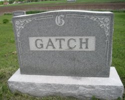
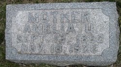
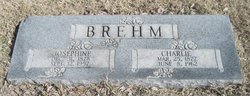
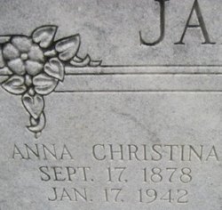
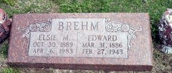
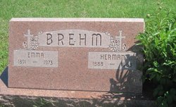
Amelia Ursula Brehm Gatch
| Birth | : | 13 Sep 1882 Enterprise, Dickinson County, Kansas, USA |
| Death | : | 10 Nov 1926 Abilene, Dickinson County, Kansas, USA |
| Burial | : | Walnut Grove Cemetery, Trenton, Gibson County, USA |
| Coordinate | : | 35.9947014, -89.0764008 |
frequently asked questions (FAQ):
-
Where is Amelia Ursula Brehm Gatch's memorial?
Amelia Ursula Brehm Gatch's memorial is located at: Walnut Grove Cemetery, Trenton, Gibson County, USA.
-
When did Amelia Ursula Brehm Gatch death?
Amelia Ursula Brehm Gatch death on 10 Nov 1926 in Abilene, Dickinson County, Kansas, USA
-
Where are the coordinates of the Amelia Ursula Brehm Gatch's memorial?
Latitude: 35.9947014
Longitude: -89.0764008
Family Members:
Parent
Spouse

Siblings
Children
Flowers:


Nearby Cemetories:
1. Walnut Grove Cemetery
Trenton, Gibson County, USA
Coordinate: 35.9947014, -89.0764008
2. Concidine Gravesite
Gibson County, USA
Coordinate: 35.9930000, -89.0800000
3. Roberts Family Cemetery
Eaton, Gibson County, USA
Coordinate: 35.9882200, -89.0734100
4. Salem Primitive Baptist Cemetery
Hickory Grove, Gibson County, USA
Coordinate: 35.9681400, -89.0709700
5. Olive Branch Methodist Church Cemetery
Eaton, Gibson County, USA
Coordinate: 35.9678001, -89.0607986
6. Wilson Cemetery
Gibson County, USA
Coordinate: 35.9706001, -89.0980988
7. Springhill MB Church Cemetery
Eaton, Gibson County, USA
Coordinate: 35.9871860, -89.1210420
8. Spring Hill Baptist Church Cemetery
Eaton, Gibson County, USA
Coordinate: 35.9859520, -89.1221080
9. Hall Family Cemetery
Dyer, Gibson County, USA
Coordinate: 36.0302900, -89.0393600
10. Duck Hill Cemetery
Trenton, Gibson County, USA
Coordinate: 36.0331001, -89.0413971
11. Hogue Cemetery
Yorkville, Gibson County, USA
Coordinate: 36.0495580, -89.0985780
12. Clear Creek Cemetery
Currie, Gibson County, USA
Coordinate: 36.0400009, -89.0299988
13. Good Hope Cemetery
Dyer, Gibson County, USA
Coordinate: 36.0477982, -89.0438995
14. Balentine Family Cemetery
Dyer, Gibson County, USA
Coordinate: 36.0544690, -89.0928070
15. Mount Orange Cemetery
Hickory Grove, Gibson County, USA
Coordinate: 35.9572780, -89.0045600
16. Biggs Family Cemetery
Grizzard, Gibson County, USA
Coordinate: 36.0184200, -88.9935500
17. Old Mayfield Cemetery
Eaton, Gibson County, USA
Coordinate: 35.9894960, -89.1666780
18. Mayfield Cemetery
Eaton, Gibson County, USA
Coordinate: 35.9910230, -89.1678300
19. Raines Cemetery
Trenton, Gibson County, USA
Coordinate: 35.9970680, -88.9811270
20. Beech Grove Baptist Church Cemetery
Dyer, Gibson County, USA
Coordinate: 36.0281710, -88.9886220
21. Zion Cemetery
Brazil, Gibson County, USA
Coordinate: 35.9167220, -89.0616380
22. Hartsfield Cemetery
Gibson County, USA
Coordinate: 35.9155500, -89.0721100
23. Bucksnort Cemetery
Gibson County, USA
Coordinate: 36.0318985, -88.9888992
24. Crenshaw-Wyatt Cemetery
Dyer, Gibson County, USA
Coordinate: 36.0778090, -89.0589010