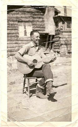
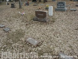
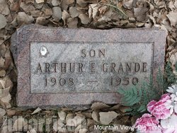
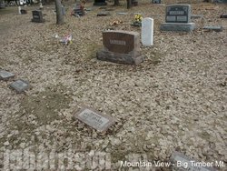
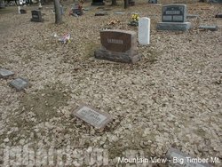
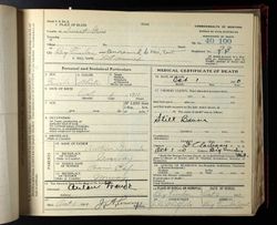
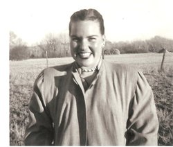
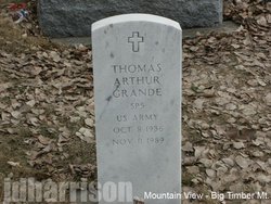
Arthur Eugene “Dutch” Grande
| Birth | : | 26 Dec 1908 Big Timber, Sweet Grass County, Montana, USA |
| Death | : | 30 Jan 1950 Yellowstone County, Montana, USA |
| Burial | : | St. Edith Churchyard, Bishop Wilton, East Riding of Yorkshire Unitary Authority, England |
| Coordinate | : | 53.9862300, -0.7838500 |
| Plot | : | Section 6, Block 4A, Lot 1, Grave 10 |
| Description | : | Big Timber Pioneer, February 2, 1950 Arthur Eugene Grande, 41, son of Mr. and Mrs. Anton Grande of Big Timber, died unexpectedly of a heart attack at his ranch home on Blue creek near Billings Monday morning about 3 o'clock. The remains were brought to Big Timber by Lowry's Monday evening and funeral services will be held from the Lutheran church in Big Timber this afternoon at 2:30, with Rev. E. S. Tollefson of Livingston officiating. Mr. Grande was born in Big Timber on December 26, 1908, and resided here for many years. He ranched on Dry creek before going... Read More |
frequently asked questions (FAQ):
-
Where is Arthur Eugene “Dutch” Grande's memorial?
Arthur Eugene “Dutch” Grande's memorial is located at: St. Edith Churchyard, Bishop Wilton, East Riding of Yorkshire Unitary Authority, England.
-
When did Arthur Eugene “Dutch” Grande death?
Arthur Eugene “Dutch” Grande death on 30 Jan 1950 in Yellowstone County, Montana, USA
-
Where are the coordinates of the Arthur Eugene “Dutch” Grande's memorial?
Latitude: 53.9862300
Longitude: -0.7838500
Family Members:
Parent
Spouse
Siblings
Children
Flowers:
Nearby Cemetories:
1. St Ethelburga Churchyard
Great Givendale, East Riding of Yorkshire Unitary Authority, England
Coordinate: 53.9745030, -0.7617170
2. All Saints Churchyard
Kirby Underdale, East Riding of Yorkshire Unitary Authority, England
Coordinate: 54.0166200, -0.7677100
3. St Martin Churchyard
Fangfoss, East Riding of Yorkshire Unitary Authority, England
Coordinate: 53.9704970, -0.8324690
4. St Andrew Churchyard
Bugthorpe, East Riding of Yorkshire Unitary Authority, England
Coordinate: 54.0108100, -0.8226900
5. St Mary Churchyard
Full Sutton, East Riding of Yorkshire Unitary Authority, England
Coordinate: 53.9897620, -0.8613700
6. St Catherine Churchyard
Barmby Moor, East Riding of Yorkshire Unitary Authority, England
Coordinate: 53.9307670, -0.8189520
7. St John the Baptist
Acklam, Ryedale District, England
Coordinate: 54.0451010, -0.8006330
8. St John the Evangelist Churchyard
Buttercrambe, Ryedale District, England
Coordinate: 54.0137300, -0.8812900
9. St. Mary's Churchyard
Thixendale, Ryedale District, England
Coordinate: 54.0387360, -0.7154888
10. St Botolph Churchyard
Allerthorpe, East Riding of Yorkshire Unitary Authority, England
Coordinate: 53.9171530, -0.8052080
11. Saint Mary's Churchyard
Huggate, East Riding of Yorkshire Unitary Authority, England
Coordinate: 53.9878100, -0.6560000
12. St Peter and St Paul Churchyard
Scrayingham, Ryedale District, England
Coordinate: 54.0342510, -0.8826130
13. St. Mary's Churchyard
Fridaythorpe, East Riding of Yorkshire Unitary Authority, England
Coordinate: 54.0220090, -0.6667190
14. St Martin Churchyard
Hayton, East Riding of Yorkshire Unitary Authority, England
Coordinate: 53.9038010, -0.7518530
15. All Saints Churchyard
Low Catton, East Riding of Yorkshire Unitary Authority, England
Coordinate: 53.9769280, -0.9268720
16. St Giles Churchyard
Burnby, East Riding of Yorkshire Unitary Authority, England
Coordinate: 53.9067790, -0.7292650
17. St Botolph Churchyard
Bossall, Ryedale District, England
Coordinate: 54.0375570, -0.9047540
18. Howsham Churchyard
Howsham, Ryedale District, England
Coordinate: 54.0565520, -0.8755670
19. Burythorpe Churchyard
Burythorpe, Ryedale District, England
Coordinate: 54.0752951, -0.7955984
20. St Mary Churchyard
Birdsall, Ryedale District, England
Coordinate: 54.0780000, -0.7508000
21. St Peter Churchyard
Upper Helmsley, Ryedale District, England
Coordinate: 54.0044650, -0.9409770
22. St Paul Churchyard
Kexby, York Unitary Authority, England
Coordinate: 53.9505970, -0.9339900
23. St. Mary's Churchyard
Gate Helmsley, Ryedale District, England
Coordinate: 53.9883720, -0.9481980
24. St. Martin Churchyard
Wharram Percy, Ryedale District, England
Coordinate: 54.0665700, -0.6901300

