
| Birth | : | 26 Oct 1887 Carroll County, Iowa, USA |
| Death | : | 12 Aug 1927 Clarinda, Page County, Iowa, USA |
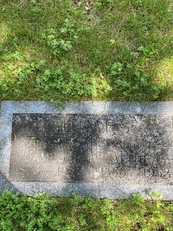
| Burial | : | Walnut Hill Cemetery, Council Bluffs, Pottawattamie County, USA |
| Coordinate | : | 41.2719002, -95.8255997 |
| Description | : | According to his death certificate he died in the Clarinda State Hospital. He is also listed as divorced. Arthur J. Levi, 39, 3661 Avenue C, died at home Friday night. He was born in Iowa. He is survived by one son, Lawrence Levi; two daughters, Lorine and Dorothy; his mother, Mrs. Jennie Levi; one brother, L. E. Levi; one sister, Mrs. Althea Humes. All live in this city. The funeral will be Monday at 2 p.m. at Cutler’s chapel. Burial will be in Walnut Hill cemetery. Council Bluffs Daily Nonpareil: Sat., 13 Aug 1927: pg. 3 |
frequently asked questions (FAQ):
-
Where is Arthur James Levi's memorial?
Arthur James Levi's memorial is located at: Walnut Hill Cemetery, Council Bluffs, Pottawattamie County, USA.
-
When did Arthur James Levi death?
Arthur James Levi death on 12 Aug 1927 in Clarinda, Page County, Iowa, USA
-
Where are the coordinates of the Arthur James Levi's memorial?
Latitude: 41.2719002
Longitude: -95.8255997
Family Members:
Parent

Spouse
Siblings
Children
Flowers:


Nearby Cemetories:
1. Walnut Hill Cemetery
Council Bluffs, Pottawattamie County, USA
Coordinate: 41.2719002, -95.8255997
2. Bikhor Cholim Cemetery
Council Bluffs, Pottawattamie County, USA
Coordinate: 41.2703670, -95.8229350
3. Ridgewood Cemetery
Council Bluffs, Pottawattamie County, USA
Coordinate: 41.2694016, -95.8272018
4. Oak Hill Cemetery
Council Bluffs, Pottawattamie County, USA
Coordinate: 41.2700900, -95.8226400
5. Green Valley Cemetery
Council Bluffs, Pottawattamie County, USA
Coordinate: 41.2743988, -95.8225021
6. Saint Joseph Cemetery
Council Bluffs, Pottawattamie County, USA
Coordinate: 41.2722015, -95.8208008
7. Cedar Lawn Cemetery
Council Bluffs, Pottawattamie County, USA
Coordinate: 41.2694016, -95.8182983
8. Memorial Park Cemetery
Council Bluffs, Pottawattamie County, USA
Coordinate: 41.2644005, -95.8261032
9. Clark Cemetery
Pottawattamie County, USA
Coordinate: 41.2551610, -95.8223390
10. Fairview Cemetery
Council Bluffs, Pottawattamie County, USA
Coordinate: 41.2703018, -95.8480988
11. Garner Cemetery
Council Bluffs, Pottawattamie County, USA
Coordinate: 41.2956161, -95.8001709
12. Stoker-Graybill Cemetery
Council Bluffs, Pottawattamie County, USA
Coordinate: 41.2532620, -95.7751770
13. Maple Grove Cemetery
Council Bluffs, Pottawattamie County, USA
Coordinate: 41.2265560, -95.8187100
14. Evans Cemetery
Crescent, Pottawattamie County, USA
Coordinate: 41.3255997, -95.8368988
15. Lewis Township Cemetery
Council Bluffs, Pottawattamie County, USA
Coordinate: 41.2117004, -95.7938995
16. Gregg Cemetery
Weston, Pottawattamie County, USA
Coordinate: 41.3330000, -95.7931000
17. Council Point Cemetery
Council Bluffs, Pottawattamie County, USA
Coordinate: 41.2110830, -95.8788610
18. Hazel Dell Cemetery
Council Bluffs, Pottawattamie County, USA
Coordinate: 41.3489723, -95.7939911
19. Trinity Cathedral Columbarium
Omaha, Douglas County, USA
Coordinate: 41.2603900, -95.9393660
20. Saint Columbanus Cemetery
Weston, Pottawattamie County, USA
Coordinate: 41.3429440, -95.7435260
21. Crescent Cemetery
Crescent, Pottawattamie County, USA
Coordinate: 41.3664894, -95.8566208
22. Prospect Hill Cemetery
Omaha, Douglas County, USA
Coordinate: 41.2780991, -95.9593964
23. First Central Congregational Columbarium
Omaha, Douglas County, USA
Coordinate: 41.2563456, -95.9658365
24. Nash Chapel Crypt
Omaha, Douglas County, USA
Coordinate: 41.2665090, -95.9721790