
| Birth | : | 11 Oct 1921 Surry County, North Carolina, USA |
| Death | : | 18 Aug 2010 Sparta, Alleghany County, North Carolina, USA |
| Burial | : | St Mary's Churchyard, Burford, Shropshire Unitary Authority, England |
| Coordinate | : | 52.3087670, -2.6126000 |
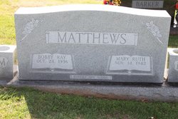
| Description | : | Mr. Bernie Ray Sutphin Sr., 88, of Lowgap, passed away Wednesday, Aug. 18, 2010, at Alleghany Care and Rehabilitation Center in Sparta. He was born Oct. 11, 1921, in Surry County to the late Nicholas Hugh and Susie Haymore Sutphin. He retired from farming and was a member of Flat Rock Pentecostal Holiness Church in Mount Airy. Mr. Sutphin is survived by two daughters and sons-in-law, Mary Ruth and Bobby Matthews of Mount Airy and Lougenia and Alvin Smith of Lowgap; and two sons and daughters-in-law, Bernie Ray and Sharon Sutphin Jr. and Nicky and Rika Sutphin, all of Mount... Read More |
frequently asked questions (FAQ):
-
Where is Bernie Ray Sutphin Sr.'s memorial?
Bernie Ray Sutphin Sr.'s memorial is located at: St Mary's Churchyard, Burford, Shropshire Unitary Authority, England.
-
When did Bernie Ray Sutphin Sr. death?
Bernie Ray Sutphin Sr. death on 18 Aug 2010 in Sparta, Alleghany County, North Carolina, USA
-
Where are the coordinates of the Bernie Ray Sutphin Sr.'s memorial?
Latitude: 52.3087670
Longitude: -2.6126000
Family Members:
Spouse

Children
Flowers:


Nearby Cemetories:
1. St Mary's Churchyard
Burford, Shropshire Unitary Authority, England
Coordinate: 52.3087670, -2.6126000
2. St. Mary's Churchyard
Tenbury Wells, Malvern Hills District, England
Coordinate: 52.3120500, -2.5962400
3. St Michael's Churchyard Extension
Tenbury Wells, Malvern Hills District, England
Coordinate: 52.2941032, -2.6183906
4. St Michael and All Angels Churchyard
Tenbury Wells, Malvern Hills District, England
Coordinate: 52.2882600, -2.6137900
5. St. Mary Magdalene Churchyard
Little Hereford, Herefordshire Unitary Authority, England
Coordinate: 52.3112129, -2.6572039
6. St Michael and All Angels Churchyard
Rochford, Malvern Hills District, England
Coordinate: 52.3134240, -2.5454090
7. St Michael & All Angels Churchyard
Knighton-on-Teme, Malvern Hills District, England
Coordinate: 52.3260900, -2.5393500
8. St. Mary's Churchyard
Caynham, Shropshire Unitary Authority, England
Coordinate: 52.3558260, -2.6564540
9. St Marys Churchyard
Kyre, Malvern Hills District, England
Coordinate: 52.2685140, -2.5488360
10. St. Peter's Churchyard
Coreley, Shropshire Unitary Authority, England
Coordinate: 52.3627780, -2.5694950
11. St. Andrew, Ashford Bowdler.
Ashford Bowdler, Shropshire Unitary Authority, England
Coordinate: 52.3308770, -2.7065930
12. Knowbury, St Paul
Caynham, Shropshire Unitary Authority, England
Coordinate: 52.3734750, -2.6300130
13. St Peter & St Paul Churchyard
Eastham, Malvern Hills District, England
Coordinate: 52.3156100, -2.5046000
14. St. Peter's Churchyard
Stoke Bliss, Malvern Hills District, England
Coordinate: 52.2627200, -2.5121300
15. St. James the Less Churchyard
Kimbolton, Herefordshire Unitary Authority, England
Coordinate: 52.2507757, -2.6957349
16. St. John the Baptist Churchyard
Doddington, Cheshire East Unitary Authority, England
Coordinate: 52.3822068, -2.5651644
17. St Lawrence Churchyard
Lindridge, Malvern Hills District, England
Coordinate: 52.3180700, -2.4779300
18. St. Mary's Churchyard
Bitterley, Shropshire Unitary Authority, England
Coordinate: 52.3922280, -2.6319790
19. Hopton Bank Methodist Church Burial Ground
Hopton Wafers, Shropshire Unitary Authority, England
Coordinate: 52.3872950, -2.5584430
20. St. Peter and St. Paul
Leominster, Herefordshire Unitary Authority, England
Coordinate: 52.2704100, -2.7398260
21. St. Michael & All Angels Churchyard
Hopton Wafers, Shropshire Unitary Authority, England
Coordinate: 52.3857100, -2.5343700
22. St John the Baptist Churchyard
Mamble, Malvern Hills District, England
Coordinate: 52.3416520, -2.4586520
23. St Mary the Virgin
Cleobury Mortimer, Shropshire Unitary Authority, England
Coordinate: 52.3792280, -2.4803610
24. St Bartholomews Churchyard
Bayton, Malvern Hills District, England
Coordinate: 52.3562100, -2.4548200