
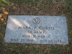
| Birth | : | 23 Sep 1912 Jackson, Waldo County, Maine, USA |
| Death | : | 30 Sep 2002 Belfast, Waldo County, Maine, USA |
| Burial | : | General Cemetery, Nottingham, Nottingham Unitary Authority, England |
| Coordinate | : | 52.9561430, -1.1615420 |
| Description | : | BELFAST - On Sept. 30, 2002, shortly after her 90th birthday, Bertha Elwell passed away at Tall Pines Nursing Home in Belfast. She was born in Jackson, Sept. 23, 1912, the daughter of Arlettie and Albert Curtis. She grew up in a large musical family. After her marriage to George Elwell in 1929, she lived in Unity and Brooks. She was a homemaker, worked several years in Belfast factories and for 20 years ran a used furniture business with her husband in Brooks. She was predeceased by her husband of 55 years, George, who died in 1984; a... Read More |
frequently asked questions (FAQ):
-
Where is Bertha Curtis Elwell's memorial?
Bertha Curtis Elwell's memorial is located at: General Cemetery, Nottingham, Nottingham Unitary Authority, England.
-
When did Bertha Curtis Elwell death?
Bertha Curtis Elwell death on 30 Sep 2002 in Belfast, Waldo County, Maine, USA
-
Where are the coordinates of the Bertha Curtis Elwell's memorial?
Latitude: 52.9561430
Longitude: -1.1615420
Family Members:
Parent

Spouse
Siblings
Children
Flowers:


Nearby Cemetories:
1. General Cemetery
Nottingham, Nottingham Unitary Authority, England
Coordinate: 52.9561430, -1.1615420
2. Nottingham General Cemetery
Nottingham, Nottingham Unitary Authority, England
Coordinate: 52.9575370, -1.1594236
3. Cathedral Church of St. Barnabas
Nottingham, Nottingham Unitary Authority, England
Coordinate: 52.9546750, -1.1570460
4. Hardy Street Jewish Cemetery
Nottingham, Nottingham Unitary Authority, England
Coordinate: 52.9619500, -1.1665900
5. St Nicholas Churchyard
Nottingham, Nottingham Unitary Authority, England
Coordinate: 52.9504780, -1.1509220
6. St Peters Church Yard
Nottingham, Nottingham Unitary Authority, England
Coordinate: 52.9522800, -1.1486940
7. Nottingham Church Cemetery
Nottingham, Nottingham Unitary Authority, England
Coordinate: 52.9649830, -1.1558070
8. Holy Trinity Churchyard
Lenton, Nottingham Unitary Authority, England
Coordinate: 52.9485630, -1.1753148
9. St. Peter Churchyard Old Radford
Nottingham, Nottingham Unitary Authority, England
Coordinate: 52.9601830, -1.1789620
10. National Justice Museum High Pavement Nottingham
Nottingham Unitary Authority, England
Coordinate: 52.9510680, -1.1443050
11. St Mary's Burial Grounds
Nottingham, Nottingham Unitary Authority, England
Coordinate: 52.9527860, -1.1419160
12. St. Mary Rest Ground
Nottingham, Nottingham Unitary Authority, England
Coordinate: 52.9568310, -1.1406580
13. National Ice Centre
Nottingham, Nottingham Unitary Authority, England
Coordinate: 52.9527790, -1.1394460
14. St. John's Carrington Churchyard
Nottingham, Nottingham Unitary Authority, England
Coordinate: 52.9755350, -1.1506790
15. St. Wilfrid Churchyard
Wilford, Nottingham Unitary Authority, England
Coordinate: 52.9346290, -1.1587770
16. Wilford Village Cemetery
Wilford, Nottingham Unitary Authority, England
Coordinate: 52.9338540, -1.1591170
17. Basford Cemetery
Old Basford, Nottingham Unitary Authority, England
Coordinate: 52.9799700, -1.1725900
18. St. Leodegarius Churchyard
Old Basford, Nottingham Unitary Authority, England
Coordinate: 52.9794240, -1.1778650
19. St. Paul's Churchyard
Nottingham Unitary Authority, England
Coordinate: 52.9667590, -1.1172140
20. St. Giles's Church & Churchyard
West Bridgford, Rushcliffe Borough, England
Coordinate: 52.9316460, -1.1288450
21. St. Leonard's Churchyard
Wollaton, Nottingham Unitary Authority, England
Coordinate: 52.9529790, -1.2200830
22. Wollaton Cemetery
Wollaton, Nottingham Unitary Authority, England
Coordinate: 52.9503000, -1.2260800
23. Beeston Baptist Chapel
Beeston, Broxtowe Borough, England
Coordinate: 52.9246600, -1.2122000
24. Carlton Cemetery
Nottingham, Nottingham Unitary Authority, England
Coordinate: 52.9682820, -1.0900230