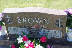
Bonna Merle Lance Brown
| Birth | : | 27 May 1933 Garden County, Nebraska, USA |
| Death | : | 27 Jul 2008 Ogallala, Keith County, Nebraska, USA |
| Burial | : | Pishill Parish Church Cemetery, Pishill, South Oxfordshire District, England |
| Coordinate | : | 51.6027550, -0.9527530 |
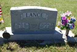
| Description | : | Bonna Merle (Lance) Brown, 75, of Lewellen, went to be with her Lord on Sunday, July 27, 2008, at the Indian Hills Manor in Ogallala after a battle with cancer. Bonna Merle was born on May 27, 1933, in Lisco to Paul Henry and Geneva Alice (Golden) Lance. She grew up and attended grade school at Lisco and graduated from the Garden County High School in 1951. On June 3, 1951, Bonna Merle was united in marriage to Albert Louis Brown at the Lisco Presbyterian Church and to this union two children were born, Teresa Ann and Terry Kent. They... Read More |
frequently asked questions (FAQ):
-
Where is Bonna Merle Lance Brown's memorial?
Bonna Merle Lance Brown's memorial is located at: Pishill Parish Church Cemetery, Pishill, South Oxfordshire District, England.
-
When did Bonna Merle Lance Brown death?
Bonna Merle Lance Brown death on 27 Jul 2008 in Ogallala, Keith County, Nebraska, USA
-
Where are the coordinates of the Bonna Merle Lance Brown's memorial?
Latitude: 51.6027550
Longitude: -0.9527530
Family Members:
Parent
Flowers:
Nearby Cemetories:
1. Pishill Parish Church Cemetery
Pishill, South Oxfordshire District, England
Coordinate: 51.6027550, -0.9527530
2. Stonor Park Cemetery
Henley-on-Thames, South Oxfordshire District, England
Coordinate: 51.5967370, -0.9289660
3. St. James' Old Churchyard
South Oxfordshire District, England
Coordinate: 51.5769360, -0.9532550
4. St Nicholas Churchyard
Ibstone, Wycombe District, England
Coordinate: 51.6247660, -0.9093120
5. St. Mary the Virgin Churchyard
Fawley, Wycombe District, England
Coordinate: 51.5743000, -0.9140000
6. St. Bartholomew's Churchyard
Nettlebed, South Oxfordshire District, England
Coordinate: 51.5752360, -0.9936230
7. St Mary's Churchyard
Turville, Wycombe District, England
Coordinate: 51.6139860, -0.8938190
8. St. Botolph Old Cemetery
Swyncombe, South Oxfordshire District, England
Coordinate: 51.6065347, -1.0157358
9. St. Botolph's New Graveyard
Swyncombe, South Oxfordshire District, England
Coordinate: 51.6064829, -1.0167999
10. St. James's Churchyard
Bix and Assendon, South Oxfordshire District, England
Coordinate: 51.5610070, -0.9511270
11. Getty Family Estate
Stokenchurch, Wycombe District, England
Coordinate: 51.6437360, -0.9334510
12. St. Bartholomew Churchyard
Fingest, Wycombe District, England
Coordinate: 51.6137200, -0.8791500
13. Henley-on-Thames Cemetery
Henley-on-Thames, South Oxfordshire District, England
Coordinate: 51.5543570, -0.9271320
14. Watlington War Memorial
Watlington, South Oxfordshire District, England
Coordinate: 51.6456450, -1.0065781
15. St. Pauls Highmoor Cross
Highmoor, South Oxfordshire District, England
Coordinate: 51.5532740, -0.9910110
16. Saint Mary the Virgin Churchyard
Hambleden, Wycombe District, England
Coordinate: 51.5773100, -0.8709500
17. Holy Trinity Churchyard
Nuffield, South Oxfordshire District, England
Coordinate: 51.5810040, -1.0378960
18. St. Mary-le-Moor Churchyard
Cadmore End, Wycombe District, England
Coordinate: 51.6263500, -0.8686600
19. St Nicholas Churchyard
Britwell Salome, South Oxfordshire District, England
Coordinate: 51.6376983, -1.0262075
20. St. Leonard's Churchyard
Watlington, South Oxfordshire District, England
Coordinate: 51.6474030, -1.0117420
21. All Saints Churchyard
Shirburn, South Oxfordshire District, England
Coordinate: 51.6577000, -0.9945000
22. St. John the Evangelist Churchyard
Hambleden, Wycombe District, England
Coordinate: 51.6052700, -0.8514000
23. St Mary Churchyard
Pyrton, South Oxfordshire District, England
Coordinate: 51.6558520, -1.0076830
24. Stokenchurch Church Cemetery
Stokenchurch, Wycombe District, England
Coordinate: 51.6572200, -0.8960300


