
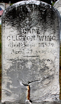
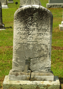
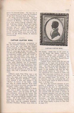
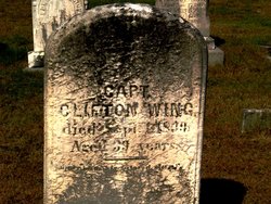
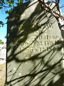
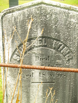
Capt Clifton Hathaway Wing
| Birth | : | 25 Jun 1796 Rochester, Plymouth County, Massachusetts, USA |
| Death | : | 1 Sep 1839 Boston, Suffolk County, Massachusetts, USA |
| Burial | : | North Marion Cemetery, Marion, Plymouth County, USA |
| Coordinate | : | 41.7280884, -70.7763062 |
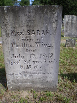
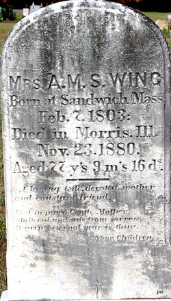
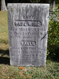
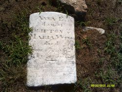
| Description | : | Capt. Clifton Hathaway Wing was born at Rochester on 25 Jun 1796, son of Philip Wing & Sarah Hathaway. He died in Boston on 1 Sep 1839. He was married to Ann Maria Spooner Freeman (the Mrs. A.M.S. Wing) 6 Oct 1822. Marker states he was 39 at death. Records show birth and death dates are true. He should have been 43 at death. This cemetery has also been called the Happy Alley or Quaker Cemetery |
frequently asked questions (FAQ):
-
Where is Capt Clifton Hathaway Wing's memorial?
Capt Clifton Hathaway Wing's memorial is located at: North Marion Cemetery, Marion, Plymouth County, USA.
-
When did Capt Clifton Hathaway Wing death?
Capt Clifton Hathaway Wing death on 1 Sep 1839 in Boston, Suffolk County, Massachusetts, USA
-
Where are the coordinates of the Capt Clifton Hathaway Wing's memorial?
Latitude: 41.7280884
Longitude: -70.7763062
Family Members:
Parent
Spouse
Siblings
Children
Flowers:


Nearby Cemetories:
1. North Marion Cemetery
Marion, Plymouth County, USA
Coordinate: 41.7280884, -70.7763062
2. Friends Burial Ground
Marion, Plymouth County, USA
Coordinate: 41.7279129, -70.7757416
3. Little Neck Cemetery
Marion, Plymouth County, USA
Coordinate: 41.7175200, -70.7624900
4. Old Landing Cemetery
Marion, Plymouth County, USA
Coordinate: 41.7103004, -70.7707977
5. Perry Family Cemetery
Rochester, Plymouth County, USA
Coordinate: 41.7501840, -70.7914780
6. Saint Gabriels Episcopal Memorial Garden
Marion, Plymouth County, USA
Coordinate: 41.7020200, -70.7626500
7. Evergreen Cemetery
Marion, Plymouth County, USA
Coordinate: 41.6985435, -70.7698517
8. Center Cemetery
Rochester, Plymouth County, USA
Coordinate: 41.7301530, -70.8185830
9. Blankenship Cemetery
Marion, Plymouth County, USA
Coordinate: 41.7076200, -70.7392100
10. Point Road Memorial Forest
Marion, Plymouth County, USA
Coordinate: 41.7071400, -70.7385050
11. Union Cemetery
Rochester, Plymouth County, USA
Coordinate: 41.7573640, -70.8202030
12. Hillside Cemetery
Rochester, Plymouth County, USA
Coordinate: 41.7750015, -70.7889023
13. Tobey-Fearing-Bliss Cemetery (Defunct)
Wareham, Plymouth County, USA
Coordinate: 41.7722600, -70.7464100
14. Ellis Family Burial Ground
Rochester, Plymouth County, USA
Coordinate: 41.7105620, -70.8397580
15. Centre Cemetery
Wareham, Plymouth County, USA
Coordinate: 41.7708015, -70.7277985
16. Saint Patricks Cemetery
Wareham, Plymouth County, USA
Coordinate: 41.7703018, -70.7264023
17. Woodside Cemetery
Rochester, Plymouth County, USA
Coordinate: 41.7848816, -70.7774887
18. Friends Cemetery
Mattapoisett, Plymouth County, USA
Coordinate: 41.6658110, -70.7838390
19. Saint Anthonys Cemetery
Mattapoisett, Plymouth County, USA
Coordinate: 41.6781060, -70.8271560
20. Howse Family Burial Ground
Rochester, Plymouth County, USA
Coordinate: 41.7262300, -70.8632760
21. Agawam Cemetery
Wareham, Plymouth County, USA
Coordinate: 41.7463989, -70.6908035
22. Pine Island Cemetery
Mattapoisett, Plymouth County, USA
Coordinate: 41.6624947, -70.7928925
23. Ellis Cemetery
Mattapoisett, Plymouth County, USA
Coordinate: 41.6957817, -70.8545609
24. Sherman Cemetery
Rochester, Plymouth County, USA
Coordinate: 41.7467728, -70.8678284