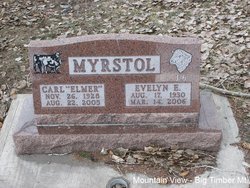
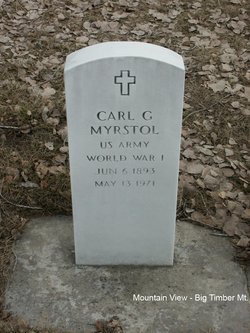
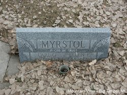
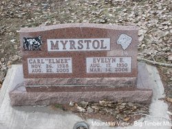
Carl Elmer Myrstol
| Birth | : | 26 Nov 1928 Big Timber, Sweet Grass County, Montana, USA |
| Death | : | 22 Aug 2005 Yellowstone County, Montana, USA |
| Burial | : | Wehrly Cemetery, Eldorado, Preble County, USA |
| Coordinate | : | 39.8598250, -84.6676020 |
| Plot | : | Section 6 Block 23A Lot 1 Grave 7 |
| Description | : | Elmer Myrstol, 76, of Big Timber passed away Monday, August 22, 2005 at St. Vincent's Hospital. Elmer was born November 26, 1928 to Carl and Ellen (Hess) Myrstol on the family ranch on the Yellowstone, Big Timber. He had been a lifelong rancher in Big Timber. Elmer married Evelyn Elizabeth Slettebo on September 30, 1948 at Big Timber. Elmer was a lifelong member of the Big Timber Lutheran Church. Elmer enjoyed camping with his family, fishing and playing horseshoes. Elmer had been on a bowling league at one time. He loved his mule, Jenny Linn. Elmer's true love was ranching and his cattle. He... Read More |
frequently asked questions (FAQ):
-
Where is Carl Elmer Myrstol's memorial?
Carl Elmer Myrstol's memorial is located at: Wehrly Cemetery, Eldorado, Preble County, USA.
-
When did Carl Elmer Myrstol death?
Carl Elmer Myrstol death on 22 Aug 2005 in Yellowstone County, Montana, USA
-
Where are the coordinates of the Carl Elmer Myrstol's memorial?
Latitude: 39.8598250
Longitude: -84.6676020
Family Members:
Parent
Spouse
Siblings
Children
Flowers:
Nearby Cemetories:
1. Wehrly Cemetery
Eldorado, Preble County, USA
Coordinate: 39.8598250, -84.6676020
2. Prices Creek German Baptist Cemetery
Hamburg, Preble County, USA
Coordinate: 39.8636017, -84.6771011
3. Old German Baptist Brethren Church Cemetery
Eldorado, Preble County, USA
Coordinate: 39.8636060, -84.6781430
4. Wares Chapel Cemetery
West Manchester, Preble County, USA
Coordinate: 39.8644447, -84.6466675
5. Stump Cemetery
Eldorado, Preble County, USA
Coordinate: 39.8577995, -84.6958008
6. Pleasant View Church Cemetery
Eldorado, Preble County, USA
Coordinate: 39.8860700, -84.6611710
7. Hamburg Cemetery
Hamburg, Preble County, USA
Coordinate: 39.8869320, -84.6791360
8. Monroe Cemetery
Eldorado, Preble County, USA
Coordinate: 39.8878710, -84.6562140
9. Dry Fork Cemetery
West Manchester, Preble County, USA
Coordinate: 39.8795433, -84.6157150
10. Gettysburg Cemetery
Gettysburg, Preble County, USA
Coordinate: 39.8349991, -84.7232971
11. Sherer Cemetery
Preble County, USA
Coordinate: 39.8083344, -84.6966629
12. Zion Cemetery
Eaton, Preble County, USA
Coordinate: 39.8104858, -84.6306305
13. Brown Cemetery
West Manchester, Preble County, USA
Coordinate: 39.8950005, -84.5958328
14. Railroad Cemetery
Castine, Darke County, USA
Coordinate: 39.9183410, -84.6244710
15. Orangeburg Cholera Cemetery
New Paris, Preble County, USA
Coordinate: 39.8319170, -84.7514870
16. Spacht Cemetery
Preble County, USA
Coordinate: 39.7875500, -84.6774500
17. Weatherly Cemetery
Preble County, USA
Coordinate: 39.8427180, -84.7605810
18. Bonebrake Cemetery
New Hope, Preble County, USA
Coordinate: 39.7867200, -84.6999600
19. Castine Cemetery
Castine, Darke County, USA
Coordinate: 39.9306050, -84.6210650
20. Wolf Graveyard
New Westville, Preble County, USA
Coordinate: 39.8130850, -84.7584920
21. Old Castine Cemetery
Castine, Darke County, USA
Coordinate: 39.9383011, -84.6250000
22. Otterbein Cemetery
Otterbein, Darke County, USA
Coordinate: 39.9453270, -84.6705110
23. Yankeetown Cemetery
Yankeetown, Darke County, USA
Coordinate: 39.9356003, -84.7230988
24. Crumbaker Cemetery
Eaton, Preble County, USA
Coordinate: 39.7696730, -84.6904060

