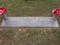
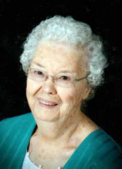
Carl Elmo Lovell
| Birth | : | 29 Jul 1914 USA |
| Death | : | 29 Nov 2005 De Queen, Sevier County, Arkansas, USA |
| Burial | : | St. John's Churchyard, Wall, Lichfield District, England |
| Coordinate | : | 52.6575100, -1.8553200 |
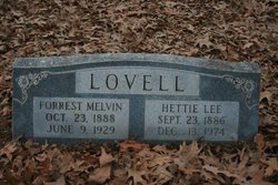
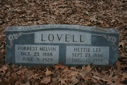
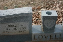
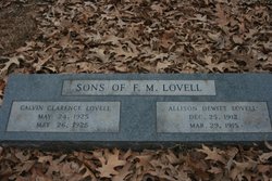
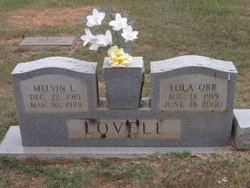
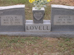
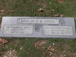
| Description | : | Carl Elmo Lovell died Tuesday, November 29, 2005 at his home with his family. He had achieved the age of 91 and was a resident of De Queen. A native of Arkansas Carl was born on July 29, 1914 the son of Forrest Melvin and Hattie Lee (Wilsford) Lovell. He is preceded in death by his parents and eight brothers; Andrew of San Antonio, TX; Earnest Dorewood; Forrest Augustus; Cecil Manning; Addison Dewitt and Calvin Clarence of De Queen; Melvin Lee of Ashdown; Oma of Atlanta, GA and one sister Mae Dunham of Texarkana. Also, preceding him in death, a... Read More |
frequently asked questions (FAQ):
-
Where is Carl Elmo Lovell's memorial?
Carl Elmo Lovell's memorial is located at: St. John's Churchyard, Wall, Lichfield District, England.
-
When did Carl Elmo Lovell death?
Carl Elmo Lovell death on 29 Nov 2005 in De Queen, Sevier County, Arkansas, USA
-
Where are the coordinates of the Carl Elmo Lovell's memorial?
Latitude: 52.6575100
Longitude: -1.8553200
Family Members:
Parent
Spouse
Siblings
Children
Flowers:
Nearby Cemetories:
1. St. John's Churchyard
Wall, Lichfield District, England
Coordinate: 52.6575100, -1.8553200
2. Christ Church Churchyard
Lichfield, Lichfield District, England
Coordinate: 52.6812150, -1.8405800
3. Grey Friars Churchyard
Lichfield, Lichfield District, England
Coordinate: 52.6829030, -1.8282720
4. Lichfield Cathedral
Lichfield, Lichfield District, England
Coordinate: 52.6855650, -1.8304500
5. St Matthew's Hospital Burial Ground
Burntwood, Lichfield District, England
Coordinate: 52.6804500, -1.8937800
6. Christchurch Cemetery
Burntwood, Lichfield District, England
Coordinate: 52.6787639, -1.8969201
7. St Michael's Churchyard
Lichfield, Lichfield District, England
Coordinate: 52.6834590, -1.8182370
8. St Peter's Churchyard
Stonnall, Lichfield District, England
Coordinate: 52.6266750, -1.8923110
9. St Chad Churchyard
Lichfield, Lichfield District, England
Coordinate: 52.6895810, -1.8209640
10. Stychbrook Cemetery
Lichfield District, England
Coordinate: 52.6998096, -1.8347392
11. St Mary the Virgin New Churchyard
Weeford, Lichfield District, England
Coordinate: 52.6330806, -1.7923083
12. St. Mary the Virgin Churchyard
Weeford, Lichfield District, England
Coordinate: 52.6322300, -1.7923200
13. St. Anne Churchyard Chasetown
Burntwood, Lichfield District, England
Coordinate: 52.6693850, -1.9381720
14. Chase and District Memorial Park
Burntwood, Lichfield District, England
Coordinate: 52.6817140, -1.9339150
15. St. Giles' Churchyard
Whittington, Lichfield District, England
Coordinate: 52.6723850, -1.7677160
16. St Peters Churchyard
Little Aston, Lichfield District, England
Coordinate: 52.6010000, -1.8662300
17. St John's Church Cemetery
Burntwood, Lichfield District, England
Coordinate: 52.6901000, -1.9349300
18. St Bartholomew Churchyard
Hints, Lichfield District, England
Coordinate: 52.6237460, -1.7683840
19. Christ Church Gentleshaw
Rugeley, Cannock Chase District, England
Coordinate: 52.7050151, -1.9264458
20. Pelsall Parish Church Graveyard
Pelsall, Metropolitan Borough of Walsall, England
Coordinate: 52.5893632, -1.8628608
21. St. James the Great Churchyard
Longdon, Lichfield District, England
Coordinate: 52.7250710, -1.8800360
22. St Chad's
Tamworth Borough, England
Coordinate: 52.6433000, -1.7418000
23. St. James’ Church Hill
Sutton Coldfield, Metropolitan Borough of Birmingham, England
Coordinate: 52.5883010, -1.8241610
24. Hopwas Cemetery
Tamworth, Tamworth Borough, England
Coordinate: 52.6417200, -1.7362600

