
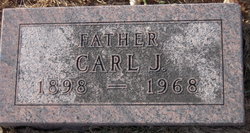

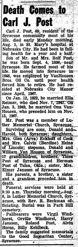
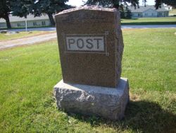
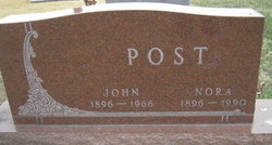
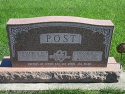
Carl J. Post
| Birth | : | 4 Sep 1898 Syracuse, Otoe County, Nebraska, USA |
| Death | : | 5 Aug 1968 |
| Burial | : | St Budoc Churchyard, St Budeaux, Plymouth Unitary Authority, England |
| Coordinate | : | 50.4130353, -4.1769516 |
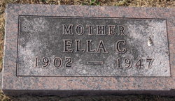
| Inscription | : | FATHER |
frequently asked questions (FAQ):
-
Where is Carl J. Post's memorial?
Carl J. Post's memorial is located at: St Budoc Churchyard, St Budeaux, Plymouth Unitary Authority, England.
-
When did Carl J. Post death?
Carl J. Post death on 5 Aug 1968 in
-
Where are the coordinates of the Carl J. Post's memorial?
Latitude: 50.4130353
Longitude: -4.1769516
Family Members:
Parent

Spouse
Siblings
Children

Flowers:


Nearby Cemetories:
1. St Budoc Churchyard
St Budeaux, Plymouth Unitary Authority, England
Coordinate: 50.4130353, -4.1769516
2. Weston Mill Cemetery and Crematorium
Plymouth, Plymouth Unitary Authority, England
Coordinate: 50.3954330, -4.1719780
3. St Mary's Church
Tamerton Foliot, Plymouth Unitary Authority, England
Coordinate: 50.4279200, -4.1582500
4. St. Pancras Churchyard
Pennycross, Plymouth Unitary Authority, England
Coordinate: 50.4012300, -4.1510700
5. St. Pancras Church Cemetery
Pennycross, Plymouth Unitary Authority, England
Coordinate: 50.4004000, -4.1497900
6. St. Leonard & St. Dilpe Churchyard
Landulph, Cornwall Unitary Authority, England
Coordinate: 50.4324670, -4.2104830
7. Milehouse Cemetery
Devonport, Plymouth Unitary Authority, England
Coordinate: 50.3814650, -4.1636975
8. Gifford Place Jewish Cemetery
Plymouth, Plymouth Unitary Authority, England
Coordinate: 50.3841970, -4.1408370
9. St. Andrew's Churchyard
Bere Ferrers, West Devon Borough, England
Coordinate: 50.4505300, -4.1715320
10. Ford Park Cemetery
Plymouth, Plymouth Unitary Authority, England
Coordinate: 50.3813700, -4.1446090
11. St. Andrew with St. Luke Churchyard
Devonport, Plymouth Unitary Authority, England
Coordinate: 50.3747560, -4.1625170
12. St. Edward's Churchyard
Eggbuckland, Plymouth Unitary Authority, England
Coordinate: 50.4007100, -4.1146830
13. St Peter and The Holy Apostles Churchyard
Plymouth, Plymouth Unitary Authority, England
Coordinate: 50.3731580, -4.1544280
14. Ebenezer Methodist Chapel Burial Grounds
Plymouth, Plymouth Unitary Authority, England
Coordinate: 50.3732824, -4.1391355
15. Efford Cemetery and Crematorium
Plymouth, Plymouth Unitary Authority, England
Coordinate: 50.3908900, -4.1100080
16. St Mary's Botus Fleming
Botus Fleming, Cornwall Unitary Authority, England
Coordinate: 50.4298100, -4.2483700
17. Estover
Estover, Plymouth Unitary Authority, England
Coordinate: 50.4100000, -4.1000000
18. St Andrew Churchyard (Defunct)
Plymouth, Plymouth Unitary Authority, England
Coordinate: 50.3699100, -4.1399240
19. Horson Cemetery
Antony, Cornwall Unitary Authority, England
Coordinate: 50.3744400, -4.2283200
20. Plymouth Naval Memorial
Plymouth, Plymouth Unitary Authority, England
Coordinate: 50.3655739, -4.1422210
21. Plymouth Hoe Old Jews Burial Ground
Plymouth, Plymouth Unitary Authority, England
Coordinate: 50.3667290, -4.1365800
22. St James the Great Churchyard
Antony, Cornwall Unitary Authority, England
Coordinate: 50.3692770, -4.2536460
23. St. Mary's Churchyard
Bickleigh, South Hams District, England
Coordinate: 50.4420600, -4.0844100
24. Maker Churchyard
Maker, Cornwall Unitary Authority, England
Coordinate: 50.3472048, -4.1853155