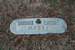
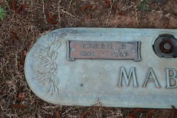
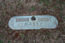
Carrie Elizabeth Baines Mabry
| Birth | : | 25 Jan 1885 |
| Death | : | 31 Jan 1961 |
| Burial | : | Circle Hill Cemetery, Punxsutawney, Jefferson County, USA |
| Coordinate | : | 40.9486008, -78.9496994 |
| Description | : | 1920 United States Federal Census about Carrie E Mabery Name: Carrie E Mabery [Carrie E Mabry] [Carrie E] Age: 35 Birth Year: abt 1885 Birthplace: South Carolina Home in 1920: Morgan, Cherokee, South Carolina Race: White Gender: Female Relation to Head of House: Wife Marital Status: Married Spouse's Name: James B Mabery Father's Birthplace: South Carolina Mother's Birthplace: South Carolina Able to read: Yes Able to Write: Yes Neighbors: View others on page Household Members: Name Age James B Mabery 39 Carrie E Mabery 35 Andrew J Mabery 15 John C Mabery 12 Thomas C Mabery 9 |
frequently asked questions (FAQ):
-
Where is Carrie Elizabeth Baines Mabry's memorial?
Carrie Elizabeth Baines Mabry's memorial is located at: Circle Hill Cemetery, Punxsutawney, Jefferson County, USA.
-
When did Carrie Elizabeth Baines Mabry death?
Carrie Elizabeth Baines Mabry death on 31 Jan 1961 in
-
Where are the coordinates of the Carrie Elizabeth Baines Mabry's memorial?
Latitude: 40.9486008
Longitude: -78.9496994
Family Members:
Parent
Spouse
Siblings
Children
Flowers:
Nearby Cemetories:
1. Circle Hill Cemetery
Punxsutawney, Jefferson County, USA
Coordinate: 40.9486008, -78.9496994
2. Saint Peters Reformed Cemetery
Punxsutawney, Jefferson County, USA
Coordinate: 40.9515150, -78.9616910
3. North Findley Street Cemetery
Punxsutawney, Jefferson County, USA
Coordinate: 40.9466000, -78.9724000
4. Oak Lawn Cemetery
Cloe, Jefferson County, USA
Coordinate: 40.9300003, -78.9356003
5. Cherva Agudath Achuin Hebrew Cemetery
Cloe, Jefferson County, USA
Coordinate: 40.9293210, -78.9359090
6. Ridgemount Cemetery
Punxsutawney, Jefferson County, USA
Coordinate: 40.9719009, -78.9317017
7. Clayville Cemetery
Punxsutawney, Jefferson County, USA
Coordinate: 40.9470000, -78.9880000
8. Saints Peter and Paul Byzantine Cemetery
Punxsutawney, Jefferson County, USA
Coordinate: 40.9750000, -78.9706000
9. Calvary Cemetery
Punxsutawney, Jefferson County, USA
Coordinate: 40.9358215, -78.9930725
10. Mount Zion Memorial Cemetery
Jefferson County, USA
Coordinate: 40.9794000, -78.9254000
11. Horatio Cemetery
Punxsutawney, Jefferson County, USA
Coordinate: 40.9392000, -79.0133000
12. Anita Community Cemetery
Anita, Jefferson County, USA
Coordinate: 40.9932450, -78.9790390
13. Pearce Cemetery
Rossiter, Indiana County, USA
Coordinate: 40.9028015, -78.9225006
14. Pleasant Grove Cemetery
Jefferson County, USA
Coordinate: 40.9398000, -78.8835000
15. Brooks Cemetery
Punxsutawney, Jefferson County, USA
Coordinate: 40.9247250, -78.8881340
16. Adrian-Anita Roman Catholic Cemetery
Anita, Jefferson County, USA
Coordinate: 40.9958000, -78.9805984
17. Anita Cemetery
Anita, Jefferson County, USA
Coordinate: 40.9972500, -78.9770700
18. Saints Peter And Paul Byzantine Catholic Cemetery
Horatio, Jefferson County, USA
Coordinate: 40.9324989, -79.0180969
19. Bowers Cemetery
Gaskill Township, Jefferson County, USA
Coordinate: 40.9472008, -78.8716965
20. McClure Cemetery
Big Run, Jefferson County, USA
Coordinate: 40.9706100, -78.8750300
21. Rhoades Cemetery
Big Run, Jefferson County, USA
Coordinate: 40.9318000, -78.8719000
22. Pifer Cemetery
Jefferson County, USA
Coordinate: 41.0068000, -78.9210000
23. Fairview Cemetery
Big Run, Jefferson County, USA
Coordinate: 40.9740300, -78.8728300
24. Old Cumberland Cemetery
Jefferson County, USA
Coordinate: 40.9264000, -78.8704000

